From on-ground monitoring plots, to high-tech sensor-laden towers and satellite measurements, all scales of TERN’s ecosystem observatory are coming together at our newest site in Queensland to deliver critical data for research, policy, management and industry-led extension.
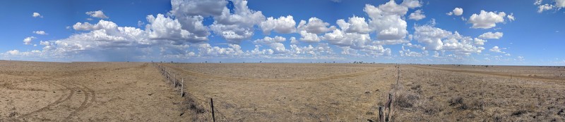
Covering an area larger than New Zealand, the Mitchell Grasslands are Australia’s most extensive tussock grasslands, supporting several threatened species and a nationally important grazing industry.
Recognising a shortage of data on the region’s ecosystems and essential services, TERN’s ecosystem observation work in the Mitchell Grasslands began 2015 with the establishment of 27 one-hectare vegetation and soil monitoring plots. Detailed data and samples from these plots provide an important baseline for future research.
This plot-based infrastructure was supplemented in 2018, when TERN, together with the Queensland University of Technology, established a much larger 25-hectare monitoring SuperSite.
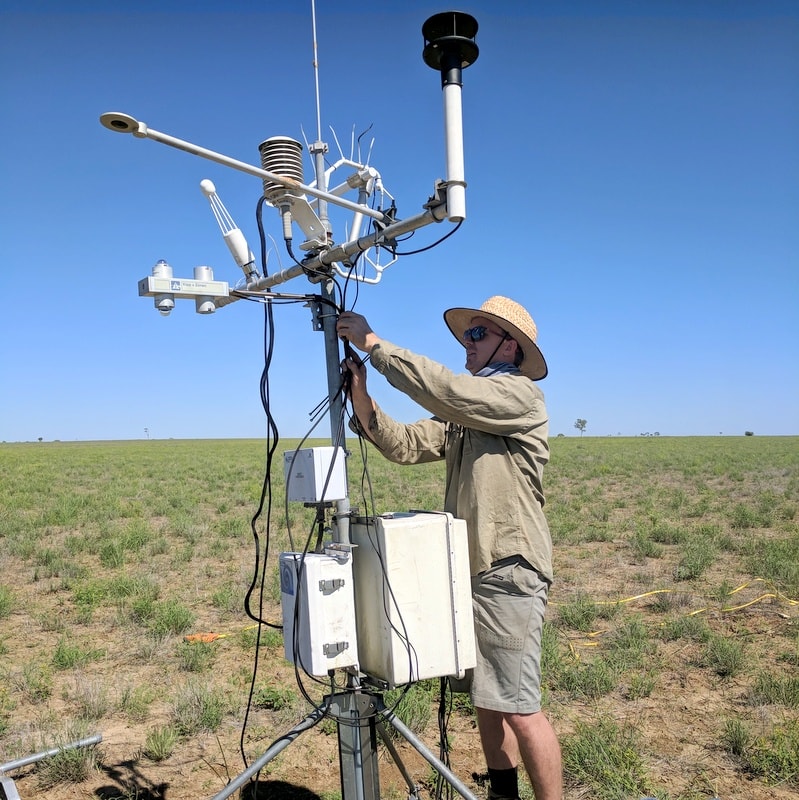
Located at the Longreach Pastoral College, the site is equipped with a sensor-laden eddy-covariance flux monitoring tower, which collects continuous data on the exchanges of carbon, water and gasses between the land surface and the atmosphere.
Christian Brunk installing sensors on the site's eddy-covariance flux monitoring tower, which collects data on the exchanges of carbon, water and gasses between the land surface and the atmosphere 24/7 (image courtesy of Dave Rowlings)
Comprehensive data for better ecosystem and agricultural management
“TERN’s research infrastructure in the Mitchell Grasslands not only fills a significant data collection gap across Australia’s biomes, but also collects data for a significant agricultural landscape,” says Prof Peter Grace of QUT’s Institute for Future Environments.
“The site’s flux tower is located in a grazed pasture, so researchers are using the data collected from the tower together with on-ground measurements to analyse the impacts of various agricultural management decisions,” says Peter.
One such researcher is Dave Rowlings of QUT.
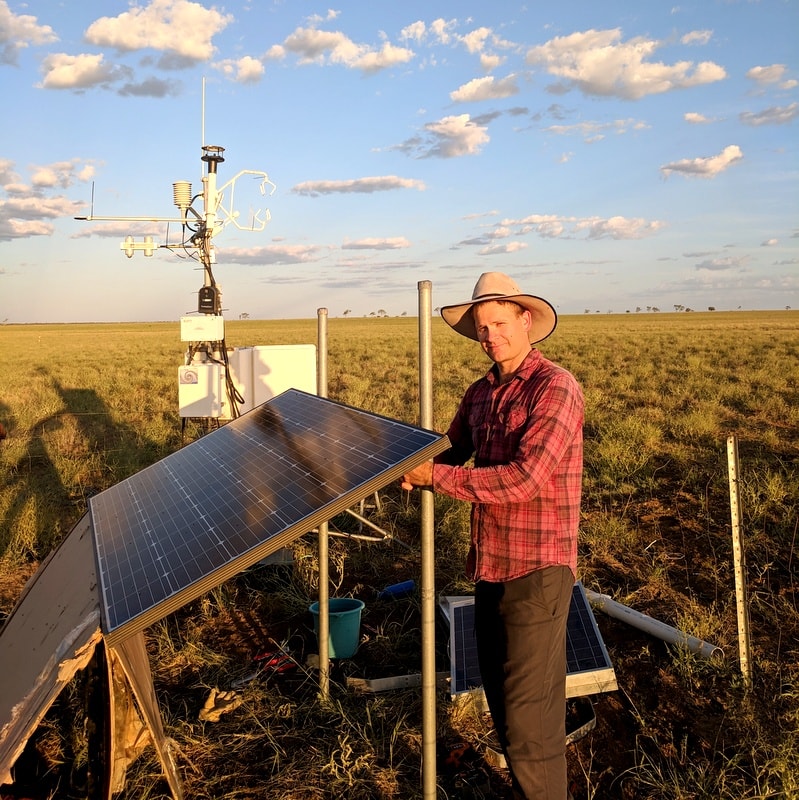
“Our analyses at the site are using TERN data to investigate how stocking rates and the placement of water troughs affect ecosystem processes such as water and carbon movements, and pasture growth and resilience, including during drought,” says Dave.
QUT researcher Dave Rowlings is using data collected from the TERN Mitchell Grass Rangeland SuperSite to investigate how stocking rates and the placement of water troughs affect ecosystem processes such as water and carbon movements, and pasture growth and resilience, including during drought (image courtesy of Dave Rowlings)
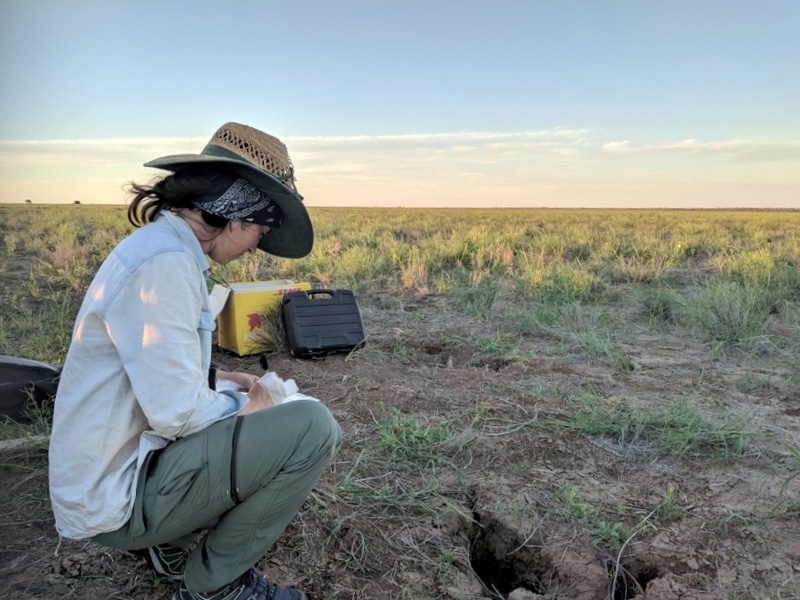
QUT researcher Sarah Carrick collects samples of the site's cracking clay soils for analysis back in the lab (image courtesy of David Rowlings)
TERN site enables validation of Australia priority Earth Observation datasets
Scaling-up the findings of plot and site-based research, like Dave’s, and integrating them with landscape-scale datasets will help farmers and land management agencies make more informed decisions.
TERN has the region covered, via its Australia-wide land observatory providing data on attributes including, measures of greenness/dryness, phenology and land cover, but the Mitchell Grassland site also plays another vital role in satellite-data delivery.
The site is regularly used by researchers from the Queensland Government, Geosciences Australia and the CSIRO to conduct the on-ground validation of nationally important Earth Observation data.
In one such example, CSIRO’s Tim Malthus has used the site to collect field data that will be used to calibrate and validate Digital Earth Australia products, including priority data on Surface Reflectance (NBAR).
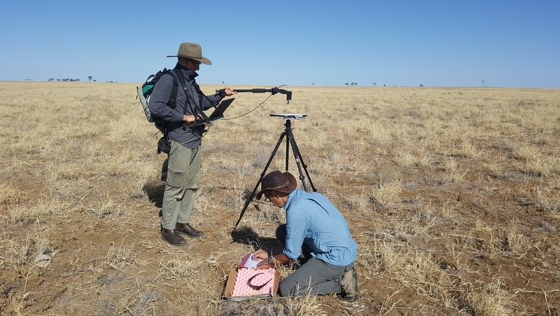
“Open-access to the TERN research site allowed our team to collect surface spectral reflectance data as part of a satellite validation campaign,” says Tim. “At the site, we used a spectroradiometer over a homogenous 1 ha plot that coincided with overpasses of the Sentinel-2 and Landsat satellites.”
“Satellite-derived surface reflectance data is instrumental in identifying and quantifying environmental change, and the on-ground data we collect at TERN sites is essential in ensuring the accuracy of the product”.
Tim Malthus of CSIRO and Peter Scarth of the Queensland Government’s Remote Sensing Centre collect surface spectral reflectance data at the TERN Mitchell Grass Rangeland SuperSite (image courtesy of Dan Tindall)
TERN infrastructure critical to Queensland Government policy and industry-led extension
The Queensland Government’s Remote Sensing Centre and its research partners at the University of Queensland and the University of Southern Queensland, are also using data from the TERN site to calibrate and validate surface reflectance products from Landsat and Sentinel satellites, as well as landcover products including fractional cover and pasture biomass.
These products are used by the Queensland Government to inform policy implementation, regulation and compliance, and industry-led extension and management practice improvement programs, particularly in the grazing sector.
“TERN sites are critical to the production of reliable surface reflectance data and land cover products which have the level of confidence required for evidence-based policy development and industry support programs in Queensland,” says Dr Peter Scarth from the Joint Remote Sensing Research Program.
“TERN infrastructure is facilitating the provision of accurate landscape-scale monitoring data that has generally been lacking in Australia’s rangelands. With a huge proportion of Queensland being comprised of rangeland ecosystems, it is fundamental that we improve our understanding of them to inform their sustainable management and conservation.”
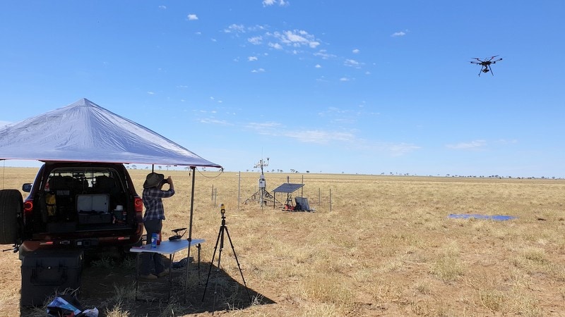
Scientists from the Queensland Government’s Remote Sensing Centre use a drone at the TERN site to collect data for the calibration and validation of nationally important satellite data products (image courtesy of Jason Barnetson)
Mitchell Grasslands observatory one of many in Queensland
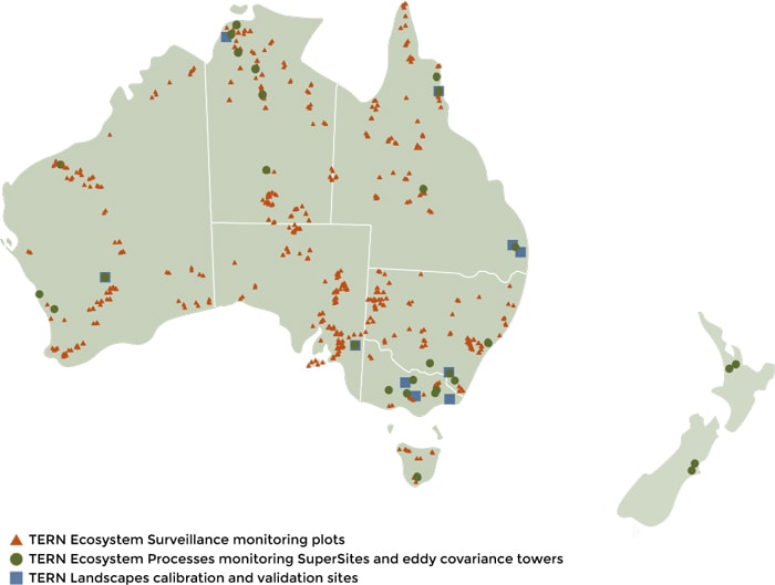
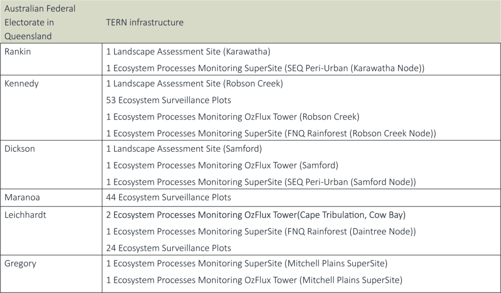
TERN’s Queensland research infrastructure is spread over six Australian Government electorates, is made up of over 100 environmental observing sites and provides approximately 15 full-time jobs.
TERN’s Queensland-based infrastructure facilitates research and management on some of the state’s key strengths, including environmental monitoring, tropical ecosystem research and harnessing the latest science and technology for improved agricultural outcomes. Moreover, our collaborative networks connect researchers, end users and investors to ensure the best research outcomes for Queensland.
By supporting the application of new technologies, products and services by Queensland’s research and management community, TERN is helping the state transform into a more knowledge-intensive diversified economy.
TERN’s Mitchell Grass Rangeland SuperSite is located at the Longreach Pastoral College, a short distance from the township of Longreach. The site is open to interested users and offers facilities for researchers and educational visitors. Please contact us for more information.
Data from the Mitchell Grasslands Rangelands SuperSite on soil, vegetation and ecosystem processes are openly available via the TERN Data Discovery Portal.
Click here to explore all three scales of TERN’s Ecosystem Observatory.
We at TERN acknowledge the Traditional Owners and Custodians throughout Australia, New Zealand and all nations. We honour their profound connections to land, water, biodiversity and culture and pay our respects to their Elders past, present and emerging.