
The manager of a fire-information service that operates across the Top End talks about why the service uses TERN infrastructure to help them manage fire.
Fires in northern Australia are quite different to those down south, says the manager of North Australian Fire Information (NAFI), Peter Jacklyn.
‘Unlike their southern counterparts that are typically intense and fast moving, fires of the north are usually less intense, and they’re slow moving and spread across large areas,’ Peter says.
‘This means that they can be more effectively viewed, monitored and analysed from space – and that viewpoint allows us to improve our understanding and management of this dynamic region of Australia.’
In fact, satellite imagery has been used so successfully to monitor fires that it is now the backbone of a number of vital fire-mapping services and products, including NAFI, used by north Australian fire and land managers.
Peter and the service he manages rely on TERN products when producing a number of their fire-monitoring products. Of particular value is the processed imagery TERN’s northern Australia AusCover node, based at Charles Darwin University, provides. It shows the areas burnt by fires – also known as fire scars.
‘TERN’s work plays a vital role in the effective operation of NAFI. Their pre-processing of a range of satellite imagery saves us a great deal of time and allows us to frequently update the burnt-area mapping, which meets the needs of fire managers by keeping them up to date,’ says Peter.
Knowing which areas have been burnt allows fire managers to map fuel sources and predict where a fire is likely to move. By combining several years of this information, they are able to create fire-history maps, which are an essential part of their planning.
This type of information is critical in achieving efficient, strategic and effective fire management in northern Australia from both public safety and environmental management perspectives.
TERN researchers are working on methods that will allow automated fire-scar mapping products to improve the current, semi-automated system. For Peter, this also means that his organisation will be able to deliver high-quality products to its stakeholders more quickly and more efficiently than ever before.
‘The NAFI service is now a key tool used for fire management across rural and remote Australia, and without the TERN infrastructure and TERN’s ecosystem research network, we couldn’t provide the same level of service,’ Peter says.
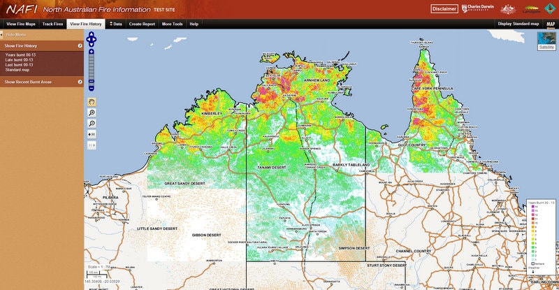
A screenshot of the NAFI service showing fire scars across northern Australian from 2000 to 2013 (Click here or on the image above to see a high resolution version) produced using processed imagery courtesy of TERN’s northern Australia AusCover node
Published in TERN newsletter July 2014
