TERN is testing prototype plant fluorescence sensors at its NCRIS-enabled ecosystem monitoring sites. Early results indicate that accurate Australia-wide hourly data on environmental stress, such as drought or excess heat indicators, are within reach.
Imagine if Australia’s scientists and land managers had open-access to hourly maps of vegetation productivity and stress at meaningful scales for any part of the nation.
Farmers could maximise the efficiency of their crop watering and fertiliser schedules and bring increased yields. The banking, finance, and insurance industry would have improved information to assess assets in natural and managed landscapes in real-time. And natural resource managers could tailor management approaches for optimal conservation and productivity outcomes.
To move towards making this reality, TERN and its partners are investing in the latest instrumentation to measure plant fluorescence with a view to long term data collection and delivery infrastructure.
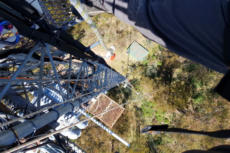
Since April 2019, prototype ‘leaf-to-landscape’ scale plant fluorescence sensors have been installed and tested at the TERN Tumbarumba Wet Eucalypt SuperSite in NSW by site partners, CSIRO and its collaborators. The new multi-scale observations are Australia’s first proof-of-concept of a coordinated infrastructure that links leaf-to-landscape vegetation productivity measurements.
Replacing lagged indicators with fast proxies
The prototype sensors are providing data streams on solar-induced chlorophyll fluorescence (SIF), a process-based dynamic proxy of vegetation productivity and stress.
SIF is the emission of photons from green plants following the absorption of excess sunlight that cannot be utilised for photosynthesis. As such, it is an accurate measure of near-instantaneous plant carbon assimilation function. Vegetation remote sensing and SIF expert Dr Zbyněk Malenovský:
“At present we rely on older sensor systems that are aircraft or satellite mounted to collect proxy data on forest productivity and stress over large areas. These proxy data in the form of colour or near-infrared images and composites are ‘seeing’ the result of stress events that may have begun weeks or even months earlier.
These ‘lagged’ indicators are insensitive to the highly dynamic hourly forest CO2 exchanges [Gross Primary Production], which is primarily driven by sunlight, but is also affected by water availability, temperature, humidity and, additionally, forest structure and architecture.
Tower-mounted SIF sensors provide a near-instantaneous measure of plant photosynthetic efficiency, which is especially useful for detecting a fast response to environmental stress such as water shortage or too strong irradiance and excess heat.”
Dr Zbyněk Malenovský
The new SIF sensor is co-located with existing CSIRO-funded thermal and hyperspectral sensors, providing a suite of game-changing research data collection for innovative environmental science.


Capitalising on future satellite sensors for coast-to-coast vegetation monitoring
SIF holds the prospect of step-change improvement from traditional optical indices, such as greenness and vigour indicators, and the data are essential in the development of algorithms that will put Australia in a position to capitalise on a number of planned future satellite sensors for coast-to-coast vegetation monitoring.
Recently, the European Space Agency (ESA) and NASA have launched several satellite systems that detect SIF, including TROPOMI, OCO-2, SCIAMACHY and GOME-2 missions. Two recent NASA optical sensors mounted on the International Space Station, ROSES and ECOSTRESS, produce hyperspectral, potentially SIF and thermal remote sensing data to measure plant productivity at a broad landscape scale.
These space-based measurements show great promise but remain largely unverified, especially over Australian ecosystems, says Prof Christian Frankenberg of Caltech and NASA in the United States, who works on the ROSES and ECOSTRESS project.
WA State Government NCRIS co-investment expands game-changing sensor network
TERN’s Tumbarumba Wet Eucalypt SuperSite is currently the only site in Australia with a permanent SIF sensor holding out the prospect of linking on-ground and remotely sensed measurements of Gross and Net Primary Productivity and water use at hourly through to seasonal time-scales.
However, thanks to recently announced NCRIS co-investment from the West Australian State Government, SIF sensors will be installed at three more TERN SuperSites in 2020. Prof Jason Beringer of the University of Western Australia and TERN OzFlux, helped secure the WA co-investment, which will enable SIF sensors to be installed at the TERN Boyagin Wandoo Woodland, Gin Gin Banksia Woodland and Great Western Woodlands SuperSites.
“By the end of 2020 there will be SIF sensors installed in multiple key representative Australian ecosystems. This is a fantastic achievement that will deliver data on environmental change at unprecedented levels of detail and quality to global research projects.
SIF sensors at all 12 TERN SuperSites would bring us tantalisingly close to be able to conduct the underpinning research required to be able to produce near-instantaneous maps of forest productivity and stress for the whole of Australia and place Australia as a world leader in Earth Observation.”
Prof Jason Beringer
TERN looks forward to working with our national and international partners and co-investors to make these aspirations reality. Stay tuned to the TERN newsletter and social channels for news of other changes to TERN research infrastructure in 2020.
- TERN acknowledges all the partners and researchers contributing to TERN’s SIF implementation at TERN sites over the past year, namely:
- CSIRO – Astronomy and Space Science, Land & Water, and Oceans & Atmosphere
- Gottstein Trust – Will Woodgate
- Australian National University Water and Landscape Dynamics (ANU WALD) – Albert van Dijk
- University of Tasmania – Arko Lucieer and Zbyněk Malenovský
Postscript: Fire severly impacts Tumba SuperSite
An understorey fire swept through the TERN Tumbarumba Wet Eucalypt SuperSite in NSW on 31 December 2019. The fire was part of the ‘Dunns Road’ fire that burnt greater than 300 000 ha (as at 10 January 2020). The tower is upright and the forest canopy is believed to be mainly intact.
TERN and its site operating partner, CSIRO, have a busy period ahead working with NSW Forestry Commission to make the site safe and restore the data stream, but we’re ready and up for the challenge! The site is expected to be deemed safe to enter sometime in February-March.
Fires at TERN monitoring sites can be devastating for all involved, disrupting long-term data streams, changing ecosystem structure and causing thousands of dollars worth of damage, but the vital new fire and ecosystem science information collected pre, during and post-fire is reason to remain positive.

Images courtesy of NSW Forestry Corporation
