When collecting data on fire it’s to be expected that things are going to get a bit hot sometimes. The annual clash between sensitive environmental sensors and seasonal bushfires unfolded yet again this year at TERN’s tropical savanna ecosystem observing site. Read on to find out how the site burnt but added to TERN’s long-term dataset—essential for Top End fire understanding and management.
In this land of fires, it’s not surprising that TERN’s nation-wide infrastructure has a history of getting a little singed from time to time. Back in 2014 our Calperum Mallee SuperSite and its sensitive ecosystem monitoring equipment burned but survived to tell the tale. With a lot of hard work the site was quickly up and running again and the unique long-term dataset was being snapped up by researchers keen to study the impacts of disturbance on the functioning of our ecosystems.
Move several thousand kilometres north to Australia’s tropical savanna and a similar clash between sensitive scientific equipment and bushfires ignites every year.
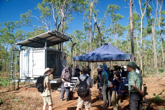
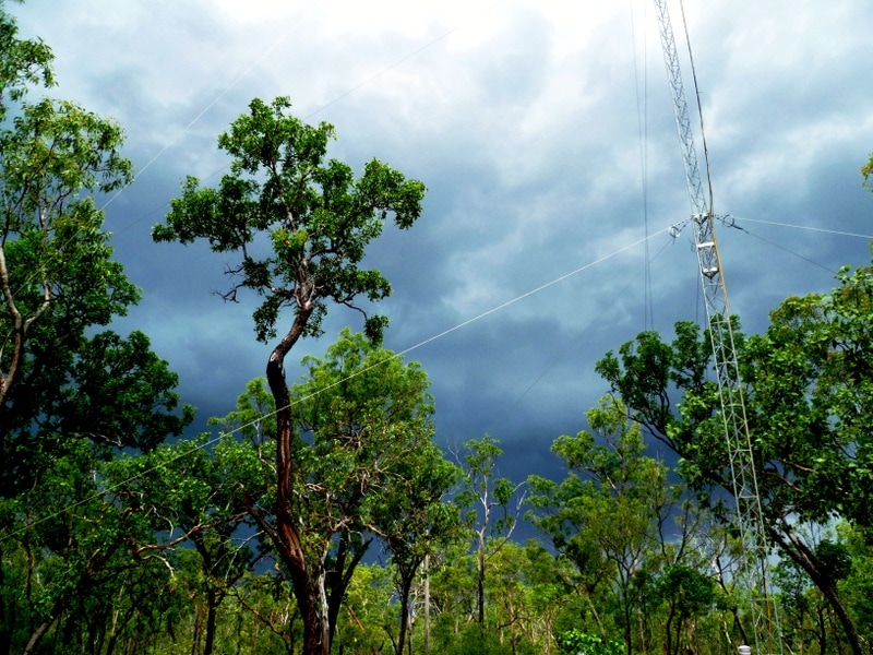
During northern Australia’s dry season fires occur frequently and can extend hundreds of kilometres across the Top End’s tropical savannas in Western Australia, the Northern Territory and Queensland. TERN has several ecosystem observation sites directly in the firing line, but none more so that our Litchfield Savanna SuperSite in the Northern Territory.
Fire-proofing infrastructure in a land of fire
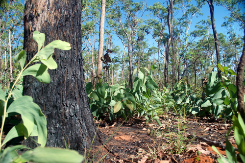
Like most years, in May 2018 a low-intensity fire passed right through the SuperSite, singing on-ground monitoring equipment and getting caught on camera by automated camera-traps.
“Fire has always been an important driver of Australian ecosystems and it’s just a normal part of the cycle up here,” says Dr Stefan Maier, owner-director of Maitec and a TERN associate who helps manage the site.
“Like the ecosystem, we have adapted with our instruments as well, so no equipment was damaged.”
Time-lapse photography from the automatic cameras at TERN’s Litchfield Savanna SuperSite showing the cycle of growth, senescence, fire, and recovery between January and August 2018 (imagery courtesy of Stefan Maier)
Explaining fire carbon relationships
Site manager, Associate Professor Lindsay Hutley of Charles Darwin University, says that the data collected by the Litchfield equipment during these fire events is very important from an ecological perspective.
“Because fire is so prevalent, and a key driving force in tropical savanna ecosystems—the dominant ecosystem of Northern Australia—the data collected by the site’s eddy covariance tower and on-ground sensors are crucial for all kinds of ecological research.”
“Scientists are using the site’s six years of excellent data to explore responses to environmental change, including how fire impacts on carbon storage, energy exchange with the atmosphere and biodiversity.”
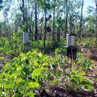
Recovery at TERN’s Litchfield Savanna SuperSite in August 2018 (left) following a low-intensity fire in May which singed the site’s on-ground monitoring equipment, including its rain gauges (right) (images courtesy of Mirko Karan)
Integrated data for Top End fire risk planning
In the context of the story that unfolds annually at TERN’s Litchfield Savanna SuperSite, it is easy to understand that strategic planning in the Top End is vital for reducing harm to people, property and biodiversity.
TERN is working closely with its partners in the region to integrate TERN’s remote-sensing data with the ecosystem process data collected from the site to support enhanced capabilities for fire management.
TERN’s digital maps of fire severity and patchiness provide more information about fires by describing their ecological impact, fuel consumed and estimates of greenhouse gas emissions. We’re also facilitating the latest fire tracking technology and delivering up-to-date information on the environmental variables that influence fire risk.
And, the first national-scale, live fuel moisture content and flammability monitoring system will use TERN-delivered data to achieve more efficient and effective bushfire preparedness and management across Australia.
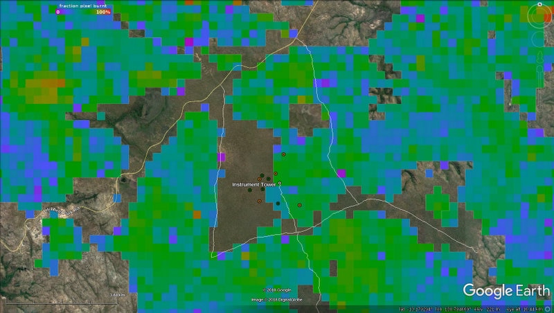
Remote sensing data delivered by TERN Landscapes showing how patchy/severe the fire in May 2018 was. The blue-green colours and the many unburnt patches indicate that the fire was very patchy. Patchiness and unburnt areas that provide shelter for small animals like lizards, means that the fire has had very little negative impact on flora and fauna. In fact, the fire has significantly reduced the ground fuel load thereby preventing another, possibly very severe, fire later in the dry season.
“When such landscape-scale remote sensing data is combined with the on-ground measurements of vegetation and fire taken from the SuperSite, a complete picture of ecosystem change can be achieved,” says Lindsay.
“With the comprehensive multi-scale fire data being delivered by TERN infrastructure, it’s also possible to predict future ecosystem disturbance events. Such predictive ability is immensely valuable not only for fire management, but also for agricultural, property and asset managers throughout northern Australia.”
- For more information on how TERN’s diverse research infrastructure is being used by our nationally networked science and management partners to increase our understanding and improve our management of fire in the landscape click here.
- For more information on TERN’s Ecosystem Processes platform, its network of 12 SuperSites and eddy covariance flux towers, and the data they collect click here or explore the open data via TERN’s Data Discovery Portal.