According to the experts, there are 101 ways to discover and download spatial data on the internet. The problem is that each one is designed for a different purpose and there isn’t an easy-to-use ‘one size fits all’ service. Users are forced to spend large amounts of time manipulating the datasets post-download, greatly slowing their workflow.
To address this, TERN and its project partners have created an open-source tool, called the Spatially Explicit Data Discovery, Extraction and Evaluation Service (SPEDDEXES), which will allow users to more easily query, extract and visualise national spatial datasets.
Currently a prototype, SPEDDEXES has the potential to enhance the way ecosystem scientists discover and query data from multiple sources based on spatial, temporal and thematic parameters.
The immediate potential use of SPEDDEXES is for the visualisation and discovery of data with high temporal and spatial frequencies (i.e. longer-term data that covers large areas) from TERN’s Ecosystem Modelling and Scaling Infrastructure (eMAST), AusCover, Australia’s Integrated Marine Observing System (IMOS), the Bureau of Meteorology (BoM), and Geoscience Australia (GA).
Users are able to customise the format of both the data and statistics they wish to download so that it meets their research requirements.
A number of national stakeholders are excited at what the SPEDDEXES prototype offers, none more than Adam Lewis of GA. ‘We at GA are keenly anticipating the outcomes of SPEDDEXES and the potential to incorporate them back into our development of the Australian geoscience data cube,’ says Adam.
Tim Pugh of the BoM echoes Adam’s anticipation ‘We are excited to join this cross-section of technologist and environmental disciplines to explore new methods in scientific data access and visualisation.’
SPEDDEXES has been developed by a collaborative team including representatives from TERN, BoM, the National Computational Infrastructure (NCI), GA, CSIRO, IMOS, The University of NSW, The University of Queensland, Macquarie University and INTERSECT who met at an ACEAS workshop led by Dr Bradley Evans of Macquarie University and hosted at INTERSECT.
Dr Ben Evans from NCI is part of this team and says that ‘The SPEDDEXES team demonstrates the value of the existing infrastructure as a collaborative environment, as well accelerating both the use and gaps in our knowledge or technology.’
Also involved is IMOS’s Satellite Remote Sensing facility leader Dr Edward King who observed ‘This is a unique opportunity for those of us grappling with big spatial datasets to understand who in the community is doing what, and to identify opportunities to adopt common approaches that will facilitate and enable data sharing and use across domains.’
For enquiries about SPEDDEXES please contact TERN’s eMAST facility director Brad Evans.
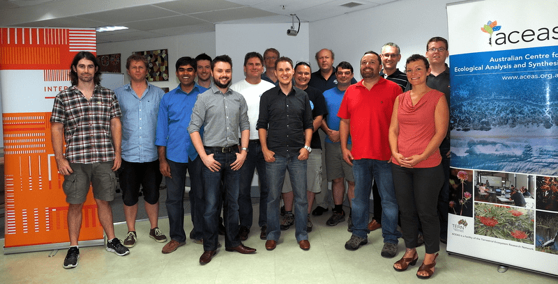
Participants of the ACEAS ‘hackfest’ that brought together national teams working on Australian gridded data discovery, extraction and visualisation to focus on creating SPEDDEXES; left to right: Duan Beckett (BoM), Roald de Wit (BoM), Siddeswara Guru (TERN), Jonathan Hodge (CSIRO), Rys Whitley (MQ), Tim Pugh (BoM), David Fuchs (UNSW), Tim Erwin (BoM/CSIRO), Alex Ip (GA), Edward King (CSIRO), Matt Paget (CSIRO), Brad Evans (MQ), David Porter (NCI), Daisy Duurma (MQ), Josh Sixsmith (GA) (photo courtesy Alison Specht)
Published in TERN’s Environmental Data newsletter August 2014
