OzSET
The OzSET researcher community, supported by TERN, operates a national network of over 300 Surface Elevation Tables (SETs) which monitor changes in tidal wetland elevation. By doing this, researchers can track the health of tidal ecosystems and coastlines in the face of climate change and rising sea levels.
Can tidal wetlands keep up with sea-level rise around Australia?
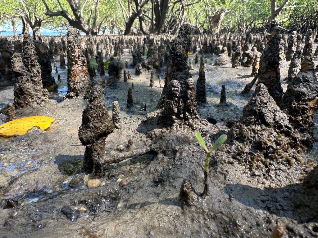
Mangroves, saltmarsh and supratidal forests are important tidal wetland ecosystems contributing to a range of ecosystem services. However, these coastal wetlands are highly sensitive to changes in sea level, given their low coastal elevation and frequent tidal inundation.
Maintaining relative elevation despite sea-level rise is crucial for tidal wetlands to persist.
Mangroves and saltmarsh vertically adjust to sea-level rise via sediment accretion and below-ground soil volume additions (e.g., root growth).
Tidal wetlands maintaining elevation relative to sea-level rise may also offer some natural coastal protection from some of the impacts of rising sea levels. For example, having healthy vegetated coastal habitats mitigates against impacts such as saltwater incursion and erosion of adjacent habitats, private and public assets and cultural heritage sites.
OzSET monitoring sites
Sites are distributed around the Australian coast and grouped by geomorphic setting. Select a pin to view location, vegetation, geomorphic setting, and tidal range.
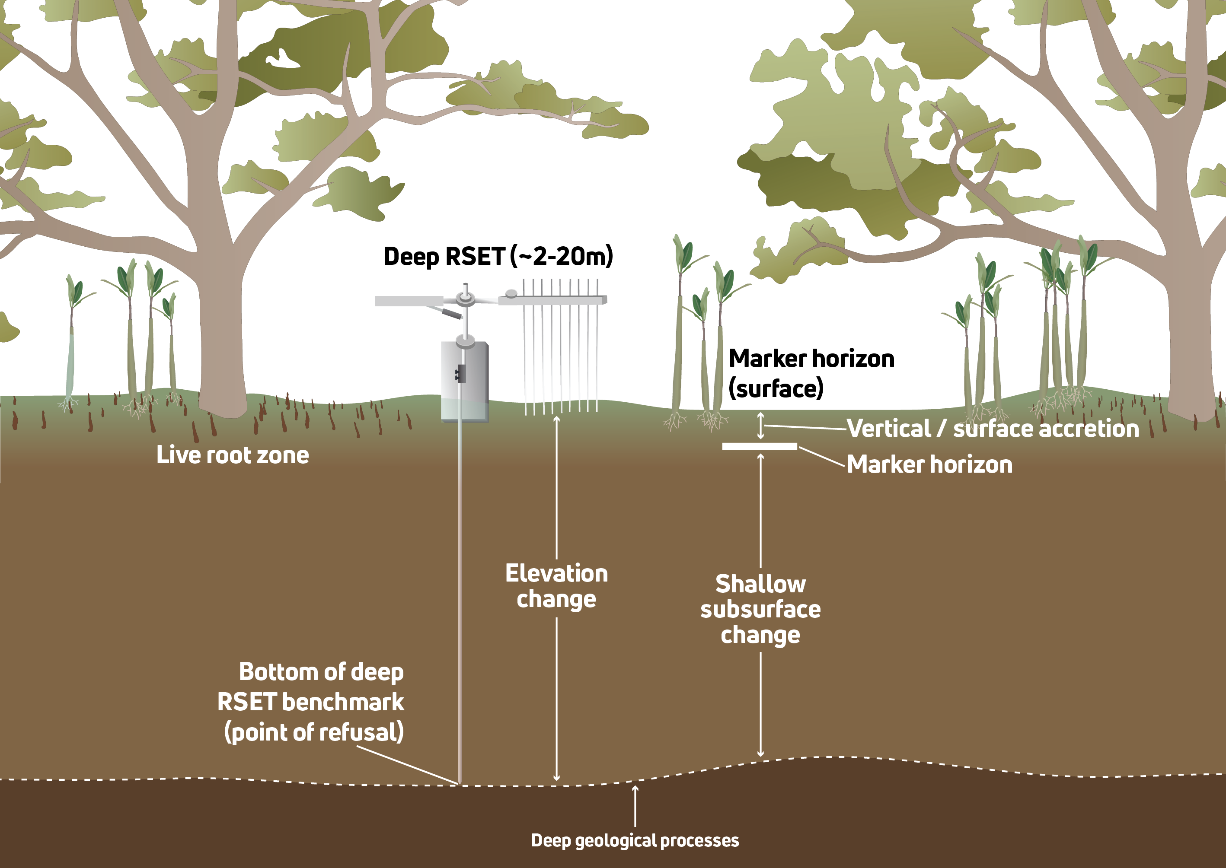
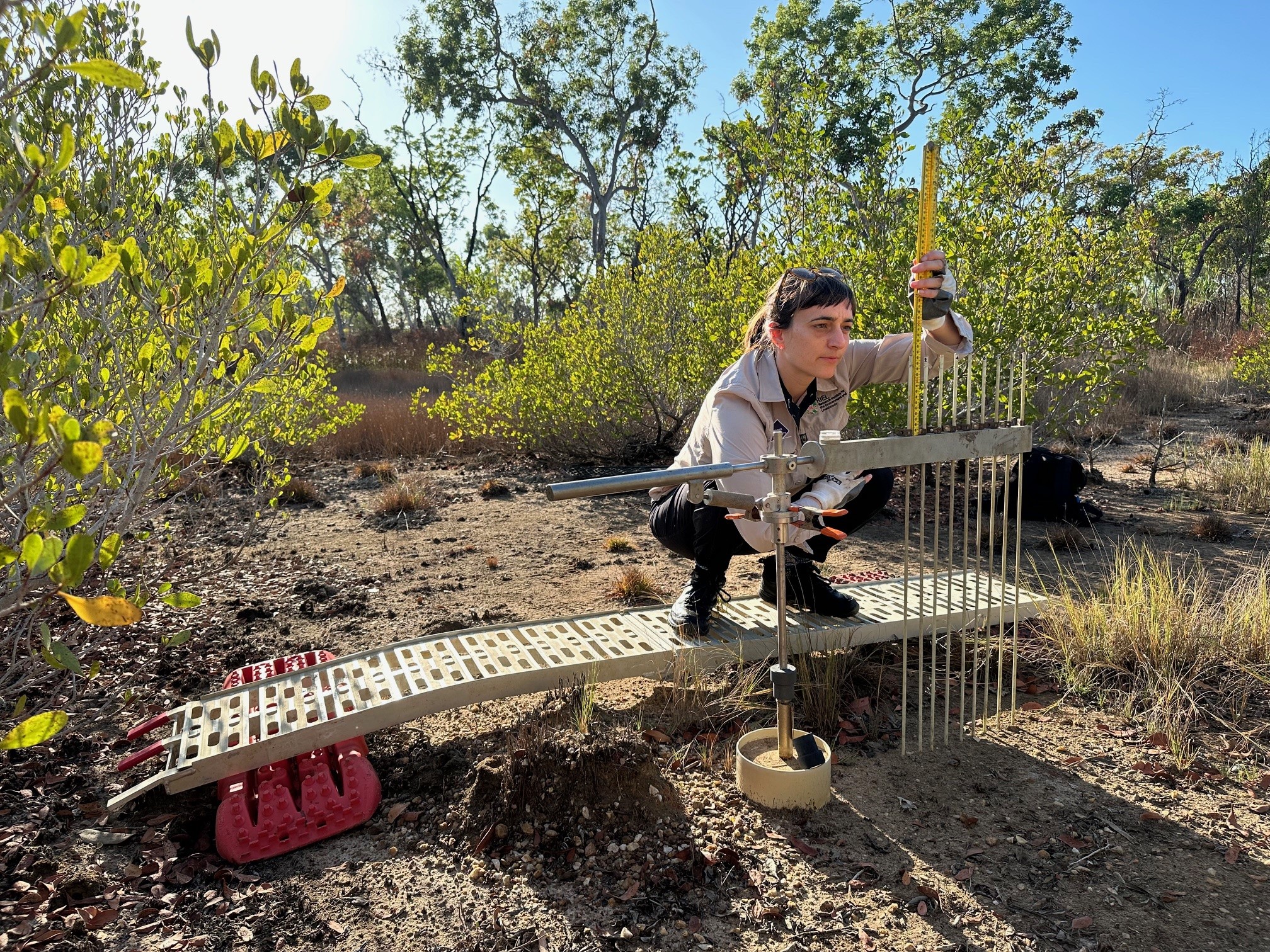
Surface Elevation Tables (SETs)
To better understand tidal wetland response and vulnerabilities to sea-level rise, Australian and international researchers have been monitoring vertical elevation change for many years using Surface Elevation Tables (including the modern Rod Surface Elevation Table design), a method developed by the USGS.
SETs precisely measure tidal wetland surface height over time and can track the changes in wetland elevation that occur through plant root growth below ground and sediment deposition above ground.
Monitoring elevation of these important wetlands through time allows for comparisons to the rate of change with sea-level rise and other environmental impacts in different tidal wetland regions.
The OzSET network
Australia has a network of over 300 Surface Elevation Tables (SETs) located around its coasts which are operated by the OzSET researcher community.
TERN, as Australia's Ecosystem Observatory, is supporting the OzSET researcher network — particularly with ensuring standardised protocols and a central data repository available through TERN's Data Discovery Portal.
Click any image to view at full size
Project timeline
Key milestones from project launch in 2024 through to national data availability in 2027.
-
1
In-person workshop on MinjerribahFebruary 2025
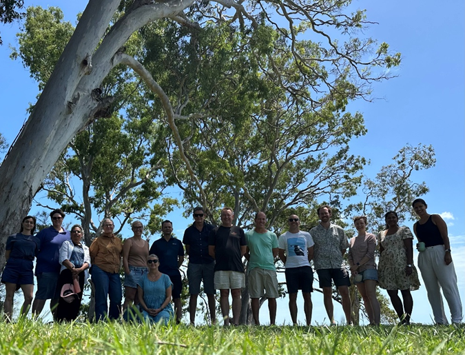
Workshop on Minjerribah with the OzSET community, February 2025. -
2
Webinar & site visitDecember 2025
Read more: Snorkelling with science: a personal journey through mangrove biodiversity.
-
3
Future community events
Future community events will be updated here.
OzSET research in practice
In the webinar excerpt below, Madeline Goddard discusses her research as part of the OzSET community (15 mins).
Learn more
Further reading and viewing on tidal wetland monitoring:
Publications using Australian RSET data
Contact
Project team
General enquiries
TERN, Long Pocket PrecinctFoxtail Building #1019, Level 5
The University of Queensland
80 Meiers Road
Indooroopilly QLD 4068, Australia
Glossary
References
- Cahoon, D. R., Lynch, J. C., Perez, B. C., Segura, B., Holland, R. D., Stelly, C., … & Hensel, P. (2002). High-precision measurements of wetland sediment elevation: II. The rod surface elevation table. Journal of Sedimentary Research, 72(5), 734–739. doi:10.1306/020702720734
- Cahoon, D. R., Reed, D. J., & Day Jr, J. W. (1995). Estimating shallow subsidence in microtidal salt marshes of the southeastern United States: Kaye and Barghoorn revisited. Marine Geology, 128(1–2), 1–9. doi:10.1016/0025-3227(95)00087-F
- Lynch, J. C., Hensel, P., & Cahoon, D. R. (2015). The surface elevation table and marker horizon technique: A protocol for monitoring wetland elevation dynamics. Natural Resource Report NPS/NCBN/NRR—2015/1078. National Park Service, Fort Collins, Colorado. NPS IRMA
- Saintilan, N., Sun, Y., Lovelock, C. E., Rogers, K., Goddard, M., Hutley, L. B., … & Jones, A. (2023). Vertical accretion trends in Australian tidal wetlands. Estuaries and Coasts, 1–14. doi:10.1007/s12237-023-01267-x