TERN’s Boyagin Wandoo Woodland SuperSite is in the Boyagin Nature Reserve, approximately 12 km west of Pingelly, Western Australia. This location is in the Avon Wheatbelt (AW2-rejuvenated drainage subregion) and has semi-arid (dry) warm Mediterranean climate. The Noongar people are the traditional owners at Boyagin.
Site Infrastructure & Characteristics
SuperSite Research Infrastructure
Two eddy-covariance flux towers
Six 1 ha Surveillance monitoring plots
SuperSite Details
Vegetation type: Wandoo Woodland, surrounded by broadacre farming
Elevation: ~484 m
Rainfall: ~445 mm/yr
Mean Temperature: ~16.9°C
Soils: Sandy and loamy gravels and sands on a mesa with gradational and duplex soils on granitic slopes
Flux Status
System
Meteorology
Turbulent flux
Radiant flux
Soil
System
Meteorology
Turbulent flux
Radiant flux
Soil
Site Research
Research using the Boyagin Wandoo Woodland SuperSite aims to answer these key questions:
Current processes - How do climate drivers influence current processes of production, water use and GHG exchange across contrasting land use types?
Past changes - How would past climate variability have influenced past production, water use and GHG emissions across contrasting land use types?
Future response – How might agricultural and native vegetation systems respond to projected climate change and management?
Combined, these questions aim to develop a better understanding of how intensively managed landscapes in WA alter hydrology, geomorphology, biology, and biogeochemistry.
Monitoring activities at the SuperSite complement the Avon River Catchment Critical Zone Observatory at the University of Western Australia Future Farm in Pingelly that focuses on rotational dryland wheat cropping and grazing pastures. Our second major aim is to undertake this project under the scientific framework of critical zone science and through this project establish the first element of a much larger critical zone observatory (CZO). The SuperSite is also co-located with the Land Ecosystem Atmosphere Program (LEAP) – Boyagin.
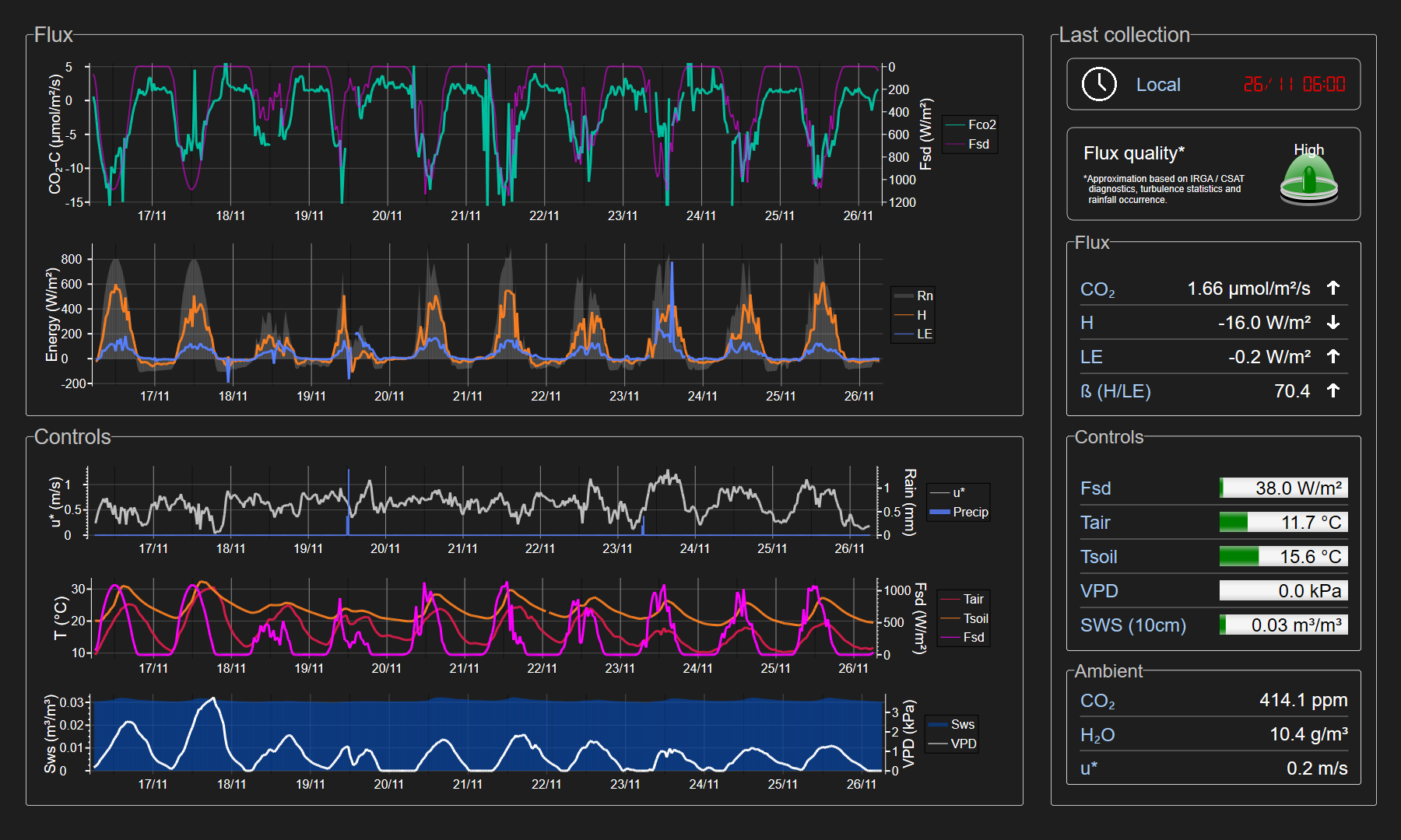
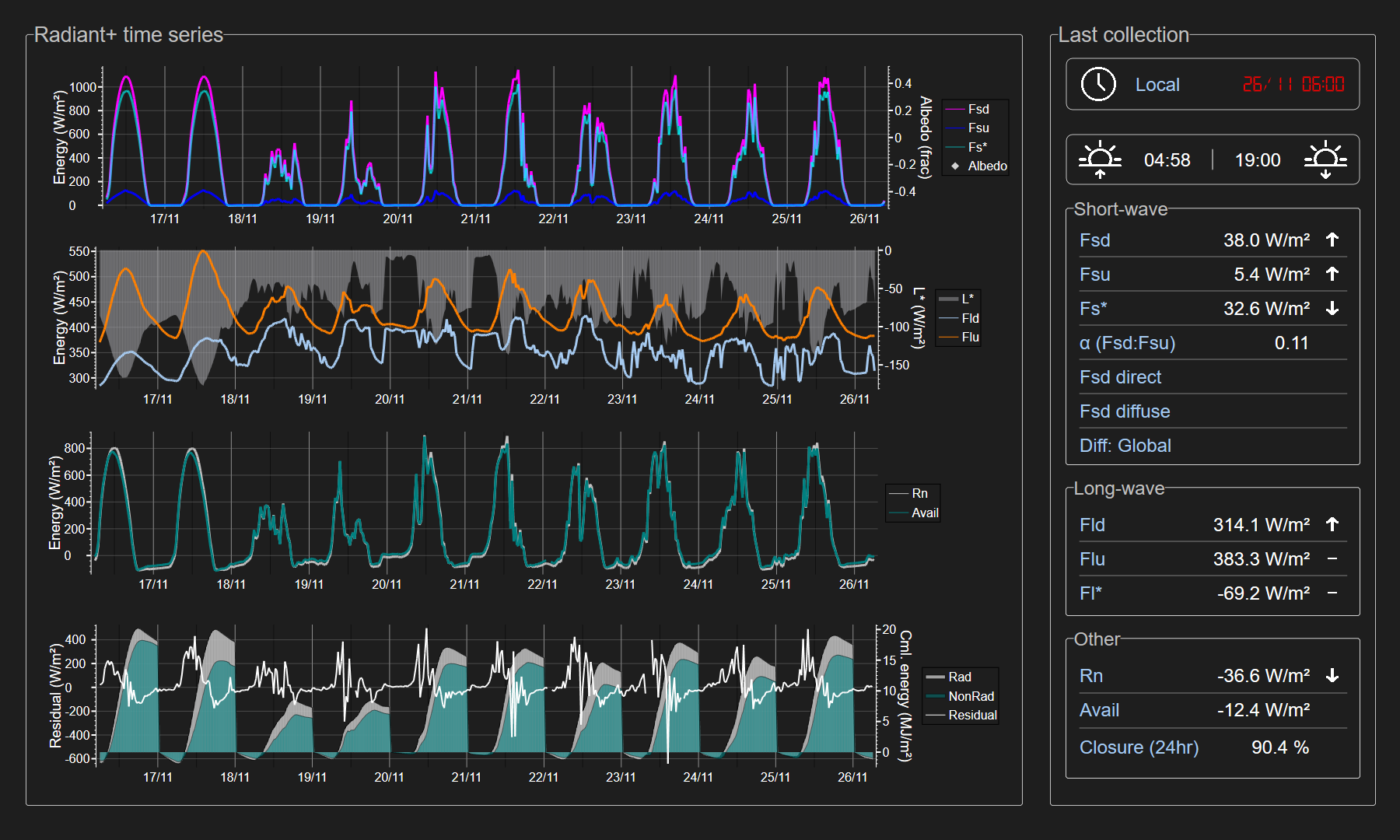
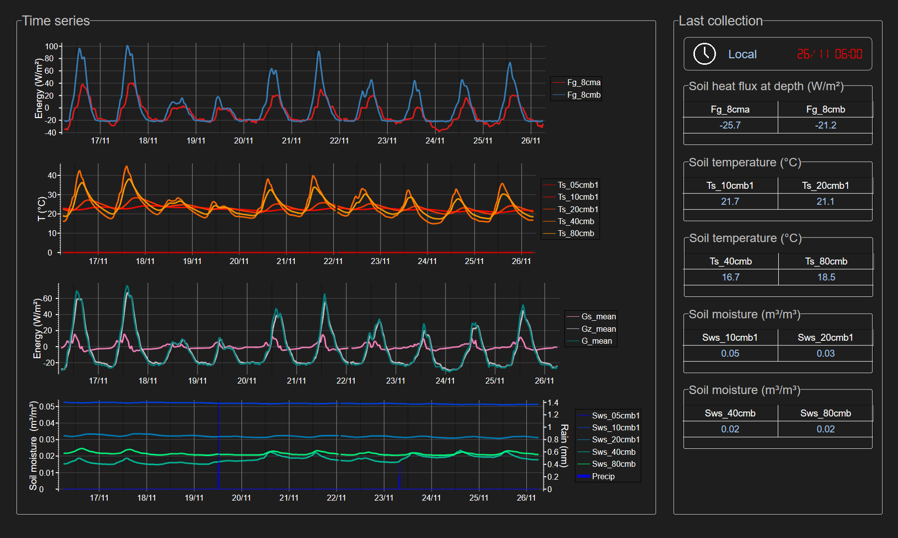
This dataset consists of measurements of the exchange of energy and mass between the surface and the atmospheric boundary-layer in semi-arid eucalypt woodland using eddy covariance techniques.