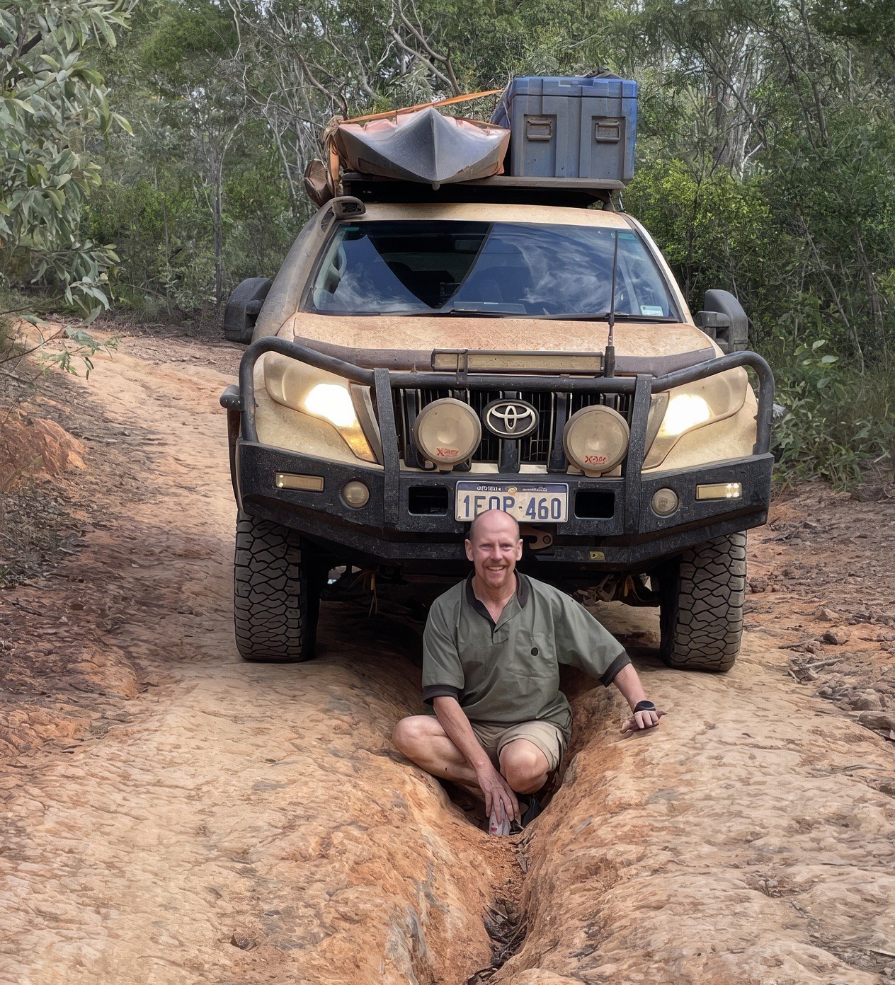
Professor Jason Beringer is moving onto new adventures beyond TERN so we take the opportunity to share some of his long-term contributions to ecosystem science and the flux community.
When future generations look back at how Australia came to understand its own ecosystems, how its forests breathe, how its savannas burn and recover, how its farmlands trade carbon with the sky, the name Jason Beringer will be prominent. Over nearly two decades, Professor Beringer of The University of Western Australia (UWA) has been a key member of a group of pioneers who have helped build one of the most comprehensive ecosystem monitoring legacies in the Southern Hemisphere.
Early Foundations: Monash University, Victoria and the Top End
Jason’s career in Australian flux science was built from Monash University in Melbourne, where he spent well over a decade developing his research program across both southeastern Australia and the tropical north. It was from Monash that he helped establish some of the most important sites in what would become the OzFlux network.

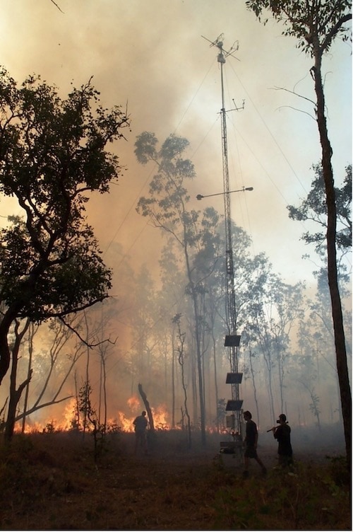
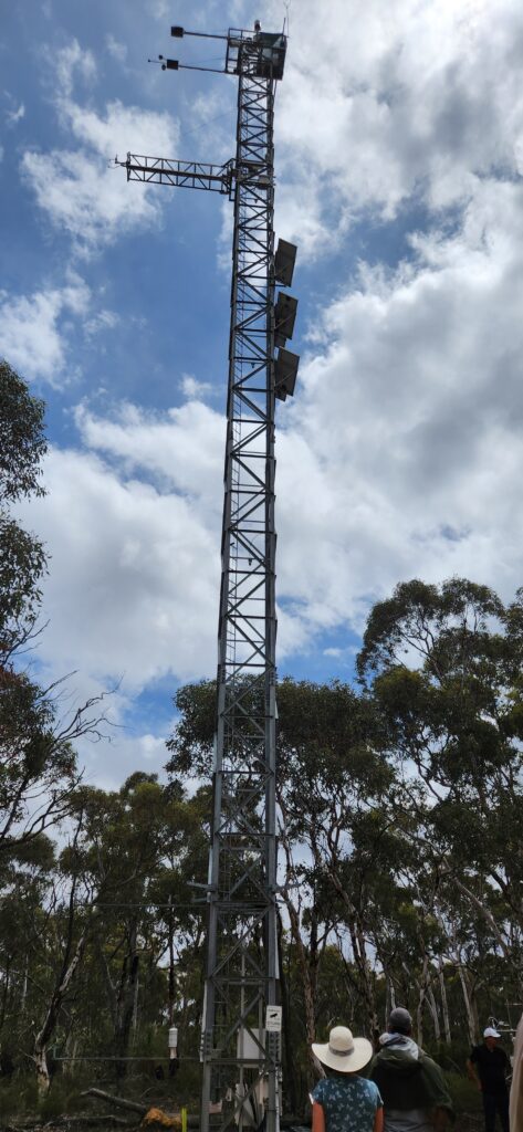
In Victoria, he was involved in several key sites. The Wallaby Creek flux station was established in August 2005 by Monash University as part of an ARC-funded sustainable futures project, operated in collaboration with Charles Darwin University and the University of Alaska Fairbanks, measuring carbon exchange in towering mountain ash forest. The site’s story of destruction and resilience, destroyed in February 2009 by bushfire, with a replacement tower established in March 2010, underscores the patience and persistence long-term ecosystem science demands.
Jason also co-managed the Wombat State Forest flux tower in Victoria, a cool temperate dry sclerophyll eucalypt forest site operating from early 2010, jointly run by the University of Melbourne and Monash University. This site is now operated by the University of Melbourne alone for TERN. And in 2011, Jason was a co-investigator on the Whroo flux station located approximately 45km southwest of Shepparton, established as part of an ARC Linkage project examining the carbon farming and land use consequences for biodiversity and water balance.
Into the Top End: building the Northern Territory Network
It is in Australia’s tropical north, however, that Jason’s most enduring field work took root and this too was done from his Monash University base. In the early 2000s, he collaborated with Professors Nigel Tapper and Lindsay Hutley to install a permanent flux tower at Howard Springs in the Northern Territory, enabling continuous investigation of how fire and climate influence carbon and water fluxes in savanna ecosystems.
Howard Springs would become one of OzFlux’s most celebrated long-term sites, and Jason’s commitment to keeping it running through lean times defined much of his early career. As he has recalled, in the decade before TERN was formally established, the tower was kept running from one small grant to the next, with many weekends and student help to maintain a continuous record.
But Howard Springs was just the beginning. Working with colleague Professor Lindsay Hutley at Charles Darwin University, Jason helped establish a network of sites along the North Australian Tropical Transect (NATT), a monitoring corridor stretching roughly 1,000km south from Darwin.
The Adelaide River flux tower was established in November 2007, managed by Monash University and Charles Darwin University, contributing data on open forest savanna dynamics. The Sturt Plains flux station, approximately 280km north of Tennant Creek, was established in August 2008 and managed by Monash University and Charles Darwin University, providing critical data on Mitchell Grass grassland far from the coast. The Dry River flux station, approximately 89km south of Katherine, was also established in September 2008, rounding out a transect that captured savanna ecosystems across a dramatic rainfall gradient. Together, these sites transformed scientific understanding of how vegetation structure, carbon balance and water use change across northern Australia’s vast interior.
The purpose of these NATT sites was consistent: to examine spatial patterns and processes of land-surface-atmosphere exchanges across scales from leaf to landscape and to determine whether fluxes across diverse ecosystems could be combined into a comprehensive, consistent estimate of regional carbon and water budgets.
TERN arrives: continental scale at last
When TERN was funded under an NCRIS grant in 2009, it provided the capital and institutional investment needed to support around a dozen flux towers and SuperSites across Australia, expanding OzFlux from a collection of individual researcher sites into a truly continental monitoring network.
Jason was at the heart of this transformation, helping build not just the physical towers but the data infrastructure that made the network function as a coherent whole. Together with Peter Isaac and colleagues, he developed the DINGO (Dynamic INtegrated Gap-filling and Partitioning for OzFlux) system. This led to the development of PyFluxPro, the standard tool now used by TERN and the flux community.
This tool standardised the processing and quality control of flux data across the entire network and ensured that measurements being made at sites across Australia and New Zealand could be meaningfully compared and combined. Indeed, OzFlux data has come to be in massive demand internationally, with most sites recording over 1,300 unique downloads each since 2015.
Researchers from around the world have turned to Australian and New Zealand flux data precisely because, as Jason and colleagues recognised, Australia’s ecosystems and climate are unlike anywhere else on Earth.
Moving to the University of Western Australia (UWA): expanding west into the wheatbelt
After his long and productive tenure at Monash, Jason moved to UWA, where he extended the flux network into new and previously unmonitored terrain. He established the TERN Boyagin Wandoo Woodland SuperSite and the Ridgefield site. These sites sit approximately 4km apart in the WA wheatbelt, providing an ideal paired monitoring setup to contrast a native woodland ecosystem with working agricultural land. The Ridgefield flux station, approximately 12km west of Pingelly, was established in January 2015 and is managed by UWA.
The Ridgefield farm is used for rotation cropping – barley, canola and lupin, with intermittent sheep grazing. Together, the two sites quantify carbon, water and energy flux differences between these contrasting land use types, and help determine how past, current and future climate variability will impact on them. Both sites are also part of Australia’s emerging Critical Zone Observatory (OZCZO) network — a multidisciplinary effort to understand landscape dynamics from plant canopy to bedrock. The overarching questions driving the sites ask how intensively managed landscapes in WA alter hydrology, geomorphology, biology and biogeochemistry — inherently multidisciplinary questions that can only be answered through sustained, long-term measurement.
Right: Boyagin Wandoo Woodland SuperSite
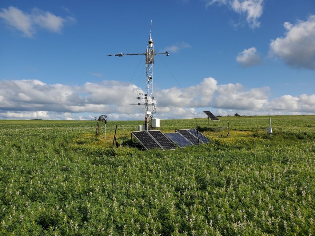
Ridgefield flux monitoring site at UWA showing a lupin crop (image: C. Moore)
Reaching Beyond Australia: Indonesia’s Peatlands
Jason’s contributions have not stopped at Australia’s borders. Recognising that some of the world’s most significant and threatened carbon stores lie in Southeast Asia’s tropical peatlands, he has taken his expertise into the region. He was one of the Australian scientists called upon to help a joint team of 30 Indonesian and Australian researchers install a 10m eddy covariance flux tower and automated monitoring infrastructure in a 10,000km² degraded peatland in Kalimantan, Indonesia — a site managed by the Borneo Orangutan Survival Foundation as part of a landscape-scale restoration and conservation program.
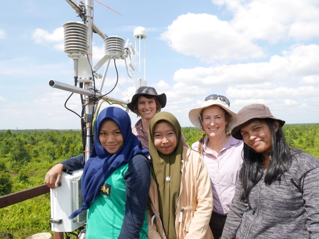
Jason’s role focused on installing the research data repository equipment under conditions that were, to put it mildly, testing — the team battled extreme heat and the threat of impending fires to successfully deploy instruments now capturing detailed data on exchanges of energy, CO₂, methane and water between the land and atmosphere.
His engagement with Southeast Asia has extended further still, with involvement in four eddy covariance flux towers measuring net ecosystem exchanges of CO₂, methane and water vapour across different land uses in the peatlands of Sumatra, Indonesia. As Jason himself has noted, Indonesia’s tropical peatlands are a globally significant carbon store, a locally critical water reservoir and some of the last remaining habitat for orangutans — making the work to monitor and support their restoration both an urgent scientific priority and a privilege.
Science That Shapes Policy
The decades of data generated across all these sites have yielded findings that matter well beyond the scientific literature. Working with Dr Caitlin Moore and a large team of researchers, Jason led a landmark paper published in Global Change Biology in 2022, drawing on OzFlux’s 20-plus year data series. A key finding was that during droughts and heatwaves, forests stop absorbing carbon dioxide and instead begin emitting it — as stressed and dying plants release the carbon stored over their lifetimes.
The network’s long-term data has also established that every hectare of Australia’s temperate forests absorbs around 3.9 tonnes of carbon per year, while every hectare of savanna sequesters approximately 3.4 tonnes — figures now central to how Australia understands its role in global carbon accounting and its pathway to net zero by 2050.
Jason has been clear about what TERN has made possible, noting that without the combination of capabilities across TERN’s platforms, major collaborative studies of this kind simply could not have been done.
A Legacy Still Growing
From Victorian mountain ash forests and the Mitchell Grass plains of the NT, to the wandoo woodlands of WA’s wheatbelt and the burning peatlands of Borneo and Sumatra, Professor Jason Beringer has helped wire Australia and the wider region into one of the most sophisticated ecosystem monitoring systems on the planet. He did so across 2 universities: building the northern Australian savanna network from Monash, then extending the vision westward and internationally from UWA, working alongside the late Dr Ray Leuning’s pioneering community and technical colleagues like Dr Peter Isaac to make the network’s data as rigorous and accessible as possible.
Jason is moving onto other adventures these days as he retires from UWA, but has given an ecosystem gift to researchers, land managers and policymakers that will compound in value for decades to come. With climate change intensifying, the need for exactly the kind of sustained, rigorous, place-based science that Jason has championed for nearly two decades has never been greater.