

The peaty soils that form the foundation of Tasmania’s highland marshes have incredible environmental and economic importance. Indeed, they are remarkable carbon sinks and are crucial to ecosystem hydrology. Yet these peaty soils, which function so well in their cold environment, now face an uncertain future. With TERN’s support, hydrologists, botanists and ecosystem ecologists are working together to better understand how these unique ecosystems are responding to climate change and what the future might hold for them.
By Mark Hovenden and Bethany Yates
How did peaty soils form?
To understand why Tasmania’s peaty soils are so precious, we need to step back in time many thousands of years. During the last glaciation much of Tasmania was desert because there was insufficient precipitation to support vegetation. Then, as the last of the glaciers receded around 15,000 years ago, landscapes became unstable as water availability increased and freeze-thaw cycles became more frequent. Yet the land was still largely unvegetated. Consequently, the plains and valleys of Tasmania’s Central Plateau became a repository for peri-glacial sediments ranging in size from small boulders down to fine clay particles, which slowly accumulated and developed into highland plains.
Over the next few thousand years, plants became established across the plains. These plants, typically sedges, grasses and other small herbaceous species, grew and died. However, their decomposition was slowed by prevailing low temperatures and water trapped above the clay layer, leading to the formation of peaty soils, rich in organic matter.
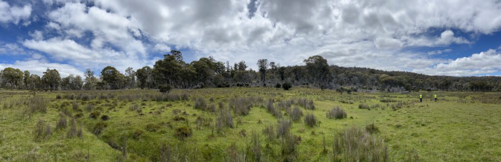
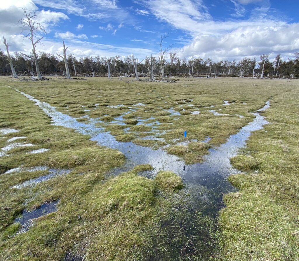
Peaty grassland surrounded by woodlands in Tasmania’s Central Highlands (image provided by Mark Hovenden)
A vital service
These peaty soils still exist in the plains and valleys across central Tasmania where the deepest organic material is up to 6000 years old. They are porous, regularly storing a huge volume of water; during the wetter times of year these soils can have a volumetric soil water content of nearly 80%. Such high soil water content maintains an oxygen-free environment where soil ‘grooblies’ (detritivores and soil microbes) are unable to break down dead plant matter. As a result, the peat continues to accumulate year on year, growing steadily over the centuries.
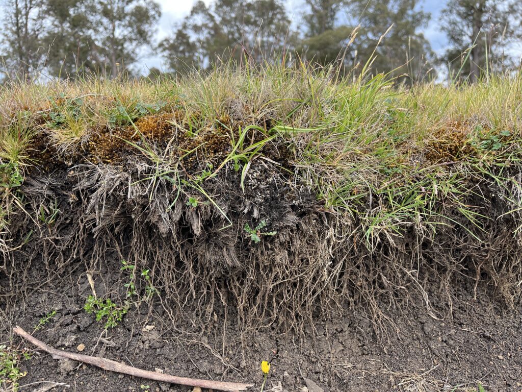
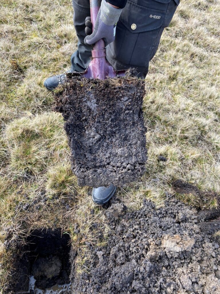
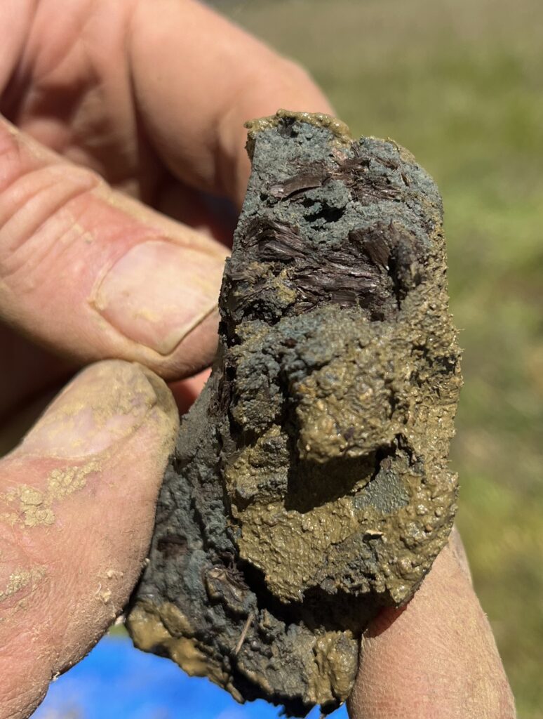
Left: a drain-edge view revealing a cross-section of grasses and moss growing on a bed of peaty soil; Top right: peaty soil on a spade showing the density of soil organic matter; Lower right: a close-up of peaty soil showing the semi-decayed plant matter (images provided by Mark Hovenden)
Rather than fully decomposing, most of the plant matter in these sites only partially decays as it becomes incorporated into soil organic matter. This keeps both carbon and nutrients locked away. As a result, nutrient availability on peaty soils is considerably lower than on mineral soils, making it difficult for nearby but nutrient-hungry woody vegetation to invade the herbaceous vegetation of the plains and valleys. Moreover, herbivores, including large populations of wombats, pademelons and wallabies, are strongly attracted to these grasslands and sedgelands and their grazing further contributes to the inability of woody plants to establish. Where you have high densities of herbivores, you have carnivores and these peaty grasslands, which are also home to a diverse invertebrate community, support a wide variety of carnivores ranging in size from mouse-sized antechinus to Tasmanian devils; from tiny wren and robins to the endangered Lathams snipe and majestic wedge-tailed eagles.
These ecosystems, colloquially known as highland marshes in Tasmania, are not only important for biodiversity, they deliver important ecosystem services vital to our economy. The spongey nature of the peaty soils means that they have an incredible capacity to absorb and store water during wet periods, slowly releasing it during drier periods. Hence, the marshes, which are widespread across central Tasmania, smooth out fluctuations in water supply, both reducing the incidence of flooding and keeping rivers flowing during times of drought, in addition to filtering the water as it goes.
A changing climate
For thousands of years, these ecosystems have been important cultural landscapes for the peoples of the Big River Nation. During warmer months the sites were important meeting places as well as being key resources for food, including meat and vegetables. University of Tasmania PhD candidate Natasha Blaesbjerg has found evidence of long-term, sensitive cultural burning practices that must have taken place during cooler or wetter periods to prevent the wholesale burning of the peat. However, over the past decade, unseasonable and intense fires in Tasmania’s central plateau have consumed considerable amounts of peat, often burning away the top 15-20 cm of soil, because they have occurred in late summer or autumn when the soils are dry and the peat is therefore more flammable.
The presence of peaty soils is evidence that these ecosystems have traditionally been a strong carbon sink, largely due to the suppression of decomposition by the combination of low temperatures and high soil water content. However, climate change is altering both of those restraints on decomposition; soils are becoming warmer and drier. Climatic modelling under the Climate Futures for Tasmania program has indicated that the central plateau is likely to become progressively drier as evaporation increases and rainfall reduces. In fact, the central plateau is predicted to dry more strongly than anywhere in the state.
Critical groundwork
To predict the impacts of these climatic changes on Tasmania’s peaty grasslands and sedgelands, we installed several research sites across the central plateau as part of the TERN-supported Australian Mountain Research Facility (AMRF). AMRF was established pre-TERN in 1999 to introduce ecological monitoring infrastructure into the high country across Australia’s southeast by a consortium of Australian Universities and land management agencies with funding from the Linkage Infrastructure Equipment and Facilities scheme of the Australian Research Council. In Tasmania, this included an eddy covariance flux tower, named ‘Silver Plains’ for its location within the Silver Plains Reserve in the Central Highlands. This tower allows us to track the carbon balance in these peaty ecosytems, providing the best indication of whether these systems are still capable of being carbon sinks and hence able to accumulate peat. The tower has formed the centre of a research program aimed at understanding and predicting the fate of these key ecosystems and the vital services they provide.
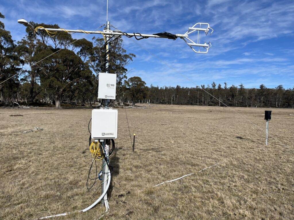
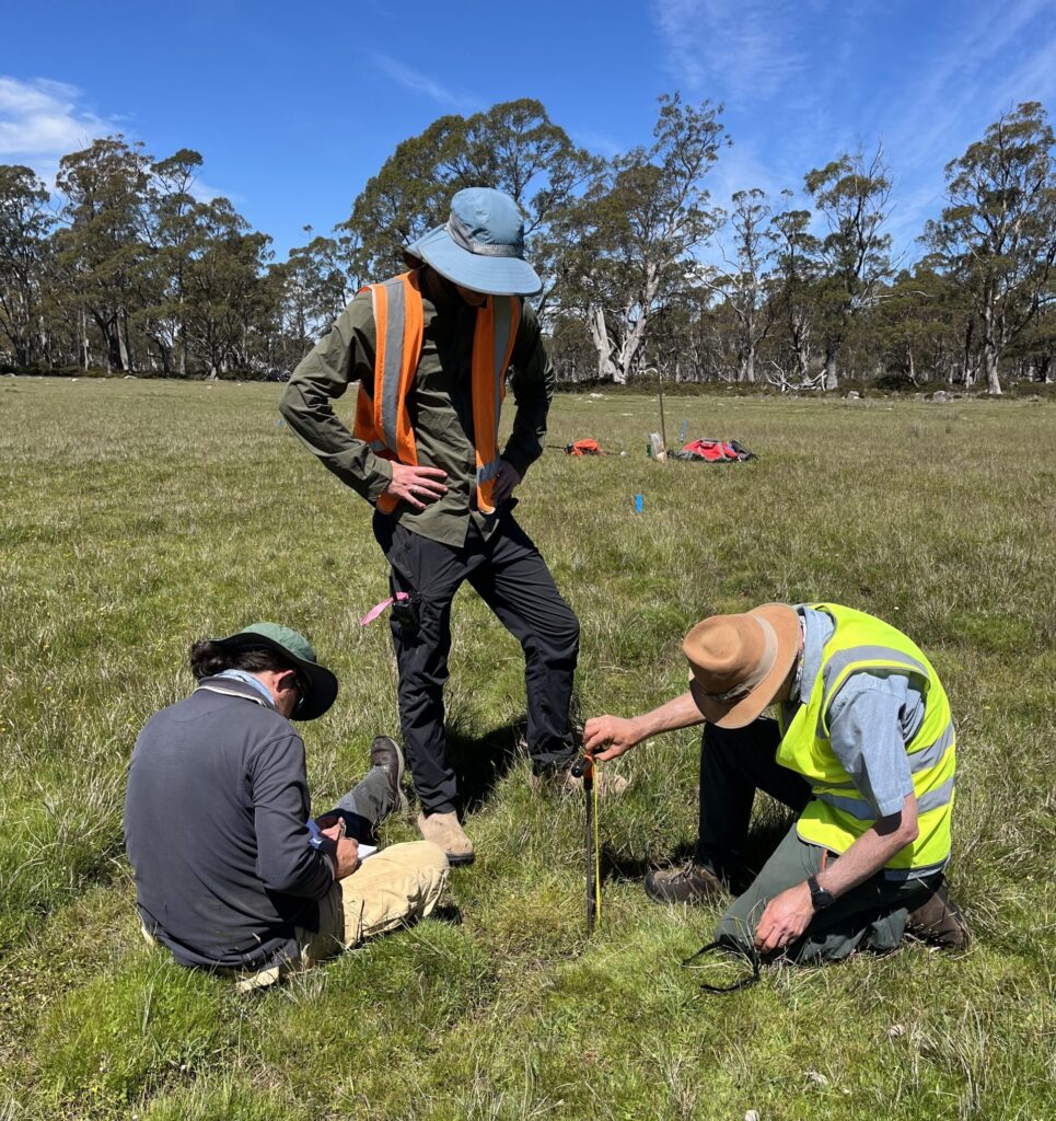
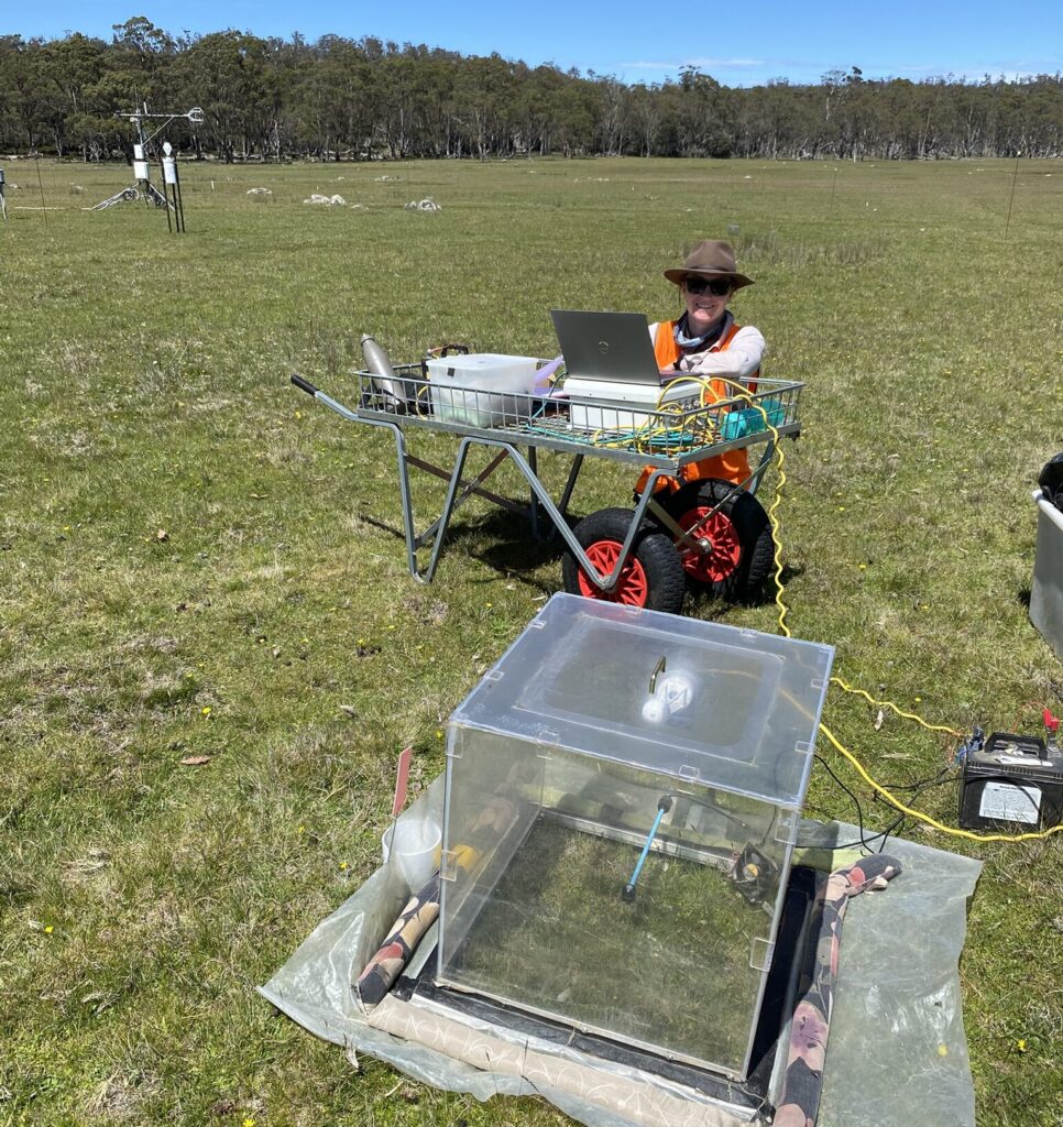
Left: Silver Plains flux tower; Right: Researchers taking measurements as they investigate ecosystem processes of peaty soils at Silver Plains (images provided by Mark Hovenden)
In 2022, AMRF became part of TERN, providing secure infrastructure support that has been vital in attracting external research funding. Currently, a team that combines researchers from the Australian National University, the University of Canberra, the University of Tasmania (UTas) and our land management partner the Tasmanian Land Conservancy, is using the TERN-supported infrastructure, including the Silver Plains flux tower, to determine the exact drivers of both carbon inputs and losses from this system. The team comprises hydrologists, botanists and ecosystem ecologists and has recently attracted funding through the Australian Research Council’s Discovery Projects scheme. Led by Prof Mark Hovenden of UTas, the team, including Prof Adrienne Nicotra, Dr Duanne White, Dr Leah Moore, Prof Martin DeKauwe and AMRF technical specialist Ms Bethany Yates, have been investigating the relationships between vegetation, soils, hydrology and carbon cycling at Silver Plains since 2016. We know already that warming accelerates decomposition, leading to increased carbon losses. Happily, we have also discovered that this ecosystem retains the capacity to be a strong net carbon sink when conditions are favourable and the soil remains moist. But climatic projections are that these conditions will become less and less frequent.
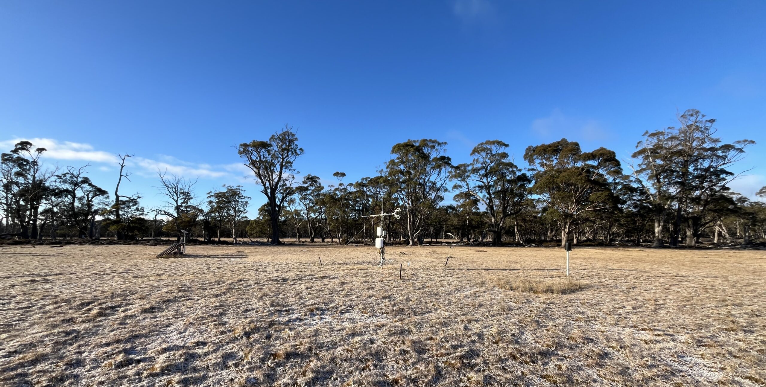
It is against this backdrop that support from TERN is assisting the Australian Mountain Research Facility to expand its efforts to understand these systems. In 2024 a new Flux Tower, called ‘Wedgetail’, was established at a marsh directly adjacent, but hydrologically distinct from the Silver Plains flux tower. Support from TERN is also enabling the installation of a network of hydrological sensors across both the Silver Plains and Wedgetail sites, enabling the study of the intimate linkages between hydrology and carbon cycling. The TERN AMRF sites in Tasmania are set to provide the long-term data and information necessary to make critical decisions about how we care for these incredibly important landscapes.

Feature image: Wedgetail flux tower with a dusting of snow, 2026 (image provided by Mark Hovenden)