

Why soil moisture matters
Soil moisture is a fundamental part of ecological function. By moderating photosynthesis, it has critical role in both promoting and constraining vegetation growth, from wild plant communities to agricultural crops. Moreover, as noted in a recent review published in Nature Geoscience, “It links the atmosphere, hydrosphere, lithosphere and biosphere, regulating water and energy fluxes, phase transitions and biogeochemical cycling.”
Understanding soil moisture dynamics and how they interact with other ecosystem processes is especially urgent in the context of a changing climate where detrimental changes in soil moisture are forecasted and are already unfolding across many regions of the world.
Worryingly, soil moisture extremes can also amplify natural hazards. As the authors of the Nature Geoscience review article go on to explain, “extreme soil moisture — whether excessively dry or wet — acts as both a driver and an indicator of diverse natural hazards, including droughts, landslides, wildfires, storms, crop failures, and disease outbreaks.”
Given this context, it’s easy to see why the Global Climate Observing System (GCOS) has classified soil moisture as an Essential Climate Variable (ECV). It’s also why soil moisture has been identified as having important implications for a number of Sustainable Development Goals that rely on soil health, particularly: SDG 2 (Zero Hunger), SDG 6 (Clean Water and Sanitation), SDG 13 (Climate Action), and SDG15 (Life on Land).
Arguably, accurate soil moisture data matters a great deal.
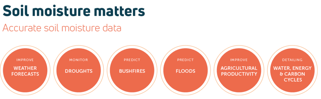
TERN Australia has a long history of soil moisture monitoring across the continent and is constantly working to expand its capabilities using innovations such as data model fusion, remote sensing, soil moisture capacitance probes, and cosmic ray neutron sensing.
Soil moisture monitoring
Soil moisture data is an important component in climate, hydrology and ecology models. In fact, ECV datasets, including soil moisture datasets, are required to support the work of the United Nations Framework Convention on Climate Change (UNFCCC) and the Intergovernmental Panel on Climate Change (IPCC). Accurate soil moisture data also improves weather forecasts, aids drought monitoring, increases the accuracy of bushfire and flood predictions, and is regularly used in epidemiological modelling of water-borne diseases.
Because fluctuations in soil moisture have a significant impact on crop yields, soil moisture data is also essential to agricultural management and food security, informing a range of activities from water-use decisions to carbon accounting.
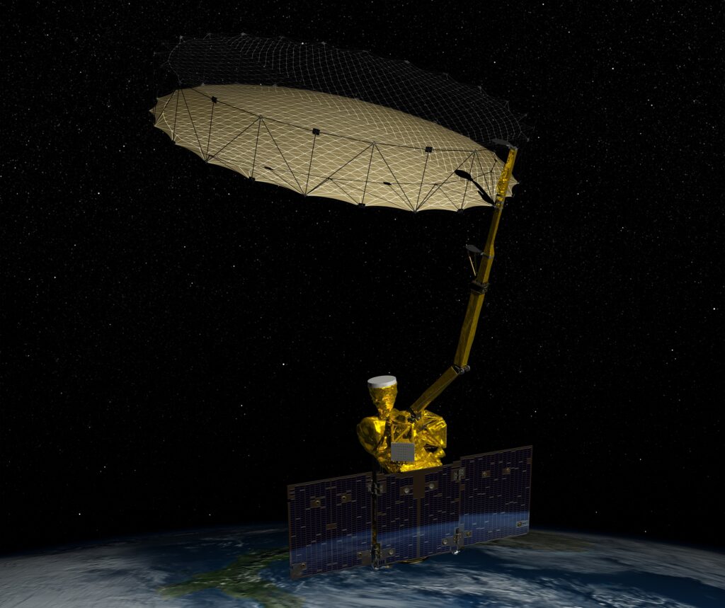
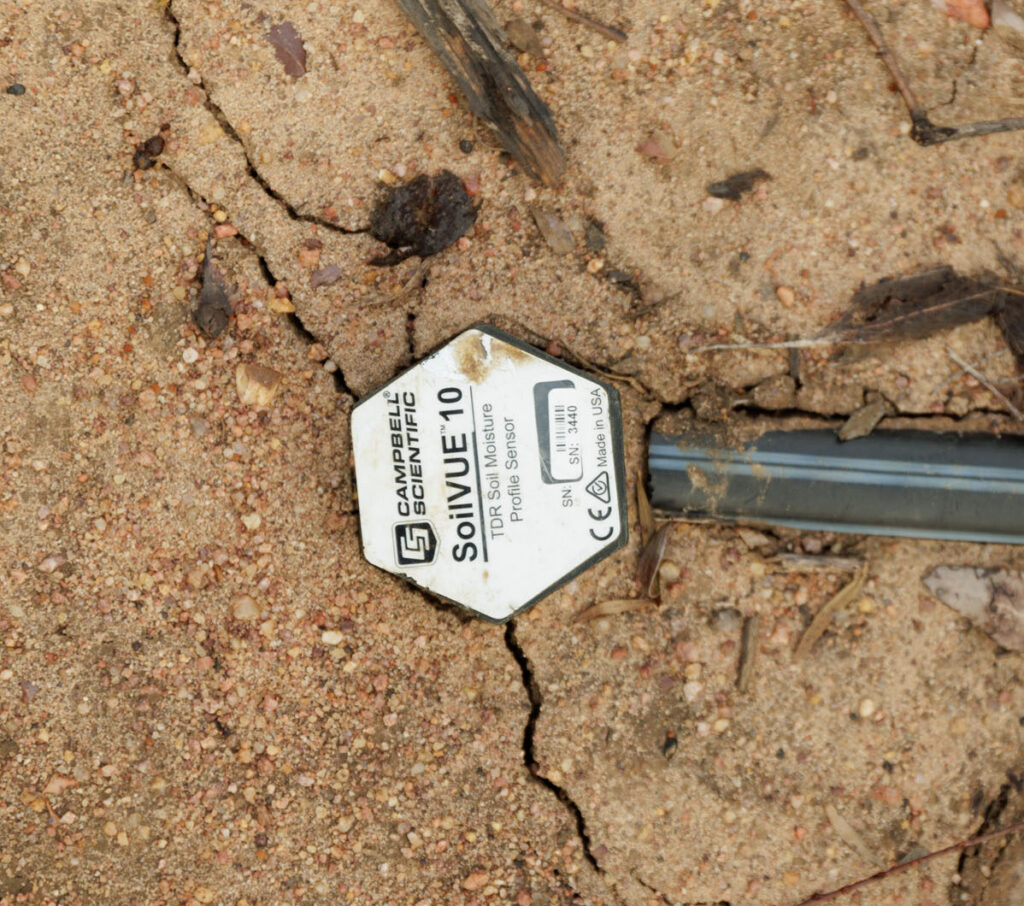
Top: artist’s visualisation of NASA’s Soil Moisture Active Passive satellite (credit: NASA); Bottom: a small in-ground soil moisture sensor (TERN).
Soil moisture is currently measured at different scales, each offering a unique level of insight:
On-the-ground, point-based sensors provide precise measurements at very specific locations and can be tailored to measure soil moisture at various depths throughout the root zone, depending on how deep you dig, so depths of 1 metre or more are not uncommon. However, once the sensor is secured in place, it has narrow spatial coverage – usually in the range of tens of cubic centimetres. Consequently, data from a single point-based sensor is difficult to interpolate across the landscape, as hydrogeology and vegetation change.
At the other end of the spectrum, global-scale satellite remote sensing captures soil moisture data over regional and even continental areas. But such broad spatial coverage comes at the cost of resolution, and the data can be too coarse to inform agricultural management decisions at the paddock scale. Moreover, satellite remote sensing only penetrates the top layer of soil (~ 5cm), providing limited information about moisture deeper in the rootzone.
But the idea is not to pit point-based and satellite sensing against one another, says Dr David McJannet, Principal Research Scientist in CSIRO Environment and Project Leader for TERN CosmOz. The idea is to combine multiple observation sources and fill the spatial gap in between them to achieve a comprehensive picture of soil moisture across the landscape at multiple scales.
Curiously, the means for filling that data gap begins elsewhere in the universe, most likely with the spectacular death of a massive star.
Cosmic rays
Cosmic rays are high energy particles — mostly protons and helium nuclei — that travel through space. Evidence suggests most cosmic rays in our galaxy originate from supernovas, the violent explosions that occur when extremely large stars reach the end of their stellar lifecycles. The final energetic cataclysm and subsequent shockwaves send charged particles hurling through space at near lightspeed.
Scores of supernovas occur every second throughout the universe and occur at an average of around two or three per century in our galaxy. Moreover, a single supernova remnant can continue to create cosmic rays for thousands of years. As a result, we’re constantly inundated with them.
“Cosmic rays are continuously showering the Earth”, says David.
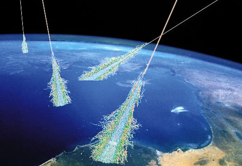
He explains that when cosmic rays slam into the nuclei of atoms in Earth’s upper atmosphere, the collision often knocks protons and neutrons and other subatomic particles out of those nuclei. These are sent careening in all directions, which slam into the nuclei of other atoms, and so on. This ongoing process, called spallation, creates cascades of subatomic particles in the atmosphere, including highly energetic neutrons called fast neutrons.
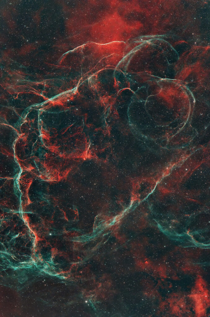
The Vela Supernova Remnant (800 light-years away) is the remaining cloud of gas and dust from a supernova that exploded around 11,000 years ago (image credit: Pawarun via Adobe iStock)
As fast neutrons travel down to the Earth’s surface and penetrate the soil, they continue to collide with the nuclei of other atoms and lose energy to become epithermal neutrons. However, because they’re so tiny compared to most nuclei, they tend to just ricochet without slowing down much. This is often likened to a ping-pong ball glancing off a bowling ball.
However, when a collision occurs between objects with similar mass, a lot more energy is transferred from one to the other. It’s more akin to one billiard ball colliding with another. This is essentially what happens when an epithermal neutron slams into the nucleus of a hydrogen atom, which is just a single proton and has a similar mass. In this collision, the epithermal neutron transfers a lot of energy to the proton and slows down as a result.
“Hydrogen is the most effective element for reducing neutron energy,” says David.
So, what does this have to do with soil moisture?
Every water molecule contains two hydrogen atoms, so epithermal neutrons are slowed down by the presence of water and become thermal neutrons. Soil moisture is the biggest source of water — and therefore hydrogen — in near-surface dryland settings. It points to an inverse relationship, says David: wet soil leads to slower neutrons, while dry soil results in more epithermal neutrons.
“This means we can simply measure changes in neutron intensity in the epithermal neutron range to infer soil moisture changes,” he says.
All you have to do is count the number of neutrons travelling at speeds of up to 4.4 million metres per second. Easy, right? Fortunately, a cosmic ray neutron sensor (CRNS) does exactly this. It functions like a counter for particles travelling in the epithermal neutron energy range (0.5eV to 100 keV).
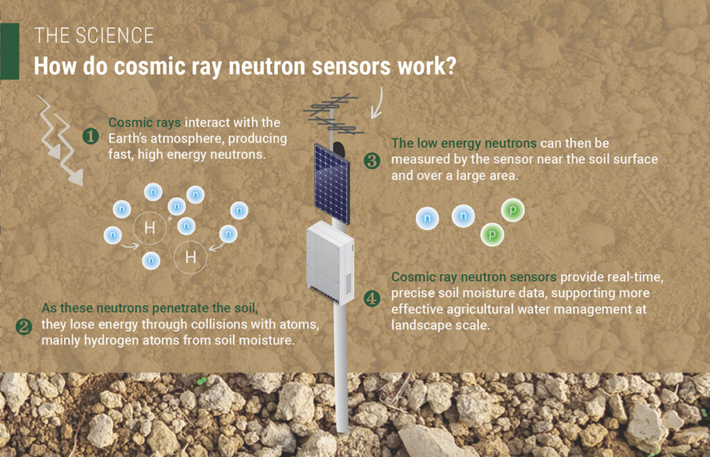
“If you restrict measurements to within the epithermal neutron energy band and then just literally count the number of neutrons you detect within this energy band, we find that the more neutrons you count, the drier the soil is,” David explains.
Conversely, as soil moisture increases, there’s more hydrogen available to decelerate those epithermal neutrons. As they slow down, they fall below the energy threshold of epithermal neutrons (~0.5 eV) and are not counted by the sensor, says David.
“A key feature of the cosmic-ray soil moisture observations is the sheer size of their large measurement footprint,” he says.
A CRNS is typically erected at around 1 or 2 metres above the soil surface, so it can detect epithermal neutrons arriving from all directions, including the neutrons that penetrate the surrounding soil and ricochet back out again. As such, it can detect epithermal neutrons over an area with a radius of around 200 to over 300 meters (8 hectares), providing information about soil moisture in this area to a depth of around 30 cm. According to David, this allows you to smooth out the spatial variability between point-based soil moisture sensors and bridge the gap to satellite measurements.
CosmOz
The Australian cosmic-ray soil moisture monitoring network (CosmOz) was established by CSIRO in 2010. It began with the deployment of stand-alone CRNS monitoring stations but things really got going when they partnered with TERN, says David. With TERN funding support, the CosmOz team began installing CRNS sensors at TERN’s flux station sites.
“We’ve now got them all over Australia,” he says, explaining how there are currently 33 CRNS sites with soil moisture data (22 active). Moreover, the initiative has led to a network of remarkable collaborations across states and institutions.
“For instance, the sensor at the TERN Gingin Banksia Woodland Supersite in Western Australia is being run out of Curtin University, we’ve also got people from Charles Darwin University who run the sensor at the TERN Litchfield site in the Northern Territory, and we have people from James Cook University who run the sensor at the TERN Robson Creek site in Queensland.
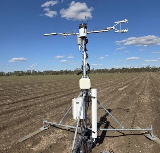
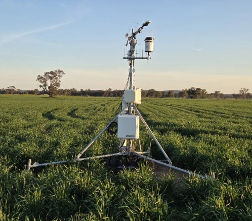

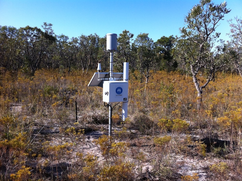
Top and bottom images on left: CosmOz CRNS monitors set up in an irrigated field (top) and a non-irrigated field nearby (bottom). Top image on right: CRNS set up in a grassland; Bottom image on right: CosmOz CRNS monitor set up at the TERN Gingin SuperSite (images via CosmOz)
Those sensors collect soil moisture data across a variety of Australian natural ecosystems, but there is an increasing interest in using CRNS in agricultural settings to better understand how climate change and irrigation practices impact soil moisture. For example, a particularly interesting observational experiment is currently underway in Narrabri, NSW, where two fields are being monitored simultaneously to determine the impacts of irrigation, says David. “One is irrigated cotton and the other is non-irrigated cotton, and there are flux stations and cosmic ray sensors on both.”
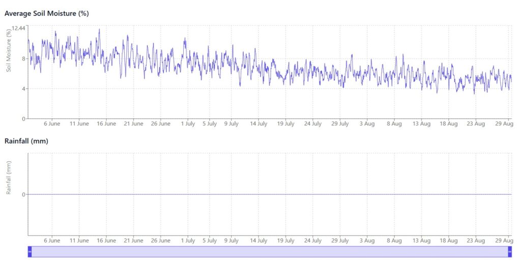
Top: recent soil moisture data from CosmOz CRNS at TERN’s Litchfield Savanna Supersite in the Northern Territory showing declining soil moisture over recent months; (bottom) rainfall data from the same location over the same time period rainfall (bottom) data from (via: CosmOz)
Maximising the benefits
The CosmOz team is also investigating how CRNS data could provide more insight into ecosystem fluxes that are influenced by soil moisture, such as evapotranspiration or photosynthesis.
“We’re trying to maximise the benefits of CRNS,” he says.
Flux towers provide estimates of evapotranspiration and Gross Primary Productivity — which is the amount of carbon being captured via photosynthesis in an ecosystem — but there are always inherent uncertainties in those estimates, says David.
In a recent study, David and his colleagues paired the data from 20 flux stations with the data from co-located CRNS sensors. This was done across a range of different ecosystems and climates around the globe from very humid to vary arid, he says. Combining those CRNS predictions with flux observations helps reduce uncertainties in estimates of evapotranspiration and GPP. They then used this data to train machine learning models. Those models were then able to make predictions of evapotranspiration and photosynthesis fluxes when supplied with soil moisture and meteorological data.
“We are showing that with the help of machine learning, we can use simple soil moisture measurements and meteorological data to make predictions of these quite complex processes,” he says.
“By using this approach, we can better understand processes like carbon capture or water use in a forest or crop,” he says.
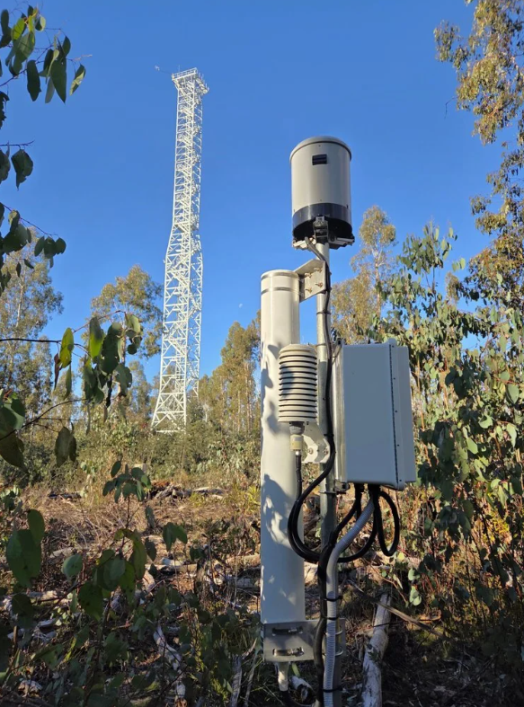
It could be particularly useful in areas where no flux data is available. Flux towers can be expensive to install and maintain, which limits how many can be setup across large areas. So even when you have a quite extensive flux network, global coverage is still quite limited, David explains. But CRNS stations are more affordable, so there’s scope to establish these sensors in more locations.
“You can’t take flux measurements everywhere,” he says. “But there’s an opportunity to fill in the gaps with machine learning models that are informed by simpler measurements like soil moisture observations from CRNS.”
“It means you can start building a better spatial picture of what’s happening across a landscape.”

Feature image at top: a visualisation of cosmic rays entering Earth’s atmosphere and triggering a cascade of subatomic particles (called a spallation) (image credit: Simon Swordy, UChicago via NASA)