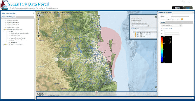
A screen shot of the SEQuITOR data portal that can be used to combine detailed data from many different sources and make them easier to understand
Most Australians live on or near the coast, enjoying the beaches, waterways and lifestyle that come with it. In response to the resultant growing pressure on our coastal ecosystems many government agencies, researchers and others collect data about the health of our rivers, estuaries and bays. The problem is that these datasets – dispersed across the country – are often very difficult to find and access.
A project led by the CSIRO and funded by the Australian National Data Service is changing that. The South East Queensland Integrated Terrestrial to Ocean Research project (SEQuITOR) is making access to coastal data simple. Users can map and graph different types of data from different sources quickly and easily. Data from real-time water quality sensors, modelled data from Moreton Bay and routine water quality monitoring results from the Queensland Government are all being made available. Access to much of the data has been possible because of recent efforts to release data using open licences.
Dr Christine Williams, Assistant Director-General of the Science Division in the Department of Science, Information Technology, Innovation and the Arts (DSITIA) is excited about the opportunities that open data can deliver. “Projects like SEQuITOR are making use of the Queensland Government’s open data policy. These sorts of applications mean that other researchers, government agencies and the general public can discover, combine and visualise data from several sources. Previously, this was a difficult and time-consuming process.”
Dr Andy Steven, from CSIRO, adds that “This is a first step towards improving access to coastal information in Australia. Many different organisations collect data which is key to understanding our coastal ecosystems, we need to get smarter about making use of all the information around us.”
The innovation behind SEQuITOR lies in the ability to combine many different sources and making highly detailed data easier to understand and quick to use through modern web-based visualisation and extraction tools. This means that investments in environment monitoring and data collection can start to result in improved knowledge and better evidence-based decision making, for everyone.
SEQuITOR is already being put to work, as part of a flood visualisation project funded by the Terrestrial Ecosystem Research Network (TERN). Stakeholders based in south-east Queensland are invited to attend the next project workshop in Brisbane on 12th June 2014 – please register your interest by emailing tern.comms@uq.edu.au
SEQuITOR is part of a broader program of work within the CSIRO’s Wealth from Oceans Flagship. Alongside SEQuITOR, the CSIRO is hosting the Australian Coastal Ecosystems Facility, part of the Terrestrial Ecosystem Research Network. ACEF is bringing together coastal data from across the country. The tools developed within SEQuITOR will be used within ACEF to further improve coastal data management in Australia.
SEQuITOR is accessible at http://www.sequitor.org.au and more information is available at http://blog.sequitor.org.au.
Originally published Media release, 16 May 2014, available for download here.
