
A Legacy of Water Wisdom: Wayne Meyer’s Journey from Irrigation to Arid Lands
Wayne Meyer has always been interested in water: how it moves through natural and agricultural systems, and by what happens to landscapes when there isn’t enough to go around. He
Real-time soil sensing and sampling for critical WA agricultural monitoring site
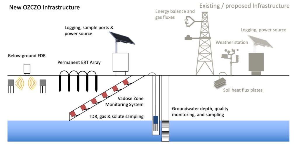
A state of the art Vadose-zone Monitoring System (VMS) has been successfully installed at the University of Western Australia (UWA) Ridgefield Farm, near Pingelley in
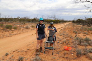
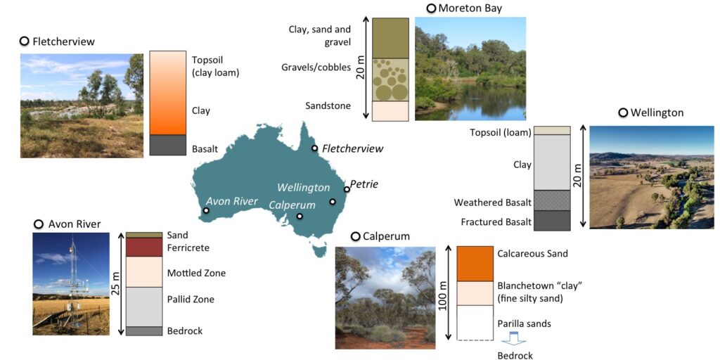
Critical Zone Observatory project kicks off at Calperum
The ARC-LIEF funded Critical Zone Observatory network (OZCZO) has started collecting data in South Australia.

Site of the month: Boyagin Wandoo Woodland SuperSite
This month we’re travelling to the wheatbelt region of Western Australia to visit TERN’s Boyagin Wandoo Woodland site and its paired Ridgefield Farm OzFlux site. Together, the sites’ automated monitoring infrastructure provide essential long-term continuous data to understand landscape dynamics in this biodiverse swath of Australia valued at almost AU$3 billion.

Paddock to reef: Australia’s newest monitoring SuperSite
The TERN-Queensland Government project to introduce continuous environmental monitoring sensors into the Burdekin region is progressing well.
The new monitoring equipment will allow TERN to deliver essential measures on the ecosystem functioning of grazing landscapes and enable improved pasture modelling for Queensland and beyond. Join us as we check in on the site’s progress.
Treetop to bedrock: understanding resilience of Australia’s Critical Zone to human impact
An interdisciplinary team is developing Australia’s first Critical Zone Observatories Strategy — the first step towards providing a robust, long-term framework for more effective and