Equipped with a mountain of high-tech reminiscent of science fiction flicks, scientists and volunteers have just spent a week working in the World Heritage Area of Tasmania to measure the composition and architecture of tall eucalypt forests that have regenerated naturally from past wildfires.
Earlier this month a group of scientists and volunteers from the University of Tasmania, the University of Queensland, the CSIRO, and Forestry Tasmania descended on the Tasmanian Wilderness World Heritage Area for a week of field work supported by TERN’s AusCover facility.
The team used a suite of high-tech equipment, including laser scanners, drones and planes to scan, measure and document the state of the forest at TERN’s Warra Tall Eucalypt SuperSite, part of the Australian SuperSite Network.
The Warra SuperSite is partly within the Tasmanian Wilderness World Heritage Area, which is managed for conservation, and partly within State forest, which is managed for multiple purposes including wood production. The site was established in 1998 to better understand the fundamental ecological processes in E. obliqua forests, to assess the rich biodiversity, and to determine the long-term effects of forest management regimes.
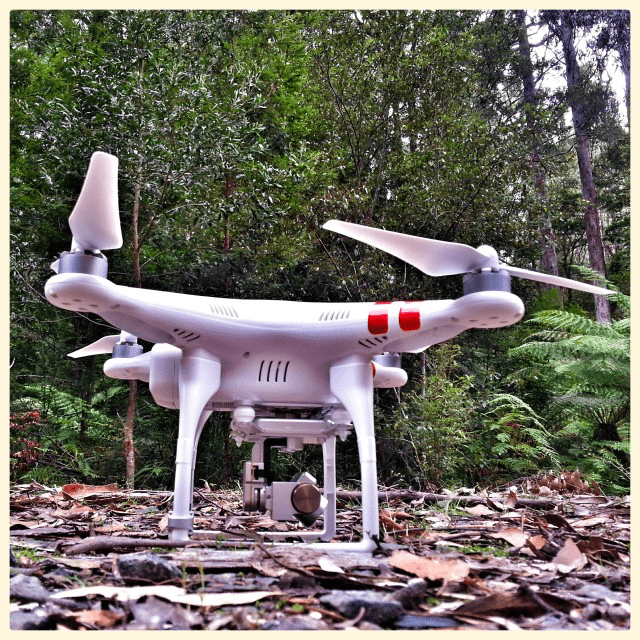 | 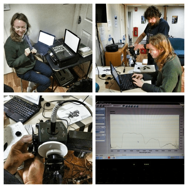 |  |
| A drone (left) and TERN’s DWEL terrestrial laser scanner (right) were just part of a suite of high-tech equipment that scientists used to measure and document the forest like never before. It wasn’t all fun and games for the team though, with a heap of data waiting for processing at the end of a long day of work (middle) (photos courtesy of Peter Scarth) | ||
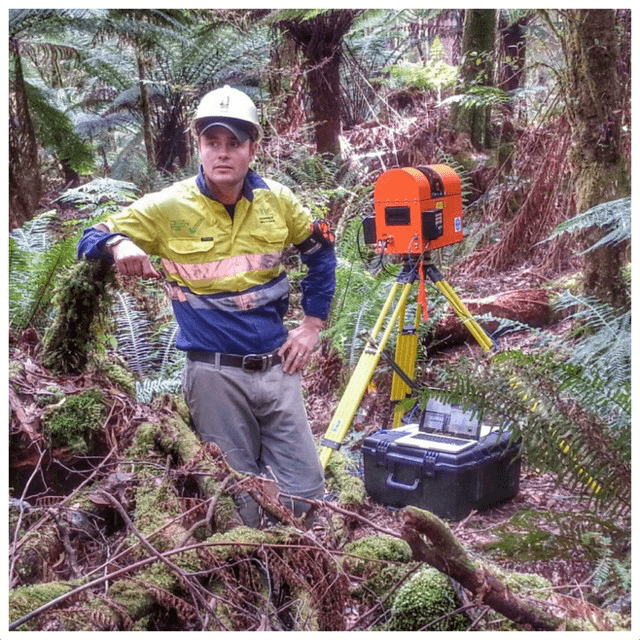
Over the week of fieldwork, ground-based teams used advanced terrestrial laser scanners, including TERN’s new DWEL scanner, to capture the three-dimensional structure of the forest beneath the forest canopy within a 25 square kilometre area. A tree climber, a slingshot, and a sharp shooter were all used to sample leaves from high in the canopy to learn about their spectral signatures and chemical composition.
For the first time in the AusCover project’s history, several small drones, or Unmanned Aerial Vehicles (UAVs), carrying multiple sensors were deployed by the coordinator of the AusCover Tasmania node, Arko Lucieer from the University of Tasmania. These UAVs were deployed to capture imagery from a unique perspective above the forest. The drone generated 3D models of the forest, and collected infrared images that will enable scientists to learn about the variety of tree species present in the forest. These UAV observations also allow researchers to link the detailed ground observations to the satellite observations covering much larger areas.

The view above the 80 m tall OzFlux tower at TERN’s Warra Tall Eucalypt SuperSite taken by the team’s ‘OktoKopter’ multi-rotor UAV, or drone. The OktoKopter UAV was flown at about 120 m above the ground, with its high-resolution camera capturing 300 images every 5-minute flight. The overlapping images captured during each flight are stitched together and used by scientists to make 3D models of the forest canopy’s structure.
Airborne Research Australia (ARA), a research wing of Flinders University, also conducted a number of flights over the site, during which the aircraft used advanced hyperspectral and LiDAR scanning to measure the 3D structure of trees and discover how the trees absorb and scatter light.
AusCover collaborator Dr Peter Scarth, of the University of Queensland, was one of those carrying out the fieldwork and says that all the data collected will be made openly accessible via AusCover’s data portal to help facilitate new science. These new datasets will help to answer complex questions about the composition and role of this ecosystem, including the total biomass and carbon stored in these old forests.
‘Trips like this are a significant investment in both time and money so it’s critical that all the data collected is captured in a way so that nothing is lost, it has comprehensive metadata and becomes free to access and reuse,’ writes Peter in his comprehensive online blog about the field campaign. ‘…Our various devices automatically uploaded over 500mb of data as soon as we were back in mobile range to the AusCover ODK Aggregate server so it’s safely backed up and ready to access using standard database tools. From here, it will be merged with any instrument data, checked for errors, and then uploaded to the AusCover portal for anyone to access. Cool.’
Arko Lucieer who led the weeklong Warra field campaign, says that such research and data provision wouldn’t be possible without the infrastructure provided by TERN and the support it receives via the Federal Government’s National Collaborative Research Infrastructure Strategy (NCRIS).
‘The collaboration of ecologists and remote sensing scientists using state-of-the-art sensor technology allows us to answer difficult questions about these complex ecosystems,’ says Arko.
For example, research data collection exercises such as these have already led to a better understanding of how harvesting methods for use in tall, wet eucalypt forests can meet social, ecological and silvicultural objectives while still being safe and productive.
This project is just one illustration of how TERN’s shared research infrastructure is allowing Australia’s ecosystem scientists to collaborate and synthesise effectively across regions and disciplines.
‘So that was a wrap – the week went really well and we achieved all we set out to collect, and more,’ concludes Peter on his blog. ‘Thanks to all the team and the Forestry Tasmania folk who came down to help, discuss, lug gear, cook, wash up, climb over decaying logs, work ridiculous hours and above all have a great time, share and learn from each other.’
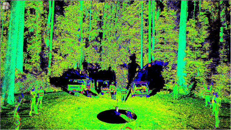
A quick scan of the team using the Riegl TLS LiDAR scanner at the Warra Flux Tower (photo courtesy of Peter Scarth)
- To read more about the fieldwork at Warra click here to view Peter’s blog.
- For more information on AusCover’s fieldwork at Warra and Arko’s research on drones for environmental monitoring click here.
- For more information on TERN’s DWEL scanner click here.
- For more information on Airborne Research Australia please contact Flinders University’s Jorg M. Hacker.
To find out more about how LiDAR works take a look at this video produced by our partners at the USA’s National Ecological Observatory Network (NEON):
Published in TERN newsletter February 2015
