Across a number of Australian cities, population growth and urban expansion are leading to rapid changes in land-use patterns and the use of resources, especially in urbanised coastal catchments.
Two of TERN’s land observatory facilities, the Australian Supersite Network, and the Australian Coastal Ecosystem Facility, are working together in south-east Queensland’s peri-urban environments to assess the impacts of land-use changes on water quantity, quality and biodiversity in the Logan and Albert estuaries.
Water quality monitoring equipment is in place at three locations in these estuaries, and is using cutting edge sensor technologies to collect real time water quality information. The equipment monitors a variety of parameters, including water temperature, pH and electrical conductivity, along with river flow, depth, sediment, dissolved organic material and nutrients.
At each of the locations, the data recorded is helping to generate a long-term dataset that can be used to monitor changes in water quality in the rapidly changing peri-urban environment. The data is being integrated into other monitoring and modelling activities, and is being delivered live to the web for public access.
This work is providing detailed information on the relationships between land use, water quality and ecosystem health of the estuary. Ultimately, this will help scientists to understand the patterns and processes that occur in complex estuarine environments. Already, this equipment has shown how nutrients and other biological parameters vary over the tidal cycle, which has important implications for design of aquatic monitoring programs.
These facilities are providing more detailed information than has ever been available for these estuaries before, and they are providing background datasets for other university and CSIRO research activities. The implementation of this monitoring equipment in the Logan and Albert estuaries is also serving as a valuable pilot program for evaluating the application of modern sensor technologies.
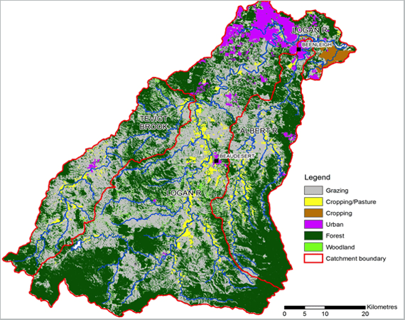 | 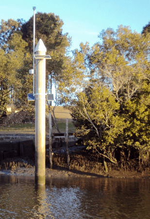 |
| Map of the Logan and Albert estuaries, where the Australian Supersite Network and Australian Coastal Ecosystem Facility are working to monitor water quality across the urbanised catchment. Different colours indicate different land uses, as shown in the legend. | One of the water quality monitoring stations used by the ASN and ACEF in the Logan and Albert estuaries |
Published in TERN e-Newsletter August 2012