The Pilbara Corridors project has established the first of its AusPlots ecosystem and environment monitoring sites in the Fortescue catchment, as part of a monitoring contribution to the national rangelands landscape. Pilbara Corridors Program Manager Ian Cotton said the initial two sites were established in May, one on Karijini National Park and one on Millstream Chichester National Park as a joint exercise between WA Department of Parks and Wildlife, Pilbara Corridors and TERN AusPlots.
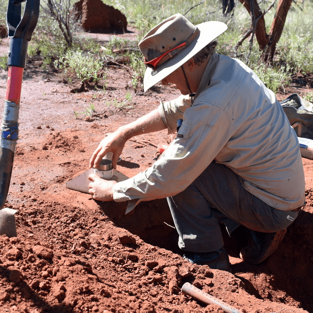 |
| TERN AusPlots staff Rick Flitton and Ian Fox collect soil bulk density samples (above) and point intercept data (below) at one of the new AusPlots monitoring sites established in WA’s Karijini National Park by Pilbara Corridors (photos courtesy of Ian Cotton) |
 |
“These two new sites are in Mulga (Acacia aneura), a regionally significant vegetation type, and Pilbara Box (Eucalyptus xerothermica) woodlands,” says Ian. “The new sites enhance existing Parks and Wildlife AusPlots sites in Western Australia and are integral to the Pilbara Corridors approach to monitoring major plant communities as part of the Pilbara Corridors project. They also add to a national network of surveillance monitoring sites,” he said.
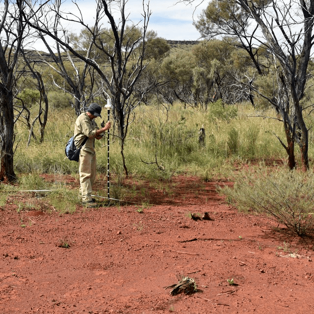
AusPlots Rangelands staff Ian Fox and Rick Flitton visited the Pilbara to provide hands-on guidance at the new sites including how to establish, sample and measure an ‘AusPlot’ and how to use the AusPlots mobile FieldSurvey app that is used to manage the data stream from onground data collection through to publication. Parks and Wildlife Nature Conservation Leader, Nigel Wessels and Pilbara Corridors Program Manager Ian Cotton joined in the field trip and helped collect plant voucher specimens, plant genetic material, soil samples and soil metagenomic samples. These samples add to the national sample library that is available for researchers to use.
The Pilbara Corridors project is funded through the Commonwealth Government’s Biodiversity Fund. The Project works in collaboration with people in the Fortescue River Catchment of the WA Pilbara region—pastoral and mining land managers and the indigenous community—through shared knowledge and best practice. The project works on landscape scale activities that connect across management boundaries providing coordinated responses to biodiversity threats.
Pilbara Corridors Program Manager Ian Cotton said the decision to implement AusPlots sites was made as they align and will assist with the current project’s environmental drivers of preservation and conservation of endemic vegetation, and reducing threats to biodiversity.
“The AusPlots rangelands methodology is ideal for this purpose because it is a nationally standardised and agreed approach,” says Ian. “The sites collectively will help identify spatial and temporal changes within sites and between sites as biological and non-biological influences come into play.”
The two new monitoring plots form part of TERN’s existing national and West Australian AusPlots Rangelands sites. Over the coming two years Pilbara Corridors plans to establish a further 30 ‘AusPlots’ in the Fortescue catchment.
- For more information on the AusPlots monitoring network click here or contact the AusPlots director Ben Sparrow
- For more information on the Pilbara Corridors project please visit: pilbaracorridors.com.au

Karijini sunset (photo courtesy of Ian Cotton)
Published in TERN newsletter June 2015
