Enhanced data on soil and exposed rock for the entire Australian continent are now openly available, with visualisations coming soon. Using innovative techniques to ‘see-through’ vegetation and analyse the land’s surface like never before, the new Barest Earth data are set to enable improved soil, lithological, geochemical and environmental modelling at home and abroad. Products tailored specifically for state-scale analyses are also downloadable at multiple resolutions.
Satellite remote sensing has been used extensively in mapping the nature and characteristics of the terrestrial land surface, including vegetation, rock, soil and landforms, across global to local-district scales.
However, with the exception of hyper-arid regions, mapping rock and soil from space has, until now, been tricky because vegetation either hides the underlying surface or confuses the light signals used by the satellite’s sensors.
Over the past year, TERN has been working with Geoscience Australia’s Exploring for the Future program, and we’re excited to announce the release of a much-improved time-series enhanced data product of soil and exposed rock that significantly reduces the influence of vegetation.
The algorithm used to generate the barest earth data, operated on Digital Earth’s Australia’s (DEA) Landsat archive, was developed through a collaboration between Geoscience Australia and the Australian National University, which was published in the Nature Communications journal.
Tailored data products at multiple resolutions
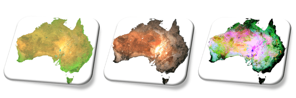
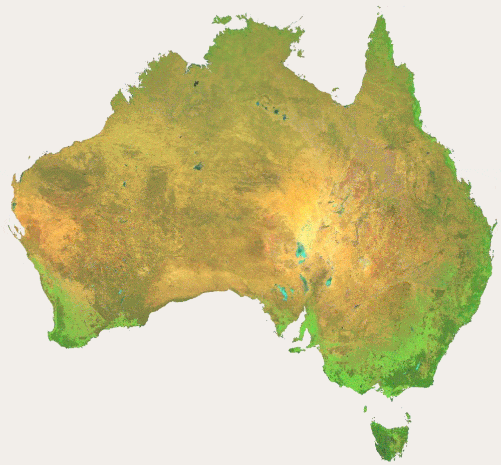
The new TERN-enabled Barest Earth data products are produced using Landsat satellite imagery. 23 ‘raster’ datasets at both 25 m and aggregated 90 m resolutions are available for the entire Australian continent and all the states and territories (complete with buffer zones around borders).
“The new TERN-enabled Barest Earth products consist of the suite of enhanced images using band ratios and a principal component analysis. These images have broad use in surface mapping and as inputs into machine learning predictive models.
It’s fantastic to see TERN working with Geoscience Australia to produce new products that meet the specific needs of Australian and international researchers.”
Dr John Wilford, Geoscience Australia
Improved inputs for better predictive modelling
The new enhanced TERN Barest Earth data provide improved inputs for predictive modelling of soil and rock properties over the Australian continent.
For example, in one pilot study, use of these data products to model chromium and sodium distribution, using a machine learning algorithm, improved model performance by up to 46%.
The new datasets improve capacity to map surface geochemistry and mineralogy and form the surface component in Geoscience Australia’s work in building a 3D framework to support the mining and resources sector.
In addition to geochemical modelling, future data users such as Dr Karen Holmes from Western Australia’s Department of Agriculture are excited about the applications within the agriculture and natural resource management (NRM) domains.
“So excited to try out the Barest Earth products – they are going to make a big difference for mapping soils in Western Australia’s rangelands. Having a better handle on surface soil colour will really help us map and monitor ground cover, so we can track land condition and focus our efforts to manage land resources sustainably.”
Dr Karen Holmes, Western Australia’s Department of Primary Industries and Regional Development
The pathways to real-world science and management impact generated by these data are set to extend beyond Australia. The environmental data represent much sought after southern hemisphere information that can result in more accurate global-scale modelling and analyses.
Additionally, Dr Adam Lewis, the Managing Director of Geoscience Australia’s Digital Earth Africa program, says that the collaborative work sets a valuable example of what can be done in other countries around the world.
“I expect that African countries would find this information equally valuable, in which case we can develop similar Barest Earth products available to the whole of Africa via Digital Earth Africa, so the work done by TERN and Geoscience Australia provides a template of world’s best practice that we can look at adopting.”
Dr Adam Lewis, Geoscience Australia