TERN has developed a powerful new method combining modelling and field surveys to determine the optimal location of new monitoring plots in bioregions not currently covered by the national ecosystem research infrastructure. New TERN plots will provide better spatial and temporal data to meet the needs of researchers and modellers.
Monitoring Australia’s vast and diverse terrestrial ecosystems is a complex and time-consuming task.
Through its surveillance monitoring program, TERN aims to ensure every terrestrial ecosystem in Australia is represented in its sample and data libraries, so that environmental change across all systems can be monitored and there are no gaps in information.
Indeed, over the past decade, TERN has collected and made available soil and vegetation data and samples from over 750 monitoring plots across the Australian continent.
However, there is always room for improvement in the TERN monitoring network and new survey plots can be added to efficiently increase ecological representation.
To this end, TERN is working hard to establish new monitoring plots and fill data collection gaps in bioregions not currently covered by the national research infrastructure. Doing so will provide better spatial and temporal data to meet the needs of researchers and modellers.
A combination of field campaigns and data modelling
TERN has recently developed and published a powerful new method that combines iterative modelling with field surveys to determine the location of new plots that best complement the ecological pattern of existing plots.
Dr Greg Guerin of TERN’s Ecosystem Surveillance platform says that the strategy maximises the efforts invested in field campaigns and ensures user confidence in robust, objective data collection.
“Rather than choosing new plots by looking at the map and selecting geographic gaps, we used an ecological modelling method known as Generalised Dissimilarity Modelling (GDM) combined with targeted field campaigns to ensure representative sampling.
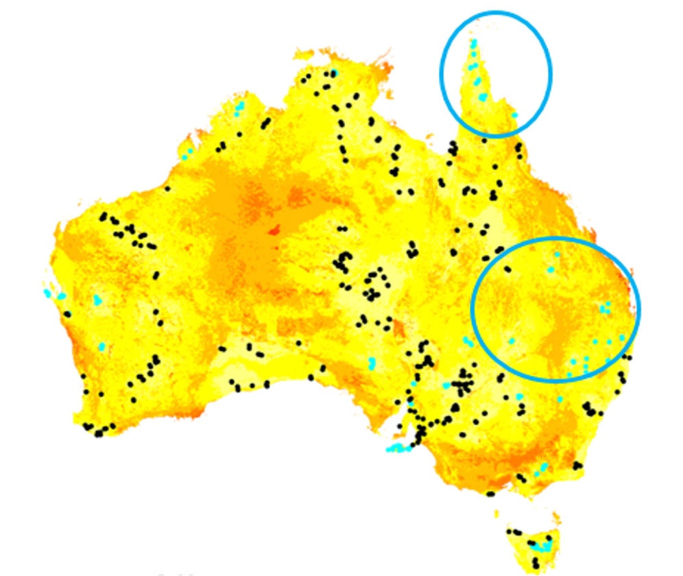
We used the comprehensive species composition data recorded in 531 TERN Ecosystem Surveillance plots already established across Australia to create a biodiversity model to inform the general location of further gap-filling surveys, which were predicted to be the most different using GDM.”
Dr Greg Guerin, TERN
This approach contrasts with the methods used to establish the original TERN AusPlots network, which used environmental layers in the absence of ground data.
The advantage of using TERN’s plant species composition data—the only standardised dataset of plant species identity and abundance across Australia—for modelling ecological differences is the ability to capture complete sets of co-occurring species at patch scale.
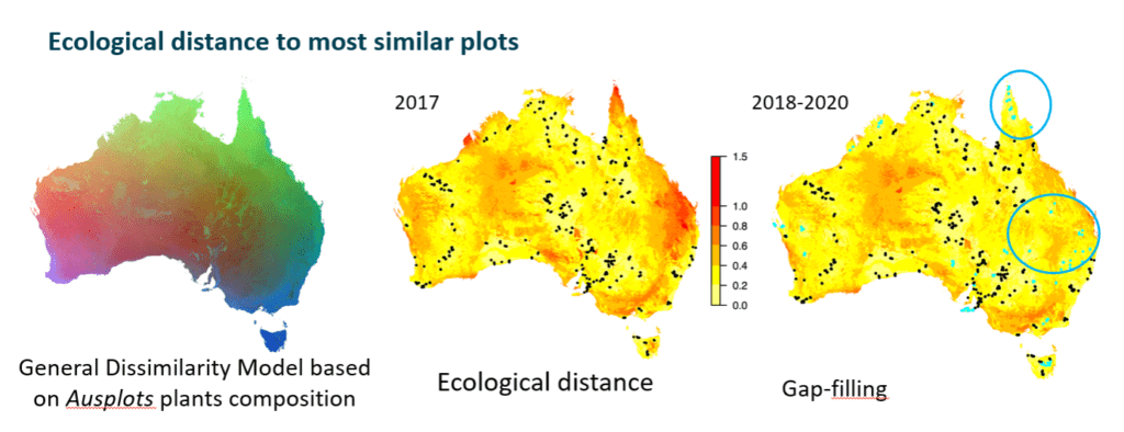
TERN has already established new ecosystem surveillance monitoring sites using the method, and will continue to use it to select new sites in the future. Red areas in the centre map above show furthest ecological distance from existing plots and blue points on the right map show new plots added to the TERN network between 2018 and 2020. Some of the first identified areas for new plots were Far North Queensland, New England Tablelands and the Kimberley region north of Broome.
Maximising ecological coverage in the absence of fine-scale biodiversity survey data
Greg says that the work demonstrates that with cycles of modelling and field-based surveys—including regular feedback of information between the two—it is possible to design an efficient program to include representation of all ecosystem types in a national ecosystem monitoring network.
“The new method of plot selection provides a logistical advantage because a relatively small number of plots are required to gap-fill.
It offers a pragmatic approach for gap-filling survey plots across Australia that balances quantitative information with the practical constraints that come with collecting fine-scale field data across Australia’s vast and diverse landscapes.
The TERN Ecosystem Surveillance field team can now focus on targeting smaller remaining gaps and revisiting plots to add temporal depth to the data and sample libraries.”
Dr Greg Guerin, TERN
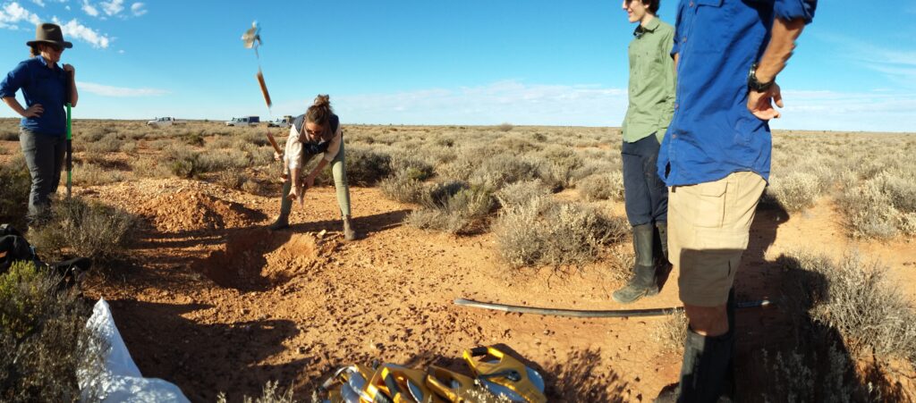
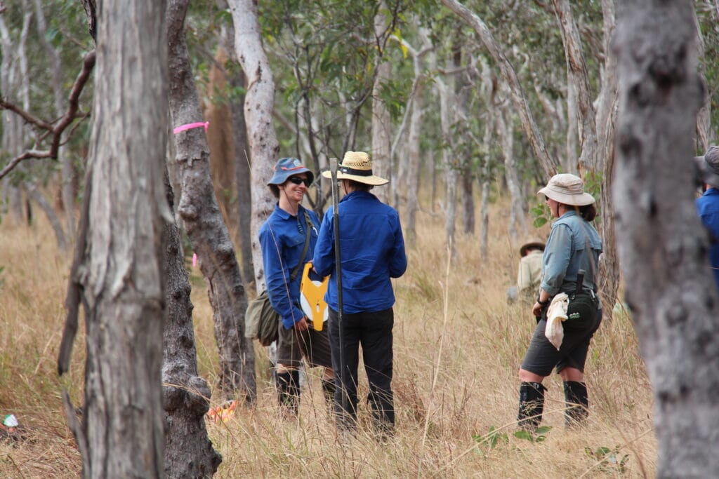
TERN’s Ecosystem Surveillance platform conducts field surveys and sampling across a national network of plots and transects to provide the data, samples and advice needed for improved monitoring and assessment of Australia’s major ecosystems.