

Vegetation structure is one of the clearest indicators of how ecosystems are faring: how much carbon they store, the habitat they provide, how they recover after fire or drought, and how resilient they remain in a changing climate. A single snapshot is rarely enough. We need measurements that can be repeated consistently over time and across scales, from individual trees to entire landscapes. This requires an almost cinematographic approach, in which researchers can change perspective, zoom in to examine the fine details of a single tree or zoom out to understand patterns across whole ecosystems. Each view reveals different information and together they create a richer, more complete picture that helps researchers interpret and validate observations made at other scales.
The versatility of LiDAR technology makes it well suited for this kind of approach. With its capacity be used across ground-based, aerial and spaceborne platforms, LiDAR technology enables researchers to map vegetation structure at multiple-scales and multiple perspective. When these approaches are combined, the biomass of a whole forest can be rendered in 3D, from individual leaves and fine-level branching to the architecture of individual trees to the large-scale morphology of an entire canopy as it spans the landscape. Moreover, LiDAR’s repeatability makes it well-suited to time-series data collection enabling researchers to tell forest recovery from decline and carbon storage from loss.
In TERN’s October webinar, Seeing our vegetation change: why LiDAR time series matter for Australia’s future, we were joined by Professor Kim Calders (Ghent University, Belgium), Dr William Woodgate (UQ, TERN), and Dr Shaun Levick (CSIRO Environment), who spoke about how they work with LiDAR to monitor Australian ecosystems. The event garnered a great deal of Australian and international attention – highlighting the widespread interest in LiDAR as an effective ecosystem-related monitoring approach.
The following article complements the webinar. It provides a brief explainer of LiDAR and its utility in forest surveys. It also discusses how ground-level and airborne LiDAR data collection at TERN’s field sites are providing granular information on vegetation structure at those locations, while also validating spaceborne LiDAR measurements as part of an international initiative to measure global forest biomass.
What is LiDAR?
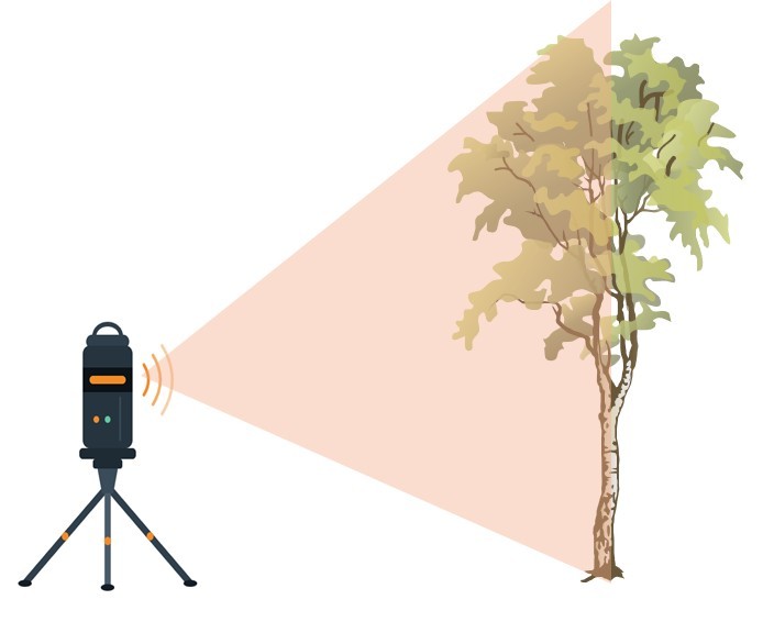
LiDAR stands for Light Detection and Ranging and involves the use of laser light to generate high-resolution three-dimensional digital maps of objects or surfaces. A LiDAR instrument emits a series of laser pulses and if a pulse hits a solid object, the laser energy is reflected back to the LiDAR’s sensor. The instrument measures the time elapsed between the outgoing and returning laser pulse, as well as the angle of the returning pulse. Because the speed of light is known, the LiDAR can then calculate the precise location in space (relative to the instrument) where the laser pulse hit the object. The sensor then generates a single data point representing 3D coordinates.
A LiDAR instrument can emit many thousands to millions of laser pulses per second, so each scan can generate an enormous ‘point cloud’ of data points. Such point clouds are used to build a 3D digital model of the scanned area. This makes LiDAR a particularly valuable tool for measuring and analysing vegetation structure.
For example, researchers can scan a single tree from multiple directions to generate an extremely detailed 3D model of that tree. As Will Woodgate noted in his TERN talk, such LiDAR-derived models are so precise you can distinguish fine-level structures. “We’re not just getting wood structure, we’re also getting leaf structure,” he said, explaining that it’s possible to classify individual data points as belonging to tree trunks, limbs, branches, all the way to individual twigs and leaves.
The spatial arrangement of a tree’s structural components — from the trunk to the branches and leaves – has a significant impact on the tree’s function, influencing photosynthetic efficiency, nutrient and water cycling, as well as carbon capture. A highly accurate 3D model of a living tree therefore offers useful insights into its function. The model also enables calculation of the tree’s total volume which can be used to estimate how much carbon is locked away in its biomass.
Another key feature of LiDAR is that it is easily repeatable. Because LiDAR data collection is both non-destructible and efficient, scans can be collected at the same location at multiple time points, making it possible to monitor structural changes across seasons, years and decades.
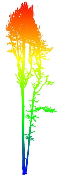
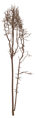
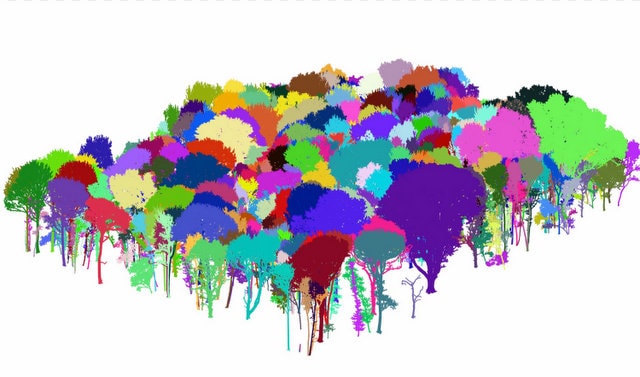
Left and middle: 3D model of individual trees generated from LiDAR scans. Right: 3D model of a forest generated from LiDAR. Images courtesy of Kim Calders.
From leaves to landscapes
While LiDAR can provide a great deal of information about a single tree, its real power lies in its capacity to map vegetation structures of whole ecosystems and landscapes. In recent decades, LiDAR instruments have become extremely compact, lightweight and durable making them amenable for use in terrestrial, aerial and spaceborne platforms. Consequently, LiDAR surveys can cover a wide range of spatial scales.
Terrestrial LiDAR
During ground-based forest surveys, researchers use an approach called Terrestrial Laser Scanning (TLS) where the LiDAR instrument is mounted on a portable tripod and rotates 360 degrees on a vertical axis to capture spatial data on the surrounding vegetation.
This is repeated at multiple different locations within the survey area according to an agreed protocol, so that individual trees, shrubs and other objects can be scanned from several directions and it is possible to carry out a scan at a future date using all the same parameters, thus building a picture of change over time.
When the resulting point clouds of data are combined into a single dataset, researchers can generate a 3D model of the above-ground vegetation in the surveyed area. It’s a useful technique for measuring vertical layers including the forest understorey, midstorey and canopy, providing information about the height, density and surface area of each layer
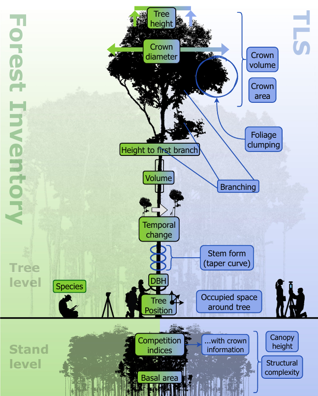
Terrestrial laser scanning provides a wealth of detailed structural data to support forest inventories (image via: Eiji Maeda et al (2025) Expanding forest research with terrestrial LiDAR technology Nature Communications cc-by-4.0)
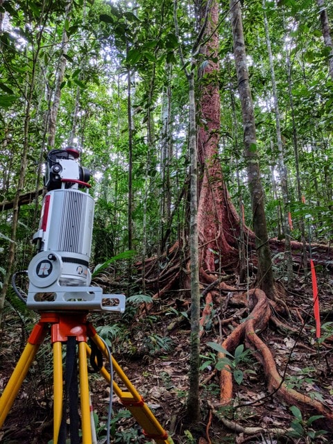
TERN conducts Terrestrial Lidar Scanning (TLS)
across its entire network of SuperSites
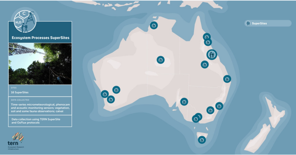
Image Left: Terrestrial laser scanner set up to collect data at TERN’s Robson Creek SuperSite (image via Kim Calders)
Airborne LiDAR
LiDAR is widely used in aerial remote sensing, where sensors are mounted on crewed aircraft or integrated into aerial vehicles (UAVs or drones).
Unlike TLS, which provides highly detailed measurements of vegetation structure from the ground, airborne LiDAR captures structural information across larger areas, enabling researchers to map forests, woodlands and other ecosystems at landscape scales.
Because the laser pulses are recorded from above, airborne surveys can efficiently measure canopy height, canopy cover and other structural characteristics over extensive or difficult-to-access terrain.
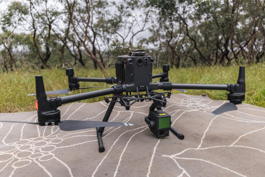

Top: Drone with LiDAR sensor attached; Bottom: Drone survey at TERN’s Robson Creek SuperSite (images via Kim Calders)
TERN collects airborne LiDAR data through both crewed aircraft and UAV-based surveys across its network of Plots and SuperSite locations, providing landscape-scale measurements that complement ground-based observations and support ecosystem monitoring across Australia.
Video: UAV-based LiDAR survey at TERN’s Litchfield SuperSite
Spaceborne LiDAR
LiDAR has been spaceborne ever since an early version of the technology was used in the Apollo15 mission in 1971 to map the surface of the Moon. Today, LiDAR is an important part of remote sensing of terrestrial ecosystems via instruments integrated into Earth observation satellites. Several satellite missions involving LiDAR are currently collecting data relevant to mapping forest biomass, including NASA’s GEDI and ICESat-2, ESA’s BIOMASS, JAXA’s ALOS, as well as NASA/ISRO’s NISAR which began scientific operations earlier this year.
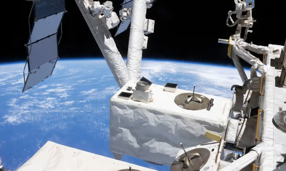
The GEDI instrument mounted on the International Space Station uses LiDAR to collect data on Earth’s biomass data (image credit: NASA)
An animation of the Global Ecosystem Dynamics Investigation (GEDI) instrument, demonstrating laser pulse interacting with a multi-level forest canopy and the ground. When the reflected photons return to GEDI, it generates a waveform that provides information about canopy structure. Through the GEO-TREES initiative, high-quality ground-based LiDAR data will help validate data from GEDI and other spaceborne LiDAR (video credit: NASA’s Goddard Space Flight Center)
LiDAR and field inventory data collected at TERN sites contribute to international calibration and validation efforts, helping to ensure that satellite-derived estimates of forest biomass and carbon are accurate and reliable under Australian conditions.

Multi-scale LiDAR
Independently, each of these platforms offers a unique viewpoint and spatial resolution. Yet each platform also has limitations. TLS captures fine details of the understorey and mid-storey, but the requirement of manual fieldwork limits coverage area and frequency of data collection. Depending on vegetation density, TLS may also have difficulty distinguishing individual tree structures higher in the canopy. Conversely, spaceborne LiDAR offers broad spatial coverage and a useful top-down view of the canopy, but this comes at the cost of resolution, which can mean sacrificing fine-scale ecological details. It can also be impacted by cloud cover. Meanwhile, airborne LiDAR fills the gap between TLS and satellite LiDAR, offering a flexible means of collecting data closer to the canopy. Nevertheless, it does not quite achieve the same degree of accuracy as TLS nor the spatial range of satellite LiDAR.
Each approach has strengths and weaknesses, but rather than pitting one against the other, researchers are increasingly using a multi-scale approach — in which two or preferably more of these platforms are used to collect data on the same survey area. For example, combining TLS with airborne LiDAR helps bridge the gap between fine-scale ground observations and broader regional or continental assessments.
When LiDAR datasets from different platforms are fused, they generate a comprehensive, spatially robust, yet high resolution dataset of a large area. It’s a powerful approach that can fill gaps and reduce statistical uncertainty, especially when combined with site-based vegetation inventories, so that the species of individual trees can be identified in the 3D digital model.
Another important advantage of combining approaches is that ground-based and airborne LiDAR observations can facilitate calibration and validation of spaceborne LiDAR surveys of the same area. In fact, the ‘cal-val’ of LiDAR observations from Earth observation satellites is central to an international initiative to monitor forest biomass and strengthen carbon accounting at a global level.
GEO-TREES
“We are entering a new era of forest observations from space,” says Klaus Scipal, who serves as Mission Manager for the European Space Agency’s MSOS and BIOMASS satellite missions at the Agency’s Centre for Earth Observation. But as he explained in a recent presentation for the Group on Earth Observations (GEO), although satellite LiDAR surveys are increasingly designed to measure global forest biomass, significant challenges remain when it comes to translating that data into reliable information on forest growth, degradation and carbon cycling. This is a particularly critical issue for carbon accounting initiatives, which require accurate estimates of total forest carbon storage over time.
After all, LiDAR does not measure biomass directly, it measures vegetation structure. The 3D models are used to calculate the total volume of vegetation which, in turn, is used to infer the total biomass. This estimate of total biomass is used to infer total carbon. Each layer of inference involves assumptions, Klaus explained, and those assumptions add uncertainty.
“We need ground-based observations, ground measurements, to anchor our earth observation products to reality.”
Although carbon accounting is now a billion-dollar market and growing, he said, “without that ground truth there isn’t enough trust to encourage investment.”
This is where GEO-TREES comes in. The Forest Biomass Reference System from Tree-by-Tree Inventory Data (GEO-TREES) is an international consortium in which TERN participates, managed by the Smithsonian Institution and the European Space Agency (ESA). Its goal is to build a global reference system of high-quality ground data to validate satellite-derived estimates of biomass and carbon.
To do this, GEO-TREES needs accurate, recurrent, site-based measurements of key forest structures at ground level. Rather than starting from scratch, they are working with ecosystem research organisations and ecosystem research infrastructures, such as TERN, to build a Forest Biomass Reference System: a network of established, long-term forest monitoring sites around the world. To ensure data consistency and usability, GEO-TREES has established standards for participating sites as well as protocols for data collection.
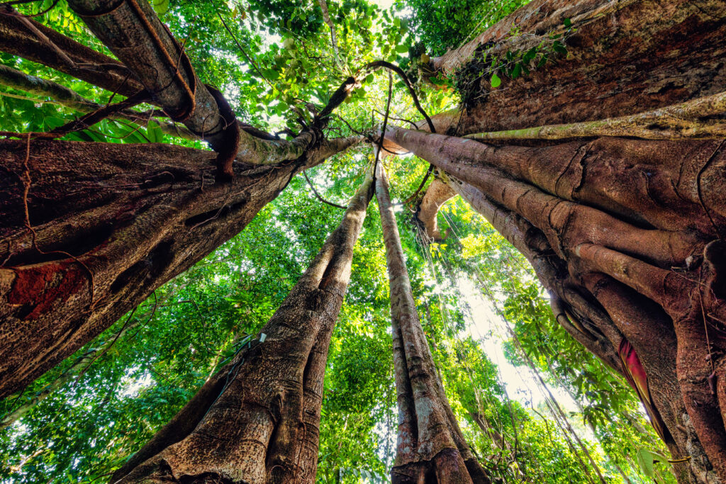
For example, current requirements include 3 hectares of ground-based lidar surveys (TLS) and 1000 hectares of high-quality aerial or UAV LiDAR surveys, as well as 10 hectares of field inventory plots for tree-by-tree surveys of tree diameter, height, and species.
GEO-TREES’ first priority is to populate the reference system with ground-based data from tropical forests, beginning with those in equatorial regions and expanding into the global south. These ecosystems are especially vulnerable to climate change and there is a substantial gap in ground-level data due to funding limitations, challenging and risky terrain, as well as dense vegetation that makes canopy penetration by satellite LiDAR quite difficult.
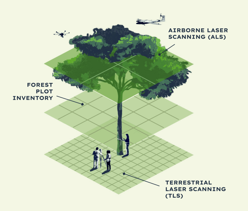
Image credit: GEO-TREES
To date, GEO-TREES has established 49 sites and is currently setting up a number of additional sites. TERN has been a participant in GEO-TREES for many years based not only on Australia’s location in the Southern Hemisphere, but also because several of our long-term monitoring sites have been recognised as valuable additions to the global network. These sites are at Robson Creek, Litchfield, Great Western Woodlands and Calperum, reflecting the strength of Australia’s existing ecosystem observation infrastructure.
With much cross-institutional collaboration and input of specialist expertise from members of TERN’s broad ecosystem community, it has met the rigorous GEO-TREES requirements for field inventories, repeat measurements and high-quality terrestrial and airborne LiDAR data collection. Additionally, TERN’s expertise in calibration and validation activities and data management provide the consistent, high-quality reference data needed to support GEO-TREES’ global forest biomass reference system.

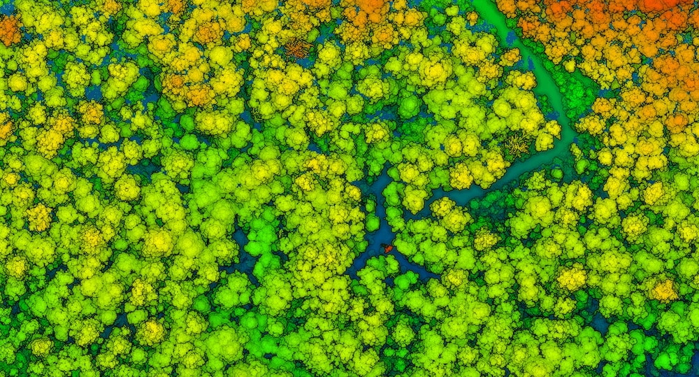
Feature image: LiDAR-generated image of the forest at TERN’s Warra Tall Eucalypt SuperSite