

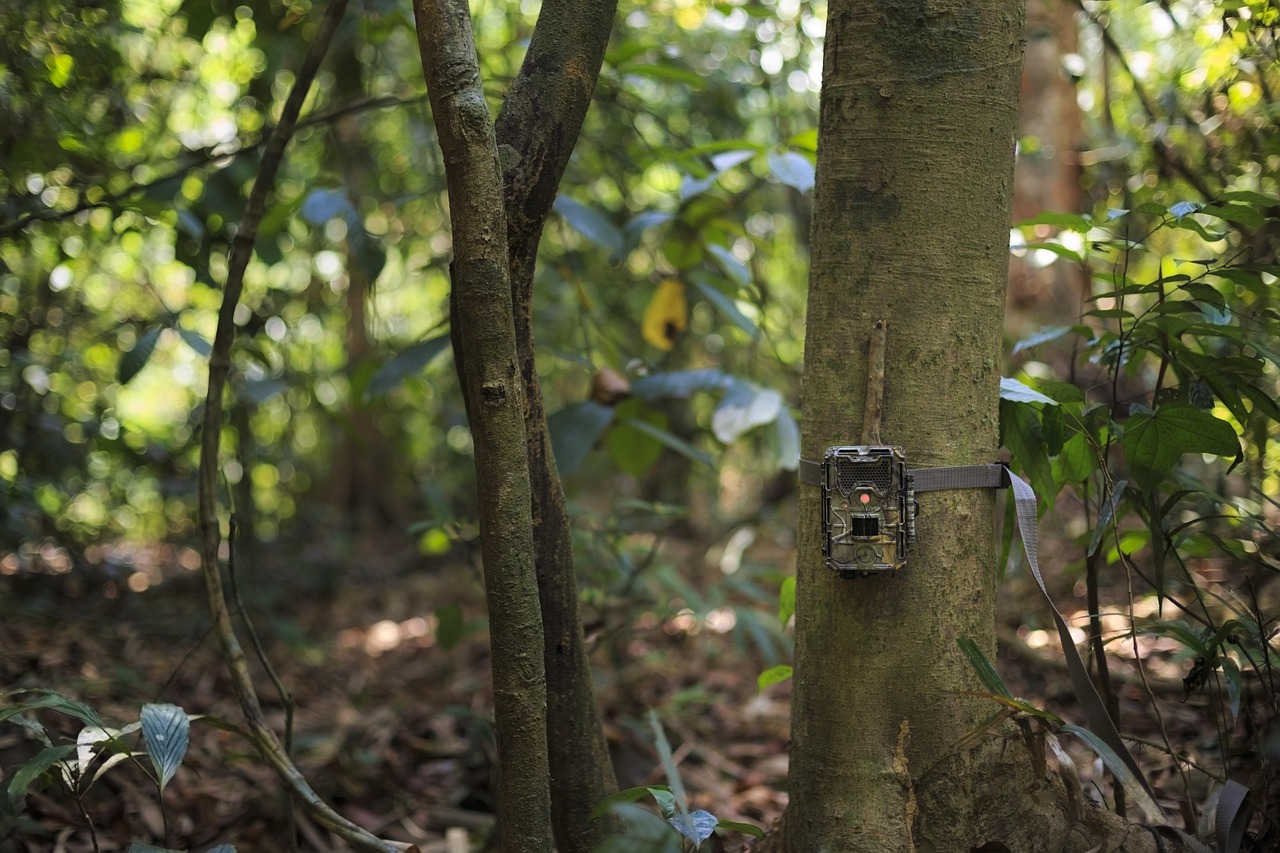
For camera trap data to deliver real conservation impact, it must be accessible, shareable, and analysis-ready. This month, a significant camera trap survey from Queensland’s Wet Tropics Rainforest, processed by the Wildlife Observatory of Australia (WildObs) team, was published on TERN EcoPlots, making a valuable biodiversity dataset available to the broader research community.
Written by Dr Zachary Amir
Principal Data Scientist, Wildlife Observatory of Australia (WildObs), TERN Australia
One dataset
Between September 2022 and March 2023, we deployed 275 camera traps running day and night across six national parks in Queensland’s Wet Tropics World Heritage Area. Each site used a pair of cameras, with one placed on a road and the other 50 metres into the rainforest. This design enables us to compare predators such as dingoes (Canis familiaris dingo) and feral cats (Felis catus), which travel along roads and trails, with small native wildlife, such as bandicoots (Perameles sp.) and pademelons (Thylogale sp.), which avoid them. Ultimately, we want to understand how they interact and all coexist in the same rainforests. By the end of the surveys, the cameras recorded 24,879 independent detections of 65 species, including endemic birds like the southern cassowary (Casuarius casuarius) and chowchilla (Orthonyx spaldingii), endemic marsupials like Lumholtz’s tree kangaroos (Dendrolagus lumholtzi) and musky rat kangaroos (Hypsiprymnodon moschatus), and feral species like horses (Equus caballus) and pigs (Sus scrofa).
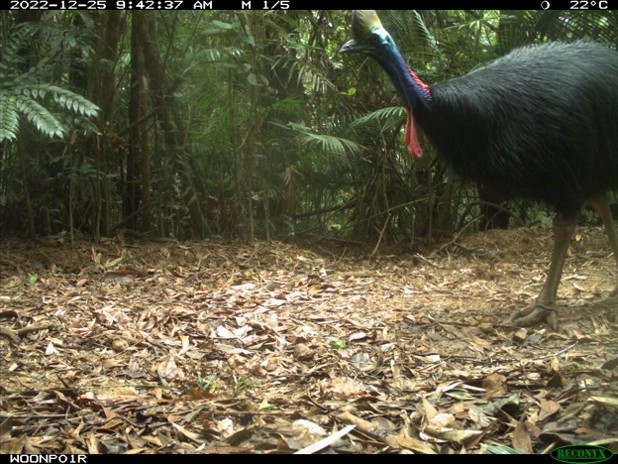
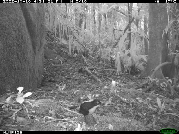
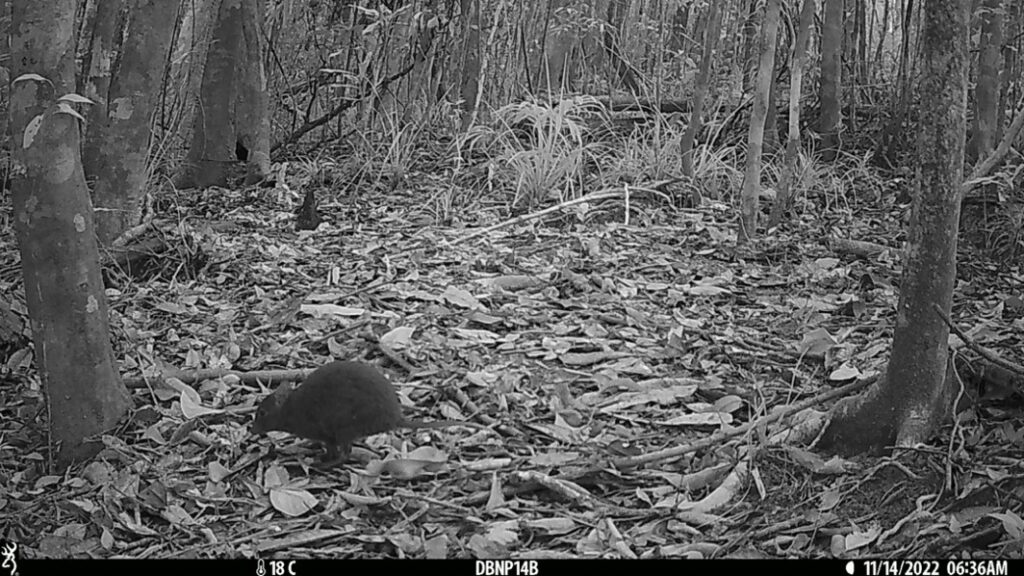
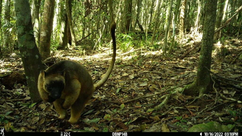
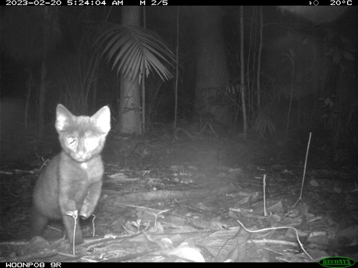
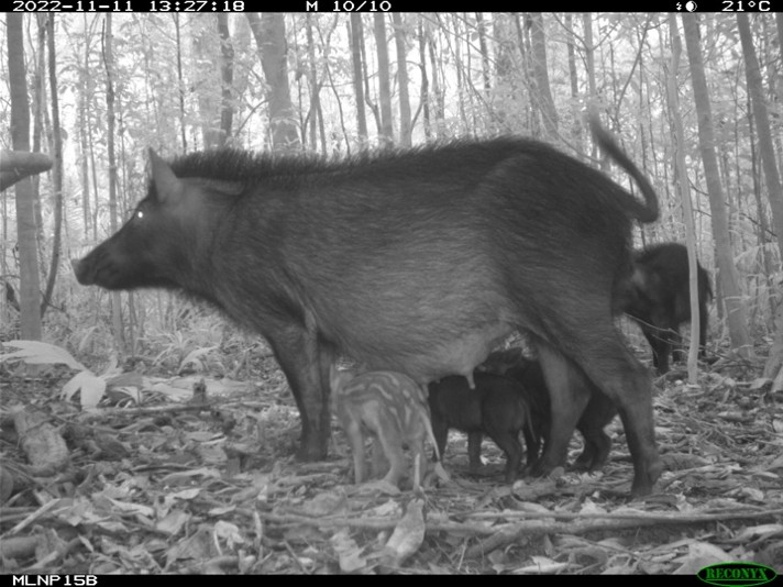
Images from our camera trapping survey across the Wet Tropics World Heritage Area, where we detected (left to right, top to bottom): southern cassowary, chowchilla, musky rat kangaroo, Lumholtz’s tree kangaroo, and feral cat and pigs. Dataset: Amir et al. (2022).
Datasets like mine often end up on a hard drive locked away in an attic. However, that isn’t for lack of goodwill. Camera trap data are notoriously large, messy, and riddled with minor errors, such that accurately describing their complexity in sufficient detail for someone else to trust takes far too much time from researchers’ already limited time budget.
This month, our Wet Tropics camera trap survey became the first Wildlife Observatory of Australia (WildObs) dataset published on TERN Australia’s EcoPlots Platform. The same data are also available through the Atlas of Living Australia (ALA), our R package, WildObsR, and the WildObs Database Dashboard (login required). Every version points back to a single Research Activity Identifier (RAiD). Sharing our Wet Tropics camera trapping dataset as widely as possible has taken two years of planning, data transformations, and technical conversations with Australia’s largest biodiversity data aggregators, and it sets a template for many more datasets to follow.
Several doors
Researchers seek different outputs from camera trap data, so we published the same survey in several formats. Think of these data formats as a ladder of information resolution: the WildObs Database stores everything, EcoPlots maintains the contextual survey structure, and the ALA retains the species essentials. Each format suits different users.
- WildObsR & WildObs Database, for camera trappers. Our R package and Database Dashboard provide the complete dataset formatted in Camtrap DP, the international standard for camera trap data. It includes every camera deployment, with meticulous details such as camera heights, detection distances and angles relative to the ground, as well as every detection. This provides the detail needed to account for diverse survey efforts, combine datasets, and fit models of species occupancy or abundance that account for animals the cameras missed. Data can be accessed programmatically or online.
- TERN EcoPlots, for linking national monitoring efforts. EcoPlots stores structured survey designs, so camera trap records sit alongside other ecological survey data. The EcoPlots data model is also closely aligned with the Australian Government’s Biodiversity Data Repository (BDR). Translating our camera trap data into EcoPlots is therefore a big step towards feeding them into the BDR.
- Access our Wet Tropics dataset on EcoPlots here: https://dx.doi.org/10.25901/mn1n-gq28
- ALA, for the widest reach. Here, surveys are reduced to presence-only occurrence records that describe each species at a particular place and time. While this may lose detail, it gains a wider audience. The ALA is the Australian node of the Global Biodiversity Information Facility (GBIF) and enables seamless data sharing between the two groups. When ALA shares occurrence records with GBIF, they are incorporated into global datasets and appear in Wild Album, a showcase of camera trap data from around the world. Each occurrence record also links to a representative image in our Tagged Image Repository (TIR) on the ALA, so anyone can check the identification themselves.
- Access our Wet Tropics dataset on ALA here: https://doi.org/10.15468/kjqw3f
- RAiD ties it all together. RAiDs were pioneered by the Australian Research Data Commons (ARDC) to support FAIR data principles by ensuring that data are findable, accessible, interoperable, and reusable. RAiDs link each dataset to the people, organisations, and outputs associated with it. Researchers can cite a single identifier, and credit flows back to all the people associated with the data.
- Access our Wet Tropics dataset RAiD here: https://raid.org/10.83062/cb5829ab
Whichever data standard you work in, you can now find this dataset, use it, and cite it.
The data we collected in the Wet Tropics are already being reused. It contributed to a range-wide study of Australia’s cassowaries, led by Skye Anderson, that linked cassowary abundance to rainfall and forest quality. It’s also been used to help develop a fine-tuned AI computer vision model for the Wet Tropics, led by Prakash Rajmohan, which has been incorporated into the WildObs Image Platform to facilitate ongoing camera trapping in the region. This is the point of sharing data properly: a survey designed to study interactions between feral and native species ended up informing cassowary conservation and the development of a region-specific AI computer vision model.
What it took
Delivering consistent and trustworthy datasets to a diverse audience is unglamorous work. Legacy datasets shared by data providers are converted to Camtrap DP via a multi-step data curation pipeline comprising 39 automated quality checks. New camera trapping data shared through the WildObs Image Platform are also subject to the same quality checks, even after they arrive in Camtrap DP. The checks confirm that the spatial and temporal extent of surveys, cameras, and detections, along with project-level information such as contributors, data-sharing agreements, and licenses, are complete and consistent. Fixes with a single correct answer are applied automatically and logged. Anything that needs an expert decision is held back until someone resolves it. Only packages that pass all tests enter the WildObs Database, and each is minted a unique RAiD through an application programming interface (API) to the ARDC. Finally, after data curation, a public copy of our database is shared widely, while obscuring information on threatened species and respecting each project’s data-sharing agreement.
That pipeline is the real product. We built it on a single dataset so it can now run on many others.
The first of many
While this Wet Tropics survey is the first WildObs dataset published on EcoPlots, it certainly won’t be the last. The WildObs Database now holds 49 publicly shared projects from 33 contributing organisations and 94 different collaborators. Including the 26 projects still under embargo, the database covers nearly 18,000 camera deployments and more than 584,000 independent detections of over 630 kinds of animals, collected between 2009 and 2026. More than 219,000 of those detections, covering over 370 different species, are now open to anyone, and the rest will become available as embargoes lift over the next two years. Another 22 projects are lined up to follow the same path onto EcoPlots.
Interest is building among data users as well. Since August, 20 users have made more than 14,000 data requests through the WildObsR API.
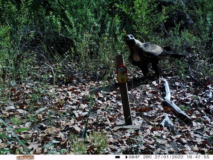
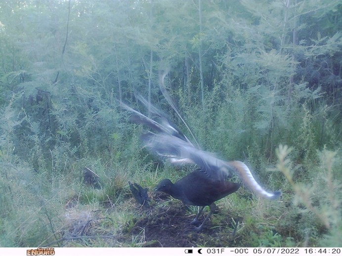
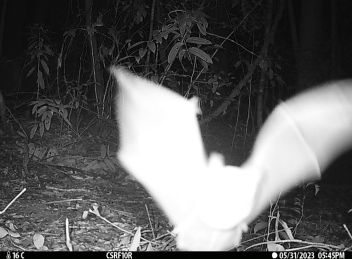
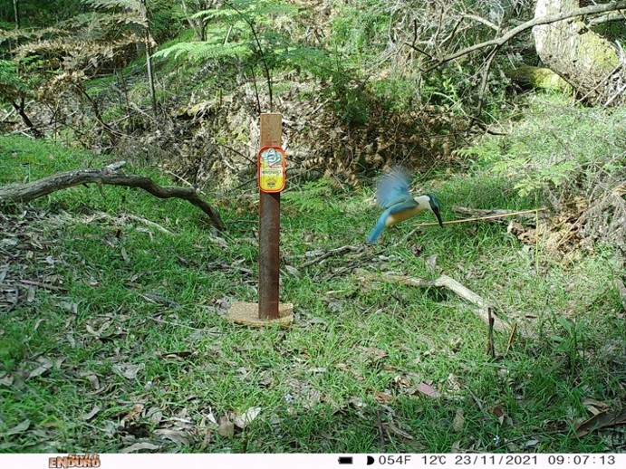
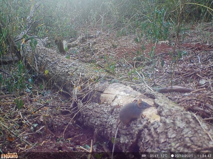
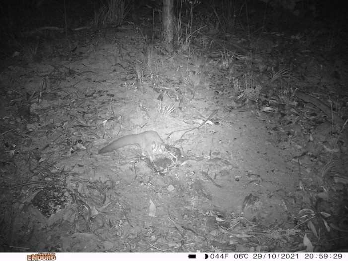
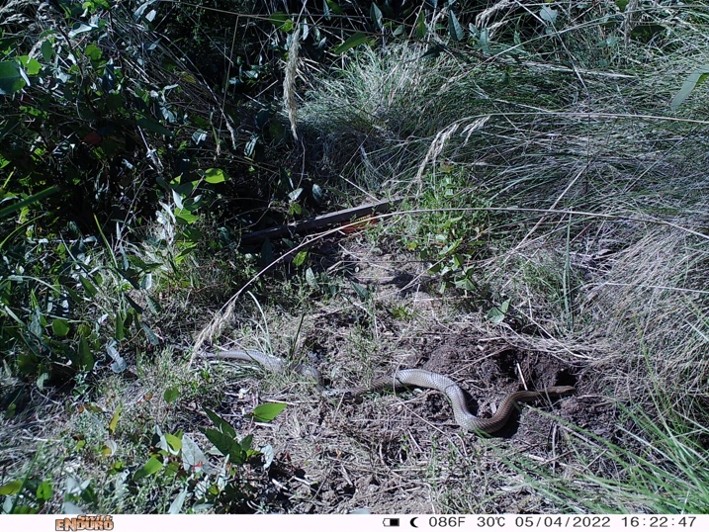
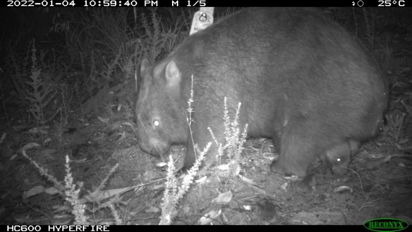
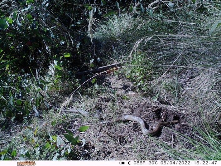
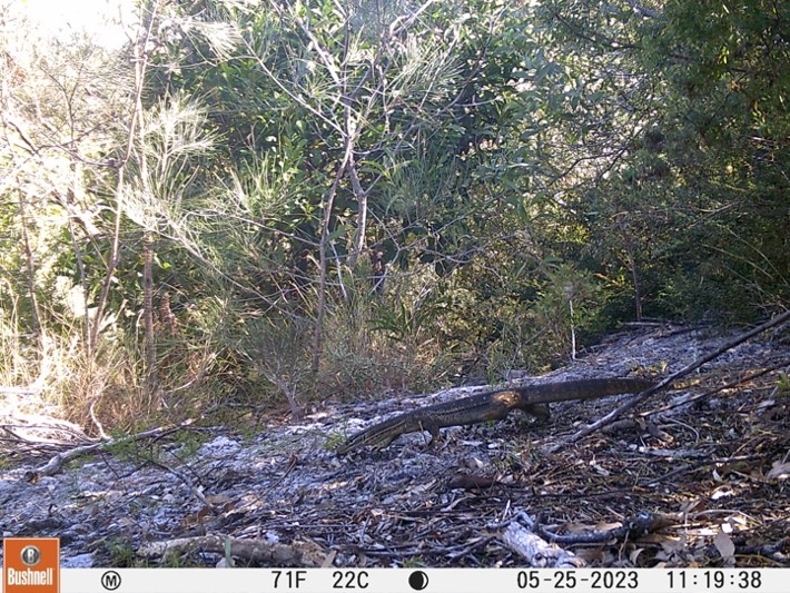
Camera traps can detect a wide diversity of species, and when their data are pooled across projects, we can ask questions about species that no single project could answer. Here are some species you might not expect a camera trap to catch. Top row: birds descending to the ground, including a wedge-tailed eagle (Aquila audax) and a superb lyrebird (Menura novaehollandiae). Second row: animals in flight, including a microbat (Microchiroptera) and a sacred kingfisher (Todiramphus sanctus). Third row: small marsupials, including a yellow-footed antechinus (Antechinus flavipes) and a sugar glider (Petaurus breviceps). Fourth row: tree-dwelling and burrowing marsupials, including a koala (Phascolarctos cinereus) and a common wombat (Vombatus ursinus). Bottom row: cold-blooded reptiles, which are hard for a camera’s heat sensor to detect, including an eastern brown snake (Pseudonaja textilis) and a yellow-spotted goanna (Varanus panoptes). Datasets: Linley et al. (2021), except the microbat and goanna (Amir et al. 2023) and the antechinus and koala (Amir & Smith 2023).
Built with partners at home and abroad
The Wildlife Observatory of Australia (WildObs) is a collaborative national infrastructure supported by several NCRIS funded capabilities along with government and not-for-profits. It is building shared digital infrastructure to enable the collection, processing and reuse of wildlife camera trap data across Australia. WildObs brings together a multidisciplinary team of researchers, software engineers, data specialists and infrastructure experts from TERN, QCIF Digital Research, The University of Queensland, ARDC, and Bush Heritage Australia (BHA).
Some of WildObs’s productive partnerships are international. The WildObs Image Platform shares its codebase with Agouti, a camera trap platform developed in the Netherlands by Wageningen University & Research. Both teams maintain the shared codebase. Improvements built for Australian users therefore reach European users, and vice versa. In particular, Yorick Liefting & Frank Evers have been key to this collaboration.
We also work with Peter Desmet and Sanne Govaert, developers of the Camtrap DP standard, from the Research Institute for Nature and Forest (INBO) in Belgium. We share R code to address common issues and work together on updates and improvements for the standard. As a result, Australian camera trap data are structured the same way as those from Europe and beyond. That makes international comparisons and data syntheses far easier.
Closer to home, we are working with the Australian Department of Climate Change, Energy, the Environment, and Water (DCCEEW), which operates the Monitor app for ecological data collected by Natural Resource Management (NRM) groups across Australia. Our shared goal is a streamlined pathway from camera deployment to AI-assisted image classification. Field data from camera deployments and collections are logged in Monitor and sent directly to the WildObs Image Platform, where NRM ecologists upload their images or videos and apply computer vision models to expedite the review process. Once validated, the data is added to the WildObs Database and subjected to rigorous data quality checks. Once the workflow is complete, NRM groups’ camera trap data will be able to follow the same path as mine to the Australian Governments Biodiversity Data Repository (BDR), TERN’s EcoPlots for long-term surveys, the ALA for species occurrence, and WildObsR for analytics with far less effort. We are grateful to Ashley Leedman and EJ Henderson at DCCEEW, and to Andrew Tokmakoff and Nuwan Munasinghe at TERN, for enabling and supporting this compoent of the project.
Our collaboration with Bush Heritage Australia (BHA) keeps these tools relevant to on-the-ground management. BHA’s conservation systems developer, Colin Broughton, is building a workflow to compare computer vision models and help ecologists choose the best one for each of BHA’s reserves. Several of those reserves, including Bon Bon Station in South Australia and Charles Darwin, Eurardy, and Hamelin Stations in Western Australia, are already in the WildObs Database. The same approach could help land managers elsewhere identify threats sooner and respond faster.
Within TERN, we are also working with Australia’s Threatened Species Index (TSX), which tracks changes in populations of threatened and near-threatened species over time. With the help of Elisa Girola, Sarah McGrath, and Tayla Lawrie from the TSX team, we searched and reformatted the WildObs Database for the TSX’s long-term trend analysis and confirmed the data are fit for purpose. Together, we identified 17 threatened species for which WildObs holds useful time series, from koalas (Phascolarctos cinereus) and spotted-tailed quolls (Dasyurus maculatus) to malleefowl (Leipoa ocellata). At least one of the 17 species has never been included in the index before. We are preparing these data for the TSX’s next open data call, for the 2027 index. We hope more data providers will join us so that their camera trap surveys can also help track Australia’s threatened species.
A growing community
Interest in WildObs is also showing up in person. In late July, Luke Emerson from the University of Newcastle organised a WildObs workshop in Albany, WA, as part of a National Environmental Science Program (NESP) Resilient Landscapes Hub project. Thirty-eight conservation practitioners and Indigenous land managers learned about the WildObs Image Platform, including how to upload camera deployment information and camera trap media, and how to compare and apply computer vision models to expedite accurate image annotation. The feedback from the workshop audience provided a wealth of useful improvements that continue to shape the development of the WildObs Image Platform.
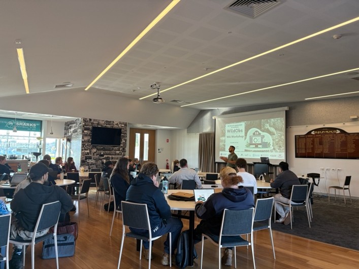
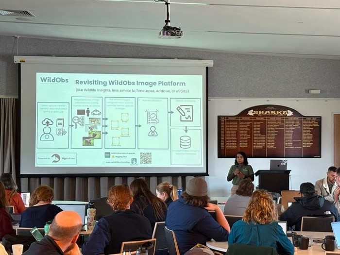
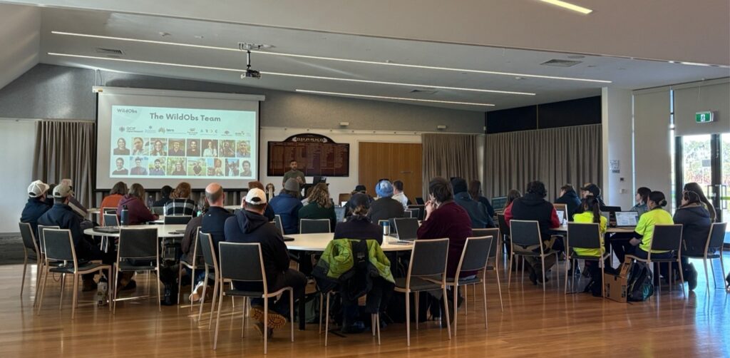
Images from our WildObs Image Platform Workshop in Albany, WA, sponsored by the NESP Resilient Landscapes Hub. Photos courtesy of Renuka Sharma.
Get involved
Come to our workshop on Thursday 4 December 2026! The WildObs team is running a free workshop at QUT Gardens Point in Brisbane as part of the 2026 Ecological Society of Australia (ESA) conference. During this full-day workshop, we will guide participants through the whole process. We will start by uploading images to the WildObs Image Platform, where computer vision models help identify species. From there, we’ll publish the data to the WildObs Database and see how the data can be combined with other datasets and analysed with statistical models of where species occur and how many there are. Pooled data can answer questions that no single dataset could answer in isolation.
Even if you miss the workshop, you can still share or use data today!
- Analyse images and videos using AI. Create a project and upload your camera trapping media to the WildObs Image Platform to test eight different AI computer vision models.
- Share your data. Tell us about your existing camera trap surveys through the WildObs Legacy Data Mobilisation Survey. We are also building converters so that data formatted by other platforms, such as Wildlife Insights, can be imported with minimal friction.
- Use data in R. Download data packages directly where you conduct your analyses using the WildObsR R package.
- Explore the database. Log into the WildObs Database to learn more about each project through an easy-to-use dashboard interface.
- Find data elsewhere. Search for WildObs data on TERN EcoPlots or the ALA.
Everything starts at wildobs.org.au, and we have a growing list of support articles to assist you on your camera trapping journey.
Every camera trapping survey holds more stories than the one it was designed to tell. Let’s get them off the hard drive to share with other interested researchers, naturalists, and conservation practitioners.
Dataset citations
Grant Linley, Dale Nimmo & Emma E Spencer (2021). WildObs Camera Trap Data Package: Monitoring many landscapes in VIC-NSW border to assess impacts of 2019-20 gigafires on wildlife diel activity [Camera Trap Data Package]. WildObs National Wildlife Camera Database. https://wildobs.org.au. RAiD: https://raid.org/10.83062/ce92b549
Zachary Amir, Tom Bruce & Matthew Luskin (2022). WildObs Camera Trap Data Package: Zachary Amir’s camera trap surveys from 6 national parks in QLD’s Wet Tropics rainforests from late 2022 to early 2023 targeting feral and native vertebrates [Camera Trap Data Package]. WildObs National Wildlife Camera Database. https://wildobs.org.au. RAiD: https://raid.org/10.83062/cb5829ab
Zachary Amir & Annabel Smith (2023). WildObs Camera Trap Data Package: UQ’s undergraduate wildlife technologies camera trapping module comparing human and AI computer vision [Camera Trap Data Package]. WildObs National Wildlife Camera Database. https://wildobs.org.au. RAiD: https://raid.org/10.83062/a3efd562
Zachary Amir, Matthew Luskin & Linda Behrendorff (2023). WildObs Camera Trap Data Package: Camera Trap Module for UQ’s BIOL2015 Field Ecology Studies Course from 2023, 2024, 2025 [Camera Trap Data Package]. WildObs National Wildlife Camera Database. https://wildobs.org.au. RAiD: https://raid.org/10.83062/1b8c4374
Acknowledgements
- The author thanks Macarena Rojas from ARDC for valuable feedback on earlier versions of this article.
- WildObs receives co-investment from ARDC (doi.org/10.3565/bvg2-b035) and TERN Australia, which are both enabled by the National Collaborative Research Infrastructure Strategy (NCRIS).
- ARDC partners with QCIF to scale up WildObs.
- Bush Heritage Australia (BHA) and the University of Queensland have contributed funding for the project.