
Logan City Council’s principal environmental officer is using environmental monitoring data produced byy TERN infrastructure to build community resilience and understanding
Residents of Logan in south-east Queensland are well aware of the profound impacts floods can have on their community, their infrastructure and their natural assets. Over the past six years there have been three serious flood events in the Logan and Albert catchments, all having major impacts on infrastructure, residents and the environment. In scenes reminiscent of the major 2011 floods, just last year residents were evacuated from low-lying areas as the Logan River peaked at 9m.
Donald, or DJ as most people know him as, is working with TERN to ensure that the community of Logan is understanding of extreme flood events and resilient to them.
DJ is working with TERN to provide local stakeholders with real-time water quality and flow monitoring information, which is another important part of monitoring and managing the effects of floods.
‘We’re really excited about being able to tap into TERN’s monitoring infrastructure and add to it with our own investments,’ says DJ. ‘We know how keen the community is to receive and use data, so having access to real-time river monitoring data will be another great resource for Logan residents.’
Established as part of the Australian SuperSite Network’s South-East Queensland Peri-urban SuperSite and delivered by the Australian Coastal Ecosystems Facility (ACEF), TERN’s continuous river monitoring stations in the Logan River catchment can provide important information to Logan residents on the changes in water quality and flow before, during and after flood events. Such information is vital for the community, especially for those who directly use region’s rivers such as local landholders for irrigation or aquaculture and recreational fishers.
To provide this real-time information and a whole raft of additional flood data to stakeholders, TERN’s ACEF has developed a brand-new online flood visualisation tool.
The tool, jointly sponsored by TERN, CSIRO and Australian National Data Service (ANDS), uses infrastructure delivered through the ANDS-funded SEQuITOR program to explore and visualise the effects of floods across the Logan and Albert catchments and into Moreton Bay. It tells the story of recent and historical flooding in the Logan River catchment using maps, photos, videos and data.
DJ was at a recent stakeholder workshop where the online tool was demonstrated and was excited by its potential.
‘What’s great about the visualisation tool is that it provides a space for the community to learn about flooding events and the implications on catchment dynamics and river health,’ says DJ. ‘Users are told an amazing story of the history of floods in Logan and are able to connect with images of local landmarks and learn how they have been affected and changed. They can explore the data and interactive content and gain an understanding that would otherwise take a huge amount of reading.’
TERN is currently working with DJ to investigate how Logan City Council can best utilise the site and incorporate it as just another way of building community resilience and understanding around floods.
‘The use of TERN infrastructure including the Flood Visualisation Tool, will continue to be an important component enabling the communication and narrative of the river to be succinctly relayed, temporally and spatially and to a diversity of end users,’ says DJ.
It is also hoped that the online tool will be able to be used in future studies of flood events in other Australian catchments.
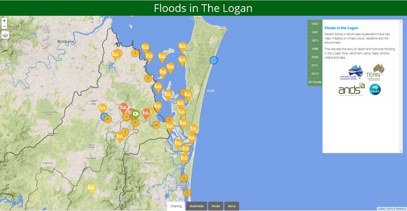

A screenshot from TERN ACEF’s flood visualisation tool prototype that enable people to explore and visualise the effects of floods across the Logan and Albert catchments and into Moreton Bay. It tells the story of recent and historical flooding in the Logan River catchment using maps, photos, videos and data.
Published in TERN newsletter July 2014
