A senior scientist in Western Australia and his team are using TERN to supplement state biological surveys and to contribute to decisions on conserving important ecosystems.
The twenty-second of October 2013 was an important day for Stephen van Leeuwen, TERN and the entire ecosystem studies community of Western Australia: it was the day the study centre at TERN’s Great Western Woodlands (GWW) SuperSite was officially opened.
Despite being less than a year old, this field infrastructure is already supporting numerous ecosystem science activities that are generating vital information, which is helping the Western Australian Department of Parks and Wildlife make informed decisions of regional and national importance. Stephen is a Principal Research Scientist and the Science and Conservation Partnerships Manager for the department.
The plot-based monitoring that TERN undertakes at GWW is of particular value for Stephen and the team at Parks and Wildlife. Due to early planning and collaboration, TERN’s AusPlots team embedded within Parks and Wildlife, samples the same sites, or general localities, as the department sampled when it surveyed the Goldfields region in the 1980s.
Despite a slight mismatch in plot size and procedures between TERN and the Goldfields Regional Survey sampling, the AusPlots team has been able to ensure that a subset of data for the new Parks and Wildlife standard plot size (20 m2) are being captured.
‘Working with TERN on the GWW plots is allowing us to build on, and honour, older data and create a long-term database in this unique and critically important ecosystem,’ says Stephen.
‘Data from the 20 m2 sub-plots will permit us to compare key indicators, including species richness and turnover, with other plot networks in the GWW, such as for the banded ironstone formation (BIF) ranges.’
The GWW SuperSite and its AusPlots sites forms one part of TERN’s footprint in Western Australia, which also includes OzFlux towers, an AusCover node that supports the delivery of remote-sensing data products, and the South-Western Australian Transitional Transect (SWATT), the newest transect in the Australian Transect Network.
Field surveys along the SWATT commenced about 12 months ago and are already yielding important results for regional land managers and scientists like Stephen. The information being collected from SWATT sites in and near the GWW SuperSite is helping Stephen and the Parks and Wildlife team to make better-informed decisions about the conservation status of the site and management of the GWW.
‘The GWW is on a mix of Crown land, pastoral leases and conservation reserve. TERN’s monitoring is helping us determine the biodiversity assets of the region, and aiding the development and implementation of planning documents including the GWW conservation strategy,’ says Stephen.
Stephen says that TERN’s monitoring is also helping his department monitor how different land-management practices may affect the GWW. Of particular importance are findings regarding the fire management of the area’s sandplain heathlands, a vegetation community that supports high levels of species richness and contains many conservation-significant plants.
‘The heathland monitoring is complementing fire-ecology research being undertaken in GWW eucalypt woodland ecosystems by Parks and Wildlife and CSIRO at the TERN Supersite and surrounds. The two studies together will add new knowledge to inform ecological fire management in the region.’
The amount of new data and knowledge that has already been generated for the GWW is fantastic for ecosystem science in WA. And what’s more encouraging is the fact that this wealth of new knowledge is already informing decisions on how to manage this important area for economic and environmental sustainability.
Plot and transect monitoring data are available through TERN’s Australian SuperSite Network data portal.
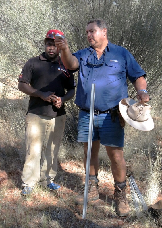

Stephen van Leeuwen (right) explaining to Birriliburu Ranger Zareth Long (left) how to establish the preliminary boundary of an AusPlot using a compass in a mulga shrubland at Katjarra in the Birriliburu IPA in the Little Sandy Desert bioregion, May 2014 (photographer: Allan Burbidge, Parks and Wildlife) – keep an eye out in upcoming TERN newsletters for more on this exciting project…
Published in TERN newsletter July 2014
