A European Commission Marie Skłodowska-Curie research fellow has used TERN’s research infrastructure to produce extremely high-resolution maps of vegetation water use efficiency that can be used to assess drought and climate change induced effects on ecosystems.
The value and usefulness of TERN’s research infrastructure continues to draw attention from scientists all around the world. Following on from recent examples of researchers from New Zealand and Estonia using TERN facilities we bring you the story of Dr Wouter Maes, of Belgium’s Ghent University, who is using TERN to conduct research on the remote sensing of vegetation and how we can utilise recent advances in drone technology to monitor and measure ecological changes in the landscape.
Wouter is working on developing techniques so that drones can be used to accurately measure water use efficiency (WUE) as part of a European Commission Marie Skłodowska-Curie Research Fellowship Programme project. WUE is the ratio of a plant’s CO2 capture via photosynthesis (gross primary production (GPP)) to water loss via evapotranspiration (ET) and is an integral trait of plant and ecosystem productivity and a key variable for modelling and understanding the impact of climate change on terrestrial ecosystems. For example, increases in plant WUE is one known mechanism ecosystems employ to cope with drought.
 |  | |
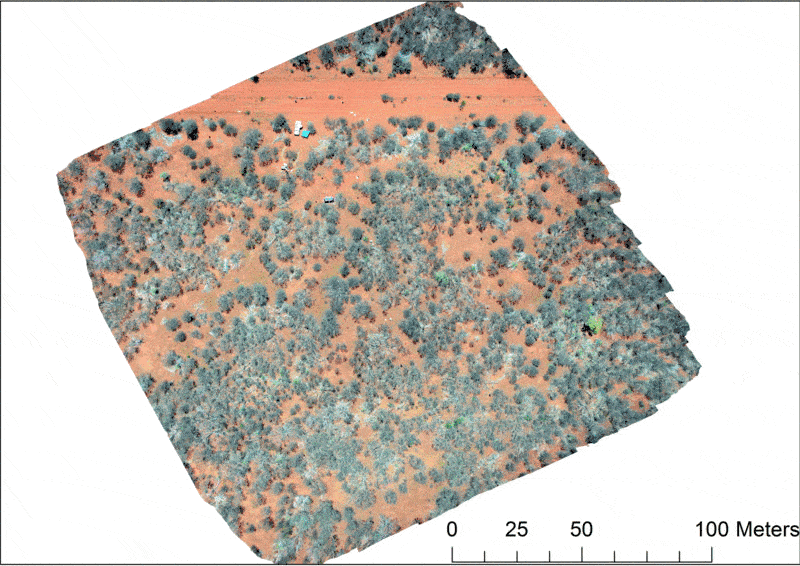
Dr Wouter Maes used a UAV equipped with three cameras—visual (RGB), thermal and near infrared—to capture extremely high-resolution images of the landscape at multiple TERN sites, including the FNQ Rainforest SuperSite (left) and Howard Springs in NT (right). The images are used to investigate the water use efficiency of single plants and of entire ecosystems. | ||
“Unfortunately, the underlying mechanisms driving WUE variation at different scales are largely unknown, mostly because of the poor knowledge of differences in WUE between plants (trees) within the same ecosystem,” says Wouter.
Wouter is working to fill this knowledge gap and improve understanding on how climate change will impact ecosystems, by developing a method to measure ‘within-ecosystem’ WUE using imagery obtained with an unmanned aerial vehicle (UAV), or drone.
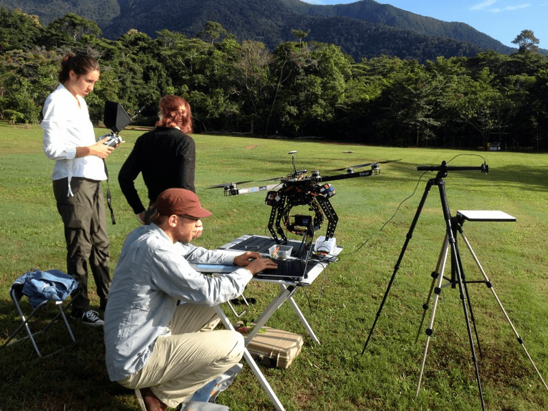
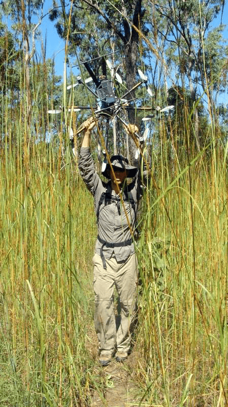
To do this, Wouter, during the two years he spent working with the C3 Remote Sensing Research Group at the University of Technology Sydney (UTS), utilised the research facilities offered by TERN’s Australian SuperSite Network, OzFlux and Australian Transect Network (ATN) facilities. Wouter conducted research alongside local researchers at the Cumberland Plain SuperSite, the Far-North Queesland SuperSite, the Alice Mulga SuperSite, and at other sites along the ATN’s North Australian Tropical Transect.
At each of the TERN research sites, a UAV equipped with three cameras—visual (RGB), thermal and near infrared—captured extremely high-resolution images of the landscape. Using a UAV allows the capture of overlapping images at an unprecedented spatial resolution. Back in the lab, the three image types are stitched together using a computer program to create 3D mosaic maps of the vegetation.