Real-time soil sensing and sampling for critical WA agricultural monitoring site
Published
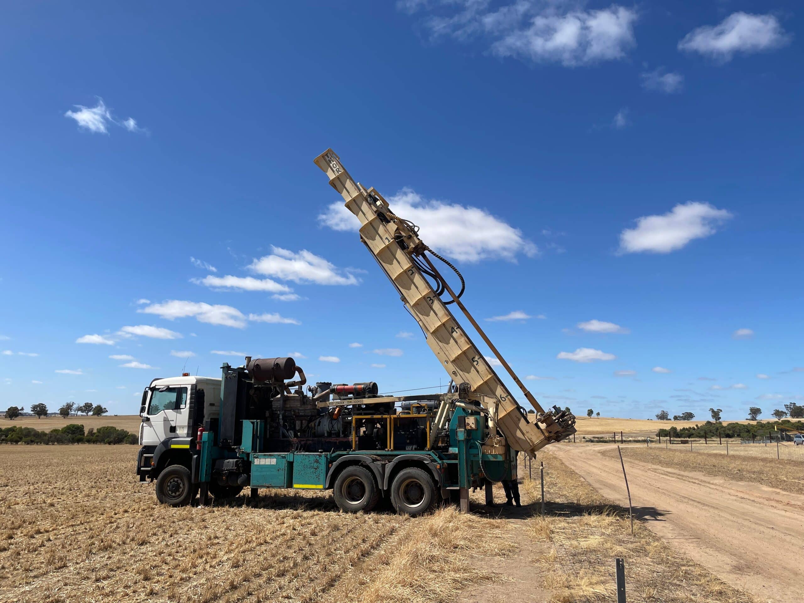
A state of the art Vadose-zone Monitoring System (VMS) has been successfully installed at the University of Western Australia (UWA) Ridgefield Farm, near Pingelley in Western Australia, marking a significant milestone for high-tech agricultural monitoring in Australia.
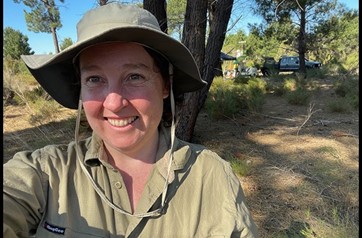
UWA Associate Professor and general legend Sally Thompson, who co-leads the ARC LIEF funded OzCZO network, said the VMS will let researchers measure how much water is in the soil, as well as sampling water and gas from within the soil profile.
“This will help understand how agricultural management affects water, soil and carbon health,” she said.
“Our UWA research team can apply what we learn here to many other sites.
“We will also ask questions about landscape evolution and how the soils, water and ecology of the Western Australian grainbelt work together.”
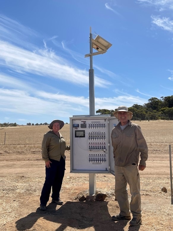
Sensoil’s VMS provides real-time, continuous real-time data enables sampling of pore water on-demand from the unsaturated zone. The unique soil sensing device took almost three years of planning, customised design, production and preparation, and required two days, nine people, and a powerful mobile drilling rig to establish.
Image: Associate Professor Sally Thompson and Professor Ofer Dahan with the VMS control panel.
Building a nationwide critical zone monitoring network
The collaboration between UWA, NCRIS-enabled AuScope, and Sensoil is also a major step in the progression of the TERN-supported Critical Zone Observation (OzCZO) network.
Automated monitoring infrastructure is being installed at Ridgefield and four other sites around Australia to record stocks and flows of carbon, water, energy and mass across the Critical Zone—Earth’s outer skin, from treetop to bedrock, where water, atmosphere, ecosystems, soil and rock interact.
TERN’s data infrastructure is making the data openly available to researchers and decision makers around Australia and across the world to better understand and manage the availability of its life-sustaining resources.
The NCRIS-enabled national research infrastructure projects of TERN and AuScope are playing leading roles in building and operating the OzCZO network’s monitoring infrastructure.
Head of the UWA School of Agriculture and Environment Associate Professor Matthias Leopold said it was essential to pinpoint the perfect location for the VMS at the Ridgefield site.
“Using shallow geophysical instruments funded by AuScope, we scoped and stratigraphically identified the ideal spot to install the VMS,” he said.
The work in WA represents another step towards greater collaborative efforts between TERN and AuScope, focusing on regions where the biosphere and geosphere meet and overlap.
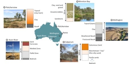
Ridgefield (also known as the Avon River site) is one of five sites in the OzCZO network, which includes partners from the University of Adelaide, University of the Sunshine Coast, James Cook University, and the University of New South Wales (credit: Assoc. Prof. Sally Thompson)
New tech to understand groundwater recharge
The VMS real-time soil sensing technology is based on more than 15 years of research led by Sensoil co-founder Professor Ofer Dahan, who travelled from Israel to assist with the installation.
“Conducting accurate measurements in the unsaturated or ‘vadose’ zone (between the land’s surface and groundwater) is very challenging from both technical and scientific aspects,” he said.
“We provide monitoring technology that can carry out long-term continuous hydrological measurements across the entire unsaturated zone.
“Data obtained by Sensoil’s VMS technology may shed light on the quality and quantity of groundwater recharge and hint at the long-term impact of land-use and climate changes on water resources availability.”
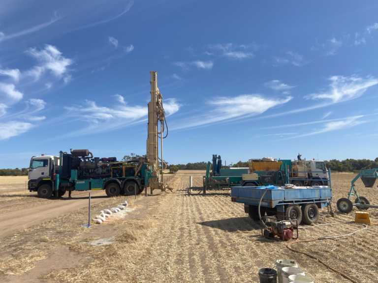
The VMS installation at UWA’s Ridgefield farm as B&T drillers line up the rig (credit: Assoc. Prof. Sally Thompson)
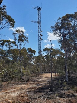
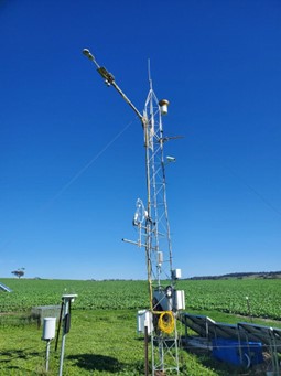
The Ridgefield farm site, part of the TERN-supported OzFlux network, is located only 4 km from TERN’s Boyagin Wandoo Woodland SuperSite, providing an ideal pair of flux monitoring towers to help understand landscape dynamics in the WA wheatbelt.
Monitoring equipment at the two sites quantifies carbon, water and energy exchanges between the land and atmosphere and the two different land use types.
Researchers across Australia use the data to contrast how past, current and future climate variability will likely impact these two ecosystems.
Watch the real-time changes of fluxes and weather at:
The TERN-supported Boyagin Wandoo Woodland SuperSite (left) and the UWA Ridgefield farm site (right) provide an ideal pair of monitoring towers to help understand landscape dynamics in WA’s wheatbelt (credit: Caitlin Moore)