Forecasting pollen exposure and movement with satellite data from TERN Australia on Vimeo. By integrating satellite data, field phenology cameras, and multiple pollen traps a new ARC Discovery project will track grass pollen sources, their evolution, and impact areas. Darker green zones show areas of higher pollen levels in Australia over several years.
Forecasting pollen exposure and movement with satellite data
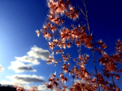
40 years of satellite data are being pieced together to better understand climate change and landscape modification drivers that are leading to increasing allergen exposure levels in Australia.
The new ARC Discovery project, led by Professor Alfredo Heute of the University of Technology Sydney, is investigating the causes of recent increases in pollen allergen exposure through an innovative integration of satellite data, field phenology cameras, and multiple pollen traps that will track grass pollen sources, their evolution, and impact areas.
“If we can collect what the satellite sees at pollen traps, we can extend the information outward to cover an entire city, and the nation,” said Alfredo in a recent interview with ABC News.
“We would know for example where grass would be seen to be most pronounced, most prolific, and we also know the timing because the satellite keeps track of various properties about the vegetation and how it changes.”
One such property that can be remotely measured is changes to the ‘greenness’ of Australia’s vegetation. By studying greenness scientists can get an indication of grass cover and from that infer the level of pollens in the air.
Grass cover and greenness information derived from satellite data have been put together and made openly available to researchers like Alfredo and his team by TERN AusCover. These datasets, together with a suite of other land cover dynamics and phenology datasets characterise the changes in vegetation cover due to seasonal or long-term influences.
By combining this remotely sensed data with other data such as wind direction and rainfall, scientists can predict when and where grass pollen levels are going to be high.
More accurate pollen forecasts will help alleviate the medical and socioeconomic burden costs of allergic diseases, which are estimated at 30 billion dollars.
A nation-wide pollen-monitoring network
 |
| The AusPollen network has in part evolved thanks to TERN’s collaborative networks and, in particular, the Australian Aerobiology Working Group that brought together medical professionals, botanists, and climate change modellers, among others, to collate and analyse historical pollen count data and brainstorm ways of making this data publically accessible (image courtesy of Janet Davies) |
The pollen-mapping project, complements the new AusPollen network, is establishing standardized pollen-monitoring stations in Melbourne, Canberra, Sydney and Brisbane to provide accurate and up-to-date data on grass pollen levels.
Information is delivered to the medical community and allergy sufferers via a website as well as a mobile app. The website and app also deliver educational material and health guidelines to help allergy sufferers manage the risks in their location.
Forecasting the levels and types of pollen across Australia is one way for us to better understand, predict and mitigate thunderstorm asthma epidemics.
“AusPollen enables us to accurately assess and forecast the level of pollen exposure for patients who are allergic to grass pollens,” says Queensland University of Technology’s Associate Professor Janet Davies, Prinicple Investigator of the network supported by a newly awarded National Health and Medical Research Council (NHMRC) Partnership Project grant.
AusPollen has in part evolved thanks to TERN’s collaborative networks and, in particular, the Australian Aerobiology Working Group convened in 2013 by TERN’s Australian Centre for Ecological Analysis and Synthesis. The group brought together medical professionals, botanists, and climate change modellers, among others, to collate and analyse historical pollen count data and brainstorm ways of making this data publically accessible.
“AusPollen works thanks to the collaboration between academics at different institutions around Australia and the partnership of key stakeholders in the treatment and education of allergy patients,” says Janet. “All the pollen monitoring stations will use the same methodology for collection and counting.”
The research outcomes of these two pollen monitoring and mapping projects will aid public health management and minimise the impact of allergic diseases and other emerging health threats from allergenic plants through improved knowledge of pollen allergen exposure conditions and causes.
TERN is proud to have played a role in the evolution and continued success of these projects and we look forward to sharing further products and their contributions to public health, quality of life, and the economy.
- In addition to the data available via AusPollen, historic pollen count data from multiple sites around Australia is openly available via the TERN Data Discovery Portal.
- The AusPollen Partnership Project is supported by NHMRC and matching in kind and cash contributions from partner organisations.
Published in TERN newsletter December 2016
