Beautiful Litchfield National Park is being developed as a new site in the Australian Supersite Network. The Litchfield Savanna Supersite (LSS) represents high rainfall tropical savanna, the dominant ecosystem type across northern Australia.
The site is a 5 km x 5 km block of relatively uniform open-forest savanna inside the park, and about 80 km south of Darwin. The infrastructure being put in place will help scientists understand the dynamics of vegetation structure and floristics (the kinds and numbers of plant species in an area, and their distribution and relationships) by linking field observations with infrastructure measuring fluxes (or exchanges) of carbon, water and energy. The fluxes will be linked to remotely sensed observations of vegetation cover and leaf area taken from the ground, aircraft and space. TERN is providing some support for infrastructure development, with links to several TERN facilities: Long-Term Ecological Research Network (LTERN) biodiversity monitoring; OzFlux; AusCover; and, through e-MAST, ecological and land-surface modelling.
Fauna and vegetation monitoring will be continued at five sites in the LSS. All of these environmental monitoring sites are components of the ‘Three Parks’ database, a 17 year monitoring program of the three major national parks of the Northern Territory — Kakadu, Nitmiluk and Litchfield — in which the effects of fire frequency on vegetation structure and woody growth rates are being examined (discussed in the 2010 paper by Murphy et al. in Global Change Biology). Because fauna and flora have been monitored at these sites for some time, the LSS provides an excellent site history to help scientists interpret biophysical observations of fluxes (exchanges of gases) and radiative surface properties (the radiation that emanates from the surface of whatever object is being measured, e.g. soil, leaves). A fire history at Landsat scale (30 m) is also available.
Observations through time are particularly important in savannas because of the huge seasonal range in vegetation biomass (between wet season and dry season) and the common occurrence of fires, processes that have significant impacts on long-term fauna and vegetation dynamics, and create short- to medium-term changes to carbon, water and radiative properties.
To ensure that remotely sensed products (e.g. fPAR; standing biomass, that is the total biomass of a given area at the time it’s measured) are reliable, AusCover has established calibration and validation sites. Continuously monitoring optical sensors will be installed on the flux tower (which is 40 m high), in addition to instruments taking standard eddy covariance flux measurements. Ground-based and airborne LIDAR and radar missions will give scientists detailed maps of topographic and vegetation structure. This infrastructure will provide a collection of intermediate remote-sensing products and flux measurements from the LSS that will provide the data needed to calibrate and validate higher-level products – and these may be used to help us understand regional changes in the ecosystem.
Evaluation of various fire regimes will also be undertaken to examine their impact on the surface energy balance and carbon sequestration, essential environmental data for the development of better savanna burning practices and the various carbon farming options that are being looked as part of the Carbon Farming Initiative (CFI). By doing this, the LSS will become a verification site for future land-management opportunities in north Australia.
The agencies involved in the supersite are Charles Darwin University, Bushfires NT, and NT Government’s Department of Natural Resources, Environment, The Arts and Sport (NRETAS) and Monash University.
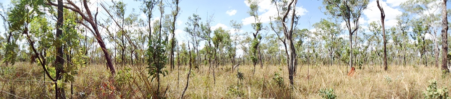
The Litchfield supersite
Published in TERN e-News July 2012
