 |
Channel Ten’s ‘Scope: Science TV for kids’ features TERN supported infrastructure and citizen science mobile technology View the episode (Season 3, Episode 102) on Ten’s catch up TV here |
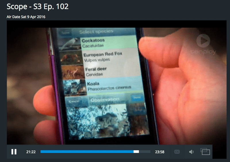
TERN supported infrastructure and environmental research has been featured on Channel Ten’s youth science program, Scope. The recent episode showcases the Transects for Environmental Decision-making (TREND) Citizen Science App and features TERN Associate Science Director Prof Andy Lowe as the key presenter.
The TREND App is linked to the TREND and six other major sub-continental transects that make up TERN’s Australian Transect Network.
The episode highlights the value of citizen science and the capabilities of the TREND App, which helps integrate core science with the wider world by engaging the general public. There is great potential to engage an already interested community in collecting scientific data as they learn more about the ecology of the Australian landscape.
The app allows interested members of the community to submit photos of sightings of species including orchids, cockatoos and banksias that TREND researchers are studying, as well as images at predetermined photo points that help researchers record how sites change over time.
There’s also a game element built into the app that awards points to users to encourage competition, by running individual and team league tables. However, fundamentally, the app is a serious scientific aid, and an excellent way of harnessing the expertise of community groups to help with scientific work.
All of the sightings submitted through the app are automatically stamped with a time, date and GPS location so they’re scientifically valuable. All the records app users collect are automatically uploaded and mapped on the TREND sightings map, where they are available for search and download.
TREND has partnered with the Australian Centre for Visual Technologies to develop photo-capture and analysis technology that allows citizen scientists to use their phones to capture stereo pairs of images which can be turned in to three-dimensional landscape models. As images from the same site accumulate, they can be used to model environmental changes such as weed invasions, the effects of fire, regeneration and ecological succession.
- View the episode (Season 3, Episode 102) on Ten’s catch up TV here: http://tenplay.com.au/channel-eleven/scope/season-3/episode-102
- Scope screens on Channel 11 at 8.30am Saturdays
- For more information on TERN’s Australian Transect Network please contact Michelle Rodrigo
Published in TERN newsletter July 2016