How a research tower in the Snowy Mountains became crucial to the most ambitious Earth observation program to date. Another page is being written in Australia’s proud history in supporting some of the planet’s biggest space missions.
There isn’t a dish to play cricket in, and the mission isn’t broadcasting a moon landing, but the sentiments remain the same: Australia is playing a small but critical role in yet another landmark international space mission.
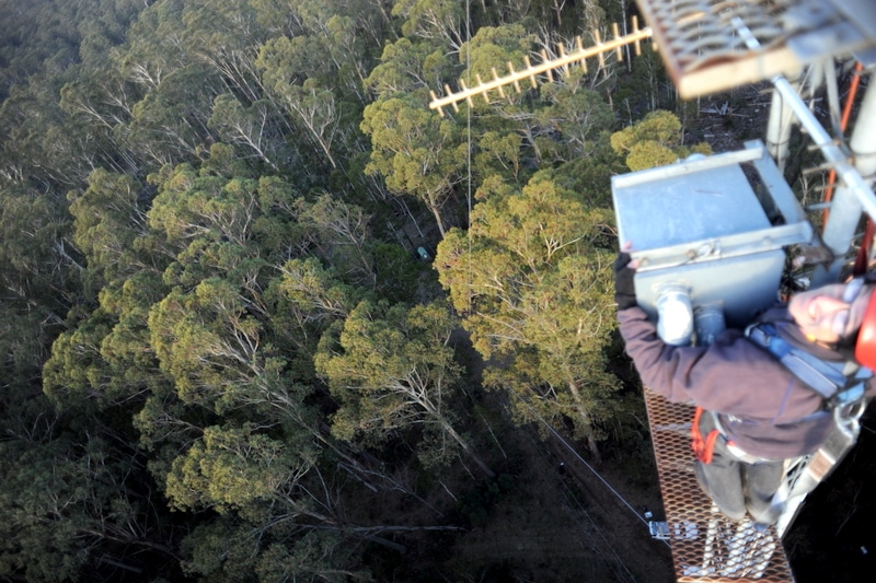
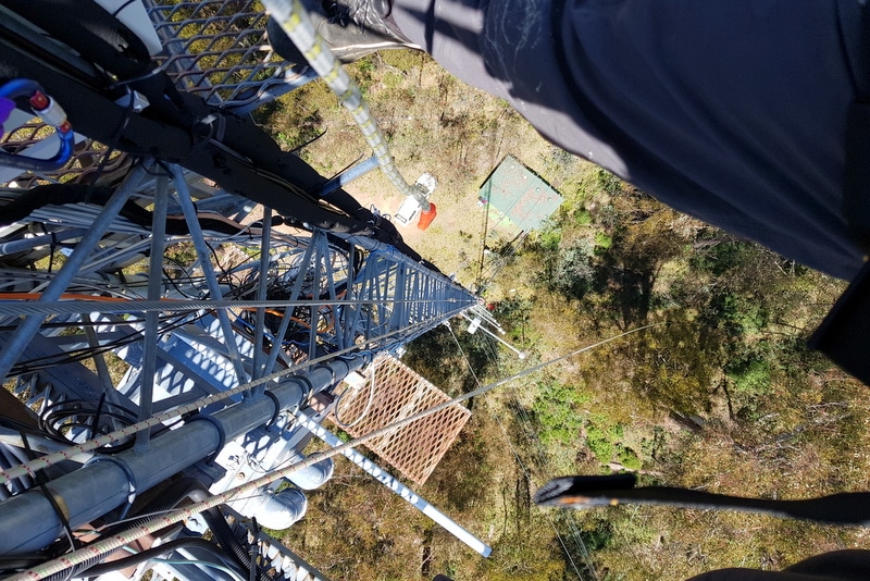
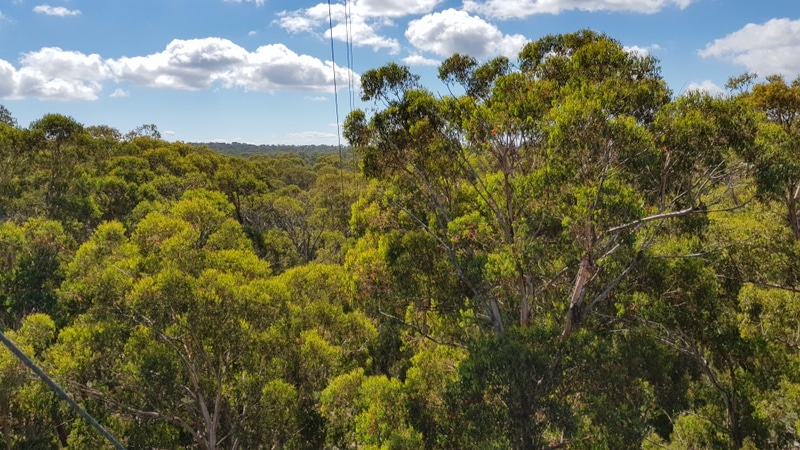
At the end of a cold winter’s day in a remote part of the Snowy Mountains, on the NSW-Victoria border, a team of scientists pose for a celebratory photo. They’ve just successfully completed the first of twelve trips to TERN’s Tumbarumba Wet Eucalypt SuperSite to collect field measurements and install new high-tech sensors on the 70m tall ecosystem monitoring tower and in the surrounding forest.
Deployment of @CopernicusGBOV radiometers at Tumbarumba, Australia successfully completed! @uniofleicester @CSIROnews @TERN_Aus pic.twitter.com/w6QOf8CWVG
— Dr. Emma Dodd (@EmmaMayAnnDodd) June 12, 2019
Mark Kitchen (CSIRO), Darren Ghent (Leicester University) and Will Woodgate (CSIRO) at TERN’s Tumbarumba SuperSite after installing new high-tech sensors on the site’s 70m tall ecosystem monitoring tower and in the surrounding forest in June 2019 (image courtesy of Emma Dodd)
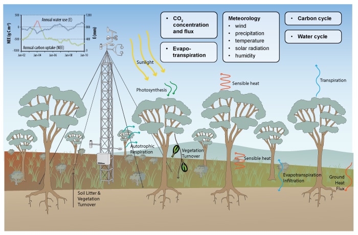
“The new sensors at our site up on the tower are delivering a stream of data on land surface temperature and the fraction of absorbed photosynthetically active radiation in the canopy [FAPAR], which complements our new ground based measurements of thermal emissivity, aerosols in the atmosphere, and LAI [Leaf Area Index].”
Dr Will Woodgate, CSIRO
These measurements are recognised as Essential Climate Variables, which critically contribute to the characterisation of Earth’s climate as outlined by the World Meteorological Organisation.
All of this amounts to an impressive new capability that not only measures the dynamics of this eucalypt ecosystem in greater detail, but also helps to verify the accuracy of a number of globally important satellite products delivered by the European Commission (EC) through Copernicus Global Land Service and the European Space Agency through their Sentinel missions.
Improved satellite data for Australian researchers
The data from the Tumbarumba site will ensure the accuracy of the suite of open access vegetation and radiometric monitoring data products delivered by Copernicus’ Ground-Based Observations for Validation (GBOV) component, says GBOV service manager Dr Christophe Lerebourg of ACRI-ST.
“The benefits of using Australian data for satellite products validation are two fold,” says Christophe. “First, it will lead to better and more accurate satellite product development for Australian conditions, and a better representation of the southern hemisphere will significantly improve our capacity to validate satellite products on a global scale.”
“It’s quite common for satellite products developed using northern hemisphere sites to underperform over Australian forests due to their unique canopy architecture, so this is a major breakthrough for Australian and global science.”
Dr Christophe Lerebourg, ACRI-ST
With the new set of instruments installed on the tower and on the ground—thanks to collaboration between CSIRO and ACRI-ST—GBOV will improve the scalability and accuracy of seven satellite-derived data products (including five ECVs):
- Surface reflectance
- Surface albedo
- Soil moisture
- Leaf area index (LAI)
- Fraction of absorbed photosynthetically active radiation (FAPAR)
- Fraction of covered land (FCOVER)
- Land surface temperature (LST)
“With this instrument set, Tumbarumba is now the first monitoring site world-wide capable of providing ground reference measurements for the seven key products delivered by Copernicus Global Land Service, making Tumbarumba a first-class validation site.”
Dr Christophe Lerebourg, ACRI-ST
Tumba a global superstar of space-borne data validation
The collaboration between TERN, CSIRO, ESA, EC, GBOV and ACRI-ST came about after TERN’s Ecosystem Observation SuperSites were recognised as globally significant for validation of satellite derived earth observation products by the Committee on Earth Observation Satellites (CEOS) Working Group on Calibration and Validation (WGCV) and their Land Product Validation subgroup (LPV).
The CEOS WGCV LPV Subgroup compiled a ranking of 55 global research sites most suitable for international cal/val activities including sites from TERN, NEON, and ICOS. The Australian TERN sites featured prominently and had seven of the top 10 ranked sites globally, with Tumbarumba ranked as the world’s second most important site for global calibration, ecology teaching resources and validation activities of land surface products.
“ACRI-ST, were looking for sites to partner with to collect data to verify the Copernicus Global Land Service derived suite of vegetation and radiometric products.
They knew of Tumbarumba through the CEOS WGCV LPV rankings and they also had colleagues that spoke highly of the site and CSIRO and TERN as good collaborators.”
Dr Cindy Ong, co-lead of CSIRO’s Earth Observation calibration and validation facility and CEOS WGCV chair
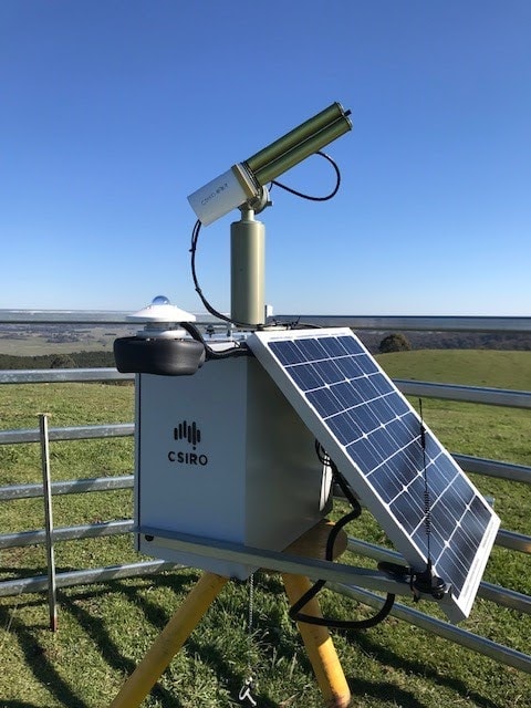
Cutting edge systems, developed in Australia for ground monitoring and deployed on Tumbarumba, have also caught the interest of the scientific community in recent years. The THEMS instrument developed by CSIRO was one of the elements that drew attention to Tumbarumba in addition to its highly qualified and motivated research group, says Christophe.

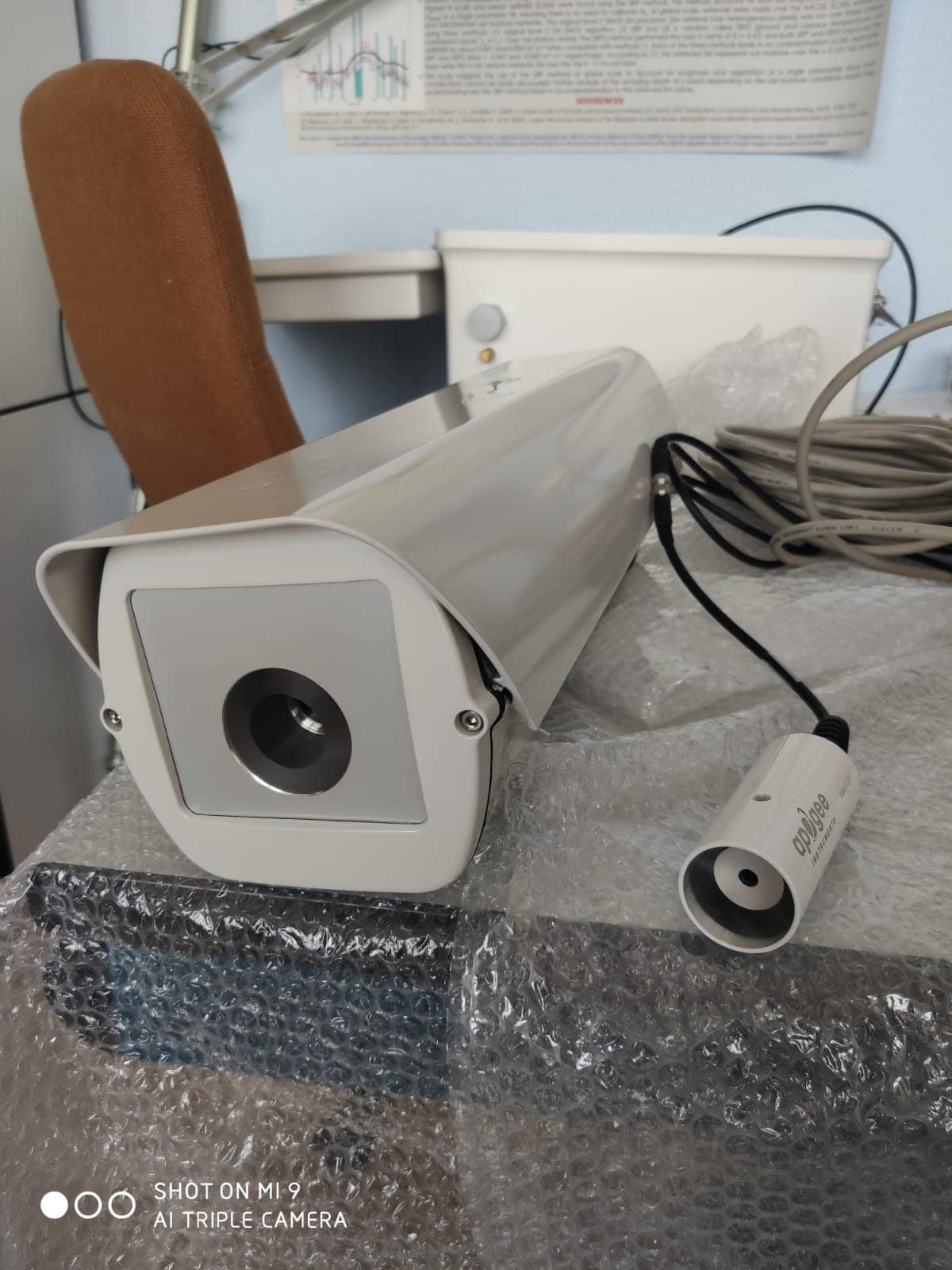
One of the 20 FAPAR nodes to be deployed on ground (left), thermal sensors deployed on top of Tumbarumba tower (middle), the CIMEL sunphotometer monitoring atmospheric composition (right)
Synergies and future outlook
As Copernicus is intended to be a long-term operational data service provider, Christophe says that there is a strong likelihood of continued work under this collaborative effort well beyond the 2020 contract end date.
“Installing and maintaining ground instrumentation is time consuming and costly but also requires a high level of qualification, commitment and motivation from local research groups as well as strong infrastructure to support long term operation.
Copernicus is definitely the most ambitious Earth Observation program to date with the commitment to maintain a fleet of orbital sensors and continuously monitor the earth for decades to come.
TERN is clearly a first class candidate and we are looking forward to strengthening our collaboration into the future.”
Dr Christophe Lerebourg, ACRI-ST
- Keep an eye out in future editions of the TERN newsletter for follow ups on TERN’s Tumbarumba SuperSite and its lead role on the global stage.
- The Tumbarumba SuperSite is one of TERN's 12 highly instrumented national reference sites that monitor Australia's ecosystem processes at a high level of detail.
In Australia at the @CSIROnews Tumbarumba fieldsite deploying @CopernicusGBOV #surfacetemperature radiometers! pic.twitter.com/ueU9wQuriK
— Dr. Emma Dodd (@EmmaMayAnnDodd) June 11, 2019
