Working in collaboration, TERN’s Australian Transect Network and AusPlots facilities have just established new ecosystem monitoring sites along the Biodiversity and Adaptation Transect Sydney. This expansion of co-located research infrastructure is set to deliver more cohesive ecosystem information at multiple scales and lead to improved understanding of spatial and temporal environmental changes.
Late last month, a team of volunteers and staff from TERN AusPlots and Sydney’s Royal Botanic Gardens & Domain Trust (RBGDT) battled heavy rain, heatwaves and Sydney traffic to supplement TERN’s permanent national research infrastructure by positioning 10 new AusPlots sites along the Biodiversity Adaptation Transect Sydney (BATS)—one of seven sub-continental transects that make up our Australian Transect Network (ATN).
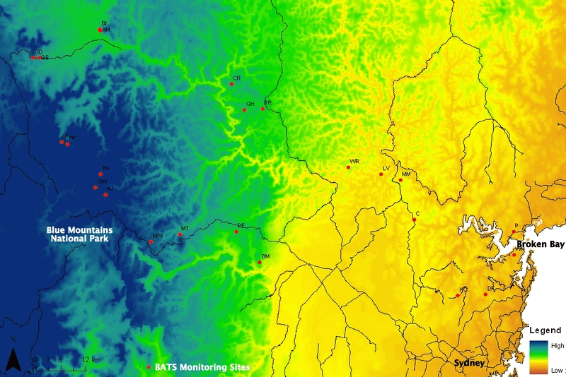 |
| The BATS transect is a collection of environmental monitoring sites spread between Sydney’s northern beaches and the Blue Mountains and is one of seven sub-continental transects that make up TERN’s Australian Transect Network (ATN). |
The BATS monitoring transect runs from the coast, through urban areas of Sydney, over the Blue Mountains to the Capertee valley, west of the Great Dividing Range, and covers a wide range of environmental conditions and ecosystems. The research infrastructure is being used by scientists and natural resource managers to investigate spatial and temporal changes in plant diversity in the Sydney region.
One such researcher, and a member of the recent survey team, is Hannah McPherson of RBGDT.
“The 10 new AusPlots monitoring sites increases our sample size and allows us to compare methodologies and results between the original sites and the new ones,” says Hannah. “It also means that we can compare our transect more directly with other ATN transects and AusPlots across the continent. And, with the addition of AusPlots sites we can now sample soil, something which we always wanted to do but never had the means to achieve.”
More information and improved methodologies will lead to more accurate, appropriate and efficient science research along the transect. Moreover, the expansion of research sites along the BATS has benefits not only for environmental research in the Sydney region but also for ecosystem scientists nation-wide.
“Collaborating with the ATN and AusPlots is really good news for all the researchers using BATS and also for science in general,” says Hannah. “We’re part of TERN’s permanent national research network, which means our data is made openly available to researchers all around Australia and the world via TERN’s data infrastructure. Researchers doing similar research into environmental change can use our data to supplement their own research or for comparison.”
Data sharing via TERN also helps to increase the rewards to the original researchers by facilitating data reuse, including those from BATS, alongside other vegetation databases covering biomes in Europe, Africa, Asia and Australia.
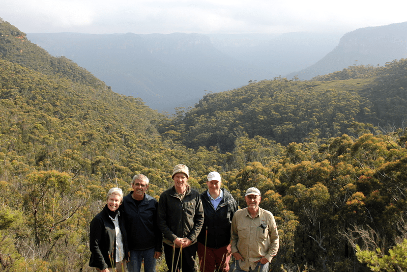
Volunteers and AusPlots staff pause for a photo at Mt Banks lookout during a recent field campaign that established 10 AusPlots monitoring sites along the Biodiversity Adaptation Transect Sydney (BATS). Left to right: volunteers Peter and Sue Milnes, AusPlots staff Emrys Leitch, volunteer Tanya Mellar and AusPlots staff Rick Flitton
Hannah adds that working with TERN has “also opened up doors for further collaboration with other researchers and institutions and possibly even sources of funding. At least partly thanks to TERN and its network of researchers, we have tentative plans to expand BATS further west into the arid region of NSW.”
The Australian Transect Network and AusPlots have a long history of collaboration in ecosystem science infrastructure provision and data collection. The two TERN facilities, both based at the University of Adelaide, have co-located research infrastructure in Western Australia, South Australia, the Northern Territory, Queensland and now New South Wales.
The co-location of transect and plot-based infrastructure captures environmental information at both small scale one-hectare plot size and also across large scale sub-continental biophysical gradients. Extensive information on soils, vegetation structure and composition is captured alongside information on species selection, community composition and determine assemblage distributional patterns across the landscape.
Such information allows researchers to understand what species occur where and how ecosystems adapt to change, and is just one of the many ways that TERN is delivering cohesive, national-scale information and understanding.
- Data collected by ATN and AusPlots is recorded and made publically available through TERN’s AEKOS data portal. Soil and plant samples are also contributed to the CSIRO National Soil Archive and regional herbaria.
- For more information on the Australian Transect Network please contact Michelle Rodrigo.
- For more information on AusPlots please contact Ben Sparrow.
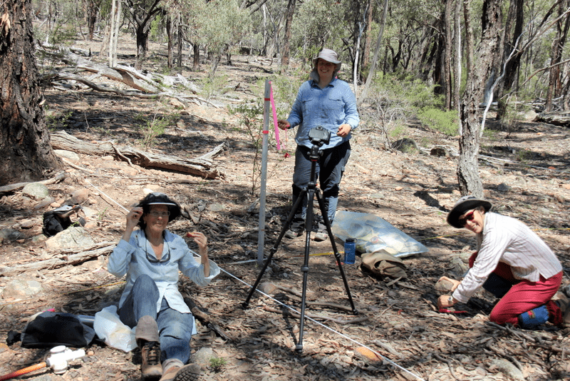
Hard at work at a new BATS AusPlots site located on private land in the Capertee Valley, NSW. Landholder April Mills (left) worked alongside volunteers Tanya Mellar (centre) and Sue Milnes (right) to establish the new ecosystem monitoring site
Published in TERN newsletter December 2015
