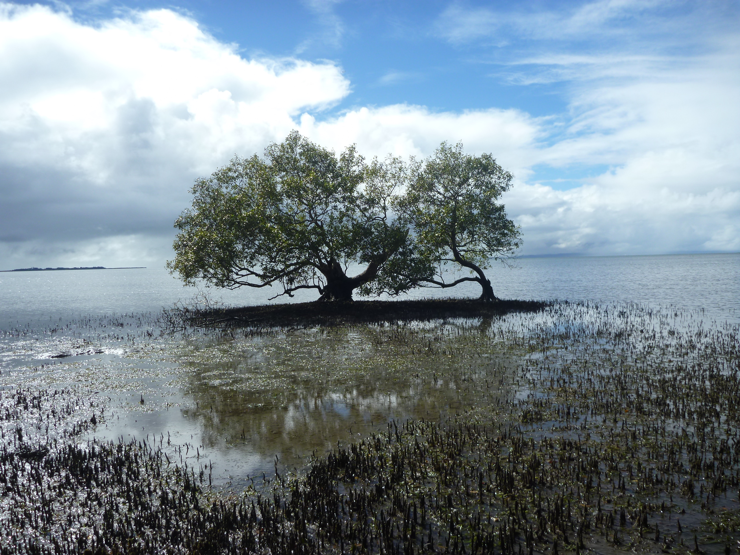
Tidal wetlands (mangroves, tidal marshes and supratidal forests) are important coastal zone habitats, making critical contributions to ecosystem services. Among these services are water quality, natural carbon sequestration, nursery grounds for estuarine fisheries and habitat for several endangered and vulnerable species of birds and mammals.
Sea-level rise threatens coastal salt-marshes and mangrove forests around the world, and a key determinant of coastal wetland vulnerability is whether its surface elevation can keep pace with rising sea level. Data to help us answer questions about tidal wetlands’ vulnerability to sea level change are being gathered around the world through use of an instrument called a Surface Elevation Table (SET). To date, approximately 1000 SET sensor stations have been installed in over 40 countries worldwide, following a common methodology established by the US Geological Survey.
The technique developed by the US Geological Survey has been described as the ‘global standard’ for wetland monitoring against sea-level rise (Webb et al. 2013). Note: a variant of the original SET design, called the Rod SET (rSET), has now been widely adopted because it allows monitoring of elevations across greater depths of the soil profile.
Elevation change measured by the SET is influenced by both surface and subsurface processes occurring within the soil profile. As shown in Figure 1, a marker horizon is used in conjunction with the SET to measure vertical accretion, which predominantly incorporates surface processes. White feldspar clay is commonly used as a SET marker horizon (SET-MH) because it is easily distinguishable from surrounding sediments.
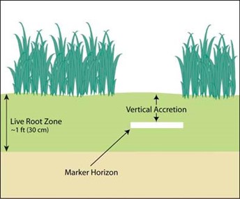
Figure 1. The SET provides highly accurate measurements of sediment elevation of intertidal and subtidal wetlands over long periods of time relative to a fixed subsurface point (Marker Horizon). (Credit Surface Elevation Table | U.S. Geological Survey (usgs.gov)
A recent Australian-authored paper, led by Neil Saintilan from Macquarie University, Sydney, shows that Australia first installed SET instruments in 2000–2001 and now has 289 documented benchmark installations distributed across 31 sites in 5 Australian states and territories (Figure 2). The Saintilan et al. 2023 paper is the first collation and analysis of the Australian SET-MH data.
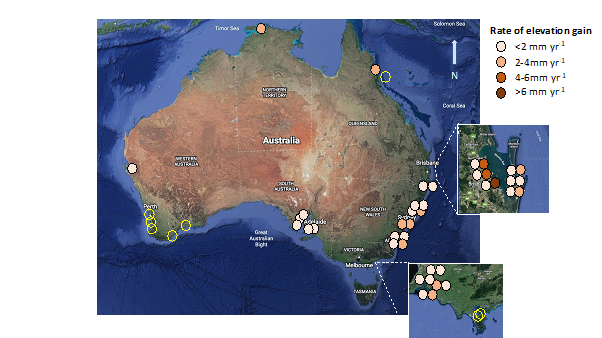
Figure 2. SET installations are clustered around the major SE Australian population centres of Adelaide, Melbourne, Sydney, Newcastle and Brisbane with more recent installations in Western Australia and the Tropical north (Darwin Harbour, Daintree, and Woody Island in the Great Barrier Reef). (Credit Vertical Accretion Trends in Australian Tidal Wetlands | Estuaries and Coasts (springer.com))
The Australian network, with its two decades of measurement from some sites, provides an important benchmark against which to assess wetland responses to accelerating sea-level rise in the decades ahead.
TERN Director, Dr Beryl Morris, says, “application of the Australian SET-MH data will help the research and management communities develop better models of coastal lowland responses to sea level rise; TERN is looking forward to supporting the data-collection work of the SET-MH network.”
TERN is participating in the recently formed cross-NCRIS collaboration, CoastRI, alongside other National Research Infrastructure projects such as IMOS, AuScope, ACCESS, AURIN, ARDC, NCI, BPA, etc. With the CoastRI initiative, there will be scope to gain a deeper, multi-faceted understanding of coastal ecosystem change with respect to potential sea level inundation.
As the graphic in Figure 3 details, an example of gaining greater insights into factors contributing to, say, soil volume change for coastal habitats, is to compare SET-MH measurements to water level changes at nearby tide gauges. CoastRI is being designed as a multi-domain NCRIS research infrastructure to rapidly improve our understanding of coastal ecosystem processes and habitat resilience.
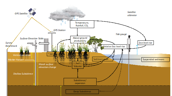
Figure 3. Operation of the SET-MH benchmark station, illustrating factors contributing to soil volume change (Credit Vertical Accretion Trends in Australian Tidal Wetlands | Estuaries and Coasts (springer.com))
