The ARC-LIEF funded Critical Zone Observatory network (OzCZO) has started collecting data in South Australia.
“A group of Earth scientists in 2001 argued that we needed to think about the vertical slice extending from the top of the bedrock to the top of the plant canopy as its own integrated ecosystem, which they call the Critical Zone area.
I like to think of this as the zone where geology is confronted by climate with generally interesting outcomes, including creation of the habitat in which almost all terrestrial life is found.”
– Assoc. Prof. Sally Thompson, University of WA, coordinator of the OzCZO network
With funding from an Australian Research Council Large Infrastructure and Equipment (ARC LEIF) grant, the Australian Critical Zone Observatory network (OzCZO) has started installing the first of its sensors on Calperum Station near Renmark, South Australia, in the semi-arid area fringing the River Murray floodplains, on land of the First Peoples of the River Murray and Mallee. The CZO sensors will be monitoring geological and hydrological conditions below the ground.
The OzCZO project is managed by a team of researchers from the University of Western Australia, the University of Adelaide, the University of the Sunshine Coast, James Cook University and the University of New South Wales.
The first CZO sensor installation has taken place alongside TERN’s Calperum Mallee SuperSite, named for its location on Calperum Station where the ecosystem is dominated by a vegetation type referred to as “Mallee”. The latter is comprised of trees or shrubs, mainly certain species of eucalypts, which grow with multiple stems springing from an underground lignotuber, usually to a height of no more than 10 m. The advantage of such co-location is that both the CZO and TERN can gain a more holistic above and below-ground perspective of the ecosystem and hydrological processes taking place.
OzCZO locations as of April 2022 (credit: Assoc. Prof. Sally Thompson)
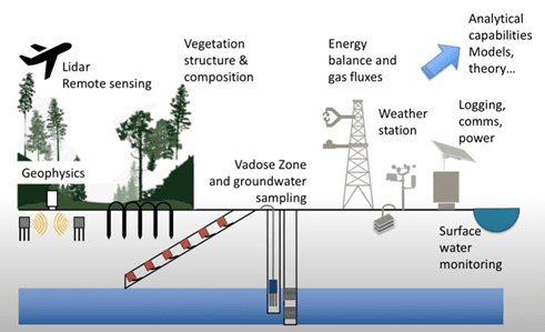
The CZO on Calperum Station is the first of five core sites that will ultimately be equipped with an instrumented vertical bore to monitor groundwater fluctuations and chemistry. A second sloping bore will be instrumented with water content, water sampling and gas sampling instrumentation – all of which will help track the interactions of the vegetation with the below ground environment.
The method and instrumentation of the sloping bore installation is being sourced from Sensoil Innovations Ltd, global provider of smart soil sensing technologies and solutions for the protection of groundwater and the environment. Sensoil first developed its sub-surface technologies at the Ben-Gurion University of the Negev in Israel. The Calperum site is being fitted with Sensoil’s Vadose-zone Monitoring System™, which provides data and analyses based on real-time, continuous monitoring and water sample collection directly from the unsaturated (vadose) zone.
Co-location of CZO and TERN instruments and surveys provides a more in-depth understanding of critical zone functions and the ecosystems they support (Credit: Assoc. Prof. Sally Thompson)
Questions that OZCZO monitoring will answer about the environment at Calperum
In general, OZCZO’s aim is to learn how Australia’s Critical Zone provides life sustaining services (food, water, energy and minerals) to a growing population in a changing climate without risking the integrity of Critical Zone functions and the ecosystems they support.
With respect to Calperum, there has already been eleven years of monitoring by TERN of CO2, H2O and energy exchanges, albeit above ground within the atmosphere, and the Mallee vegetation has been shown to be resilient to variable weather conditions and the major disturbance of fire.
Indeed, over the last five years the measured evapotranspiration from vegetation has exceeded the amount of rainfall and yet the mallee trees and some of the mid-story shrubs have continued to grow. The trees must be getting water from deep in the soil profile, but researchers think it unlikely that there is any direct connection with the regional groundwater, which is estimated to be at least 35m below the surface.
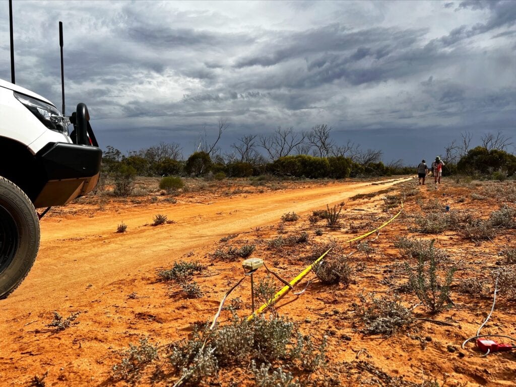
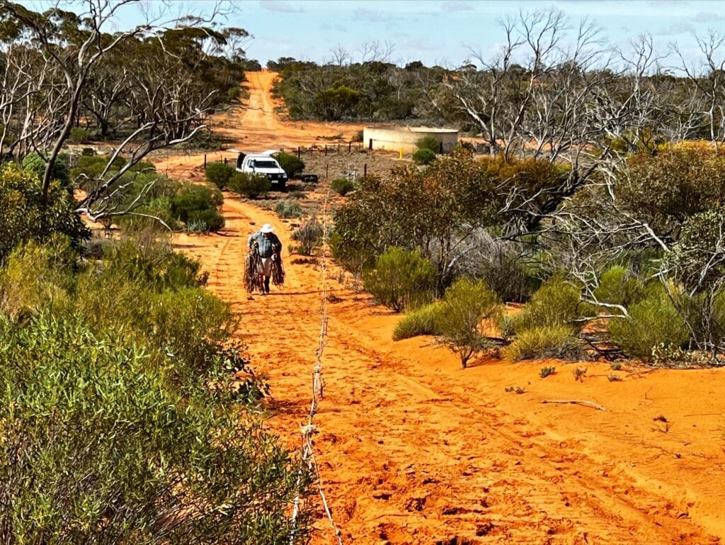
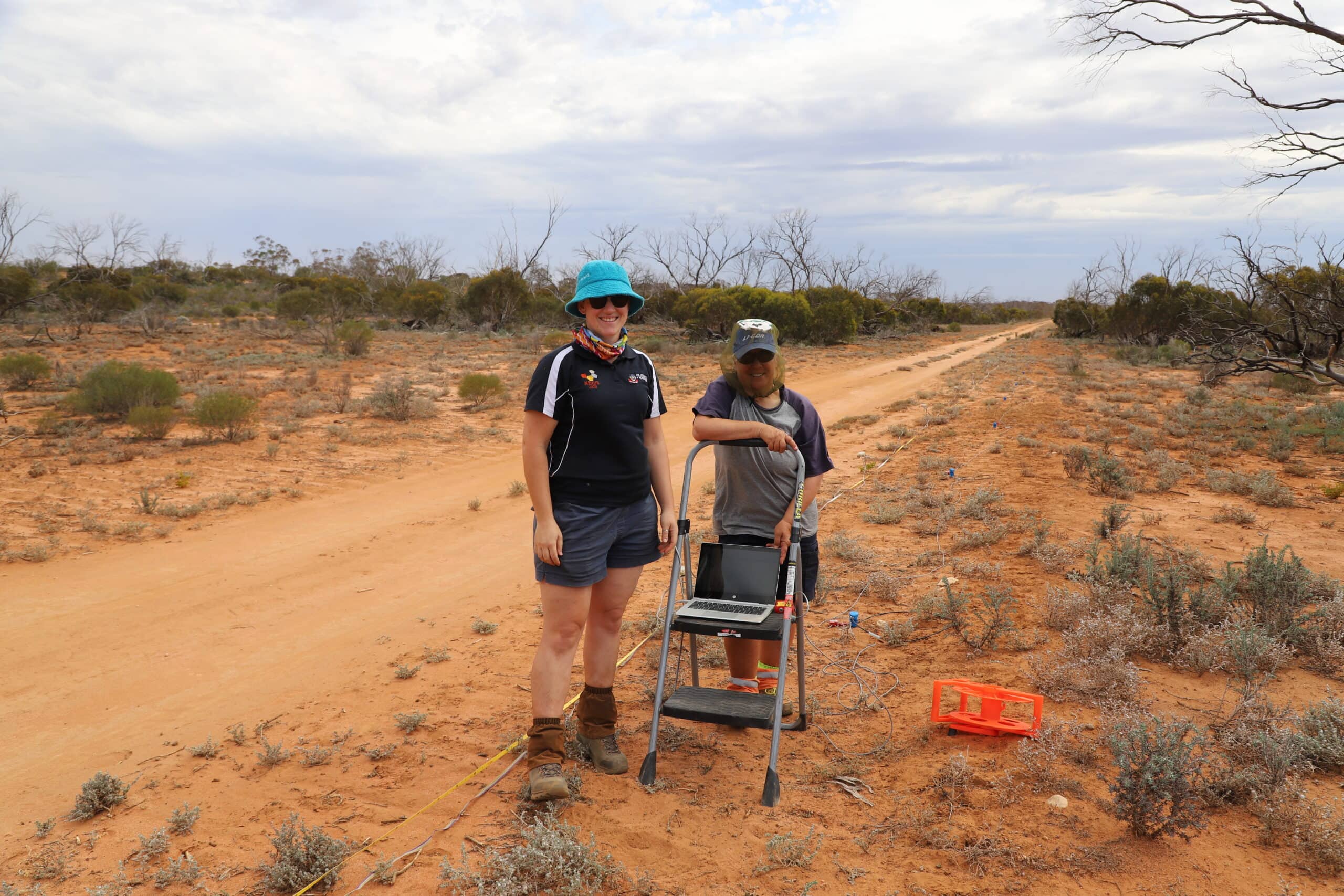
To explore this apparent anomaly, the CZO establishment will see a set of instrumented bores being installed close to the TERN flux tower. In preparation for boring, specifically, to assist in positioning the bores, Adjunct Prof Wayne Meyer (University of Adelaide) and a small team visited the Calperum site in March to take geotechnical measures (resistivity and seismic) to identify the depth to the groundwater and possibly the depth to bed rock. Next, soil cores will be collected at the time of boring and analysed to characterise the soil properties and the chemical and isotopic signatures of the various elements to assist with interpreting the depositional history of the regolith, then stored for future reference.
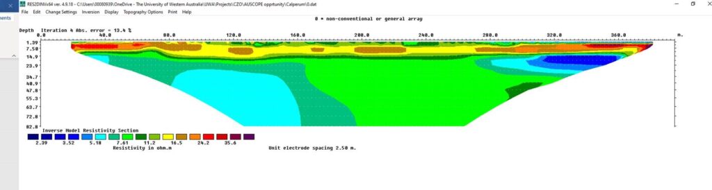
Eighty steel ERT (electrical resistivity tomography) pegs were laid out at Calperum at 5 m apart and monitored for 1.5 hours, to produce a data file for analysis at the University of Western Australia. This allows creation of an underground topography image, which is used to identify the best location for the bores and sensor shaft. (Credit: Adjunct Prof. Wayne Meyer)
Early results from the geophysics work at Calperum, which was supported by AuScope – the NCRIS enabled capability for earth and geospatial sciences – shows that there is no bedrock evident within 83m of the surface, the upper soil is very dry and the profile is quite saline.
Preliminary graphics output from resistivity survey at Calperum generated by Associate Professor Matthias Leopold (UWA)
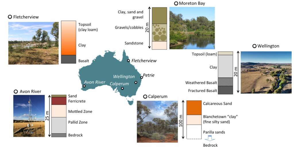
Application of shallow geophysical techniques such as electric resistivity tomography (ERT) and seismic refraction (SR), will allow more detailed characterisation of subsurface geometries and material properties, not only from Calperum but also Avon River, Fletcherview, Wellington and Petrie sites. This will include measurements of:
depth of bedrock;
water table depth;
sedimentological layering; and
characteristics of the weathering profile.
For more information about the Critical Zone Observatory Project: