Roadside signs tell us what today’s fire danger is, but wouldn’t it be nice to know what it will be in the future under a changing climate? Well, thanks to new research by the NSW Office of Environment and Heritage (NSW OEH) and the University of New South Wales we now have projections of changes in fire danger for up to 60 years in the future.
The NSW Office of Environment and Heritage has made use of TERN eMAST and the NCI’s data services to publish key data on past and forecast projections of severe fire danger across large parts of eastern Australia
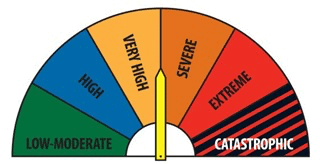
The work assessed McArthur Forest Fire Danger Index (FFDI)—observations of temperature, humidity and wind speed with an estimate of the fuel state—under NARCliM climate projections for each State Planning Region of NSW and ACT. The study predicted increases in severe fire weather across much of NSW, which in turn suggest that when fires do occur, they will be harder to control.
Such findings have significant implications for fire planning and management and have the potential to change the way fire hazard is forecast and managed.
The good news is that fire researchers, managers and policy makers have open-access to all the data behind this research thanks to TERN’s Ecosystem Modelling And Scaling infrasTructure (eMAST) and fellow NCRIS capability the National Computational Infrastructure (NCI).
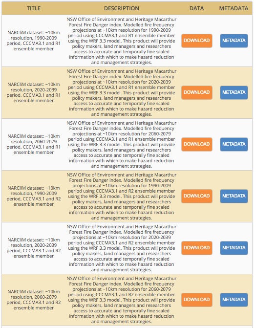
Over 90 data products are now hosted by the NCI and openly accessible via TERN. The data, available in two different resolutions (approx. 50km and 10km), give modelled hind-cast fire frequency predictions for 1950-2009 and forecast predictions for near future (2020-2039) and far future (2060-2079) periods for NSW, parts of QLD, Vic and SA on a daily basis.
The data provides policy makers, land managers and researchers with access to accurate and temporally fine-scaled information with which to make hazard reduction and management strategies. The data has been provided in a rotated pole grid mapping projection for its ease of use by the Regional Climate Modelling (RCM) community.
Yvonne Scorgie, a senior team leader within the NSW OEH’s Climate and Atmospheric Science Branch, says that there were a number of reasons why they chose to publish the data via TERN.
“We chose to publish via TERN as it has a demonstrated approach to open-data and its data portals are well known by Australia’s research community,” says Yvonne.
“TERN’s data infrastructure works well for large scientific datasets like this and includes the mechanisms that allow our datasets to be easily discoverable by the wider community.”
“The NSW OEH is committed to open data, and it’s great to have facilities such as TERN that allow us to do this,” add Yvonne.
eMAST director, Dr Brad Evans of the University of Sydney, shares Yvonne’s enthusiasm for collaboration and open data. “It’s great to be partnering with the OEH to make this important data openly accessible to the wider science community,” says Brad.
“I have no doubt that open access to these data via TERN eMAST will facilitate innovative new research and policy that will vastly improve the predictions scientists make about the ways in which climate change might be manifested and the way we manage severe fire events.”
“We have seen this in our other collaborative project with the NSW OEH, and Macquarie University, in which eMAST climate data are being used to help identify climate refugia, so I am sure that the newly made available fire data will facilitate similarly important research.”
“It’s great to know that TERN’s environmental data infrastructure is improving our land management strategies and helping answer some of Australia’s most challenging ecosystem science questions.”
- For more information on the data and how it’s being used by the collaborative projects in this article please contact TERN.
