The Food and Agriculture Organization of the United Nations (UN FAO) is utilizing TERN’s national monitoring infrastructure, data and expertise to complete the Oceania component of the Global Forest Survey (GFS). TERN joins the UN FAO GFS’s team of technical and research organisations working together to collect forest inventory data through a global network of sampling plots.
FAO is utilizing TERN’s environmental monitoring systems and expertise to collect detailed data on the characteristics and health of vegetation in Australia’s arid ecosystems. These data will play a key role in the completion of the Global Drylands Assessment pilot phase of the GFS, which aims to fill an important knowledge gap in our understanding of forest distribution and resources in global drylands—which make up over 40% of Earth’s land surface.
 |
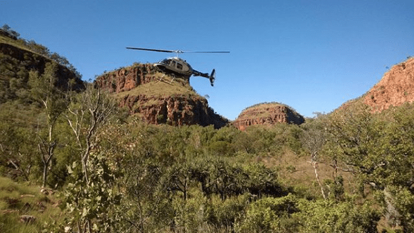
The FAO are relying on TERN’s expertise to provide scientific and technical advice on the interpretation of ecological data collected remotely from satellite images and validated using data collected by field ecologists working at TERN AusPlots’ network of rangeland monitoring plots—plots that the FAO is working on permanently incorporating into their global forest-monitoring network |
Global forest data are essential for not only understanding forest ecosystems characteristics and health, but also for improving estimates of greenhouse gas emissions from sources and removals from sinks—inventories that governments are required to submit under international climate conventions including the UNFCCC and the Kyoto Protocol.
Danilo Mollicone of the FAO said the decision to use TERN infrastructure and expertise was made thanks to TERN AusPlots’ proven expertise and research infrastructure in Australia’s arid ecosystems.
“TERN’s infrastructure and expertise is vital to the FAO and the successful completion of our Global Drylands Assessment,” says Danilo.
“The data we collect via TERN will fill an important information gap that will ensure the project has worldwide coverage. With such global coverage we’ll be able to accurately obtain estimates on tree cover, forest extension and land use in the drylands.”
“Over time, our ongoing partnership with TERN, will also help the project identify spatial and temporal changes and trends within ecosystems and between continents as biological and non-biological influences come into play”
The FAO are relying on TERN’s expertise to provide scientific and technical advice on the visual interpretation of ecological data collected remotely from satellite images of about 15,000 virtual plots scattered all across our arid ecosystems.
TERN AusPlots director Ben Sparrow says that local knowledge is vital when assessing the data contributing to the FAO GFS. “It’s pretty difficult for someone not familiar with Australian vegetation to identify acacia and eucalypt dominated vegetation from remotely sensed data so the FAO is tapping into the local knowledge of TERN’s AusPlots team to lend a hand.”
These remotely sensed data are also validated using data collected by field ecologists working at TERN AusPlots’ network of rangeland monitoring plots—plots that the FAO is working on permanently incorporating into their global forest-monitoring network.
Eventually, the FAO GFS project aims to create a web service where forest data are openly available to scientific communities and policy makers. In the meantime, researchers can openly access vast amounts of data on Australia’s arid ecosystems, including data on vegetation, soils, via TERN’s newly upgraded Data Discovey Portal.
We’re proud to be partnering with the FAO and are excited about the wealth of new data being collected and positive global outcomes that will be generated for our ecosystems as researchers, managers and decision makers worldwide utilise the data.
- For more information on this project please contact TERN AusPlots director Ben Sparrow
- Just like the data we make openly accessible, TERN’s research infrastructure is open for all use. If you’d like to make the most of our infrastructure or expertise please get in touch.
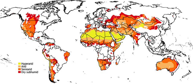
Drylands map 2014 according to UNCCD and CBD (image courtesy of FAO)
Published in TERN newsletter July 2016
