
SuperSite Research Infrastructure

SuperSite Details
System
Meteorology
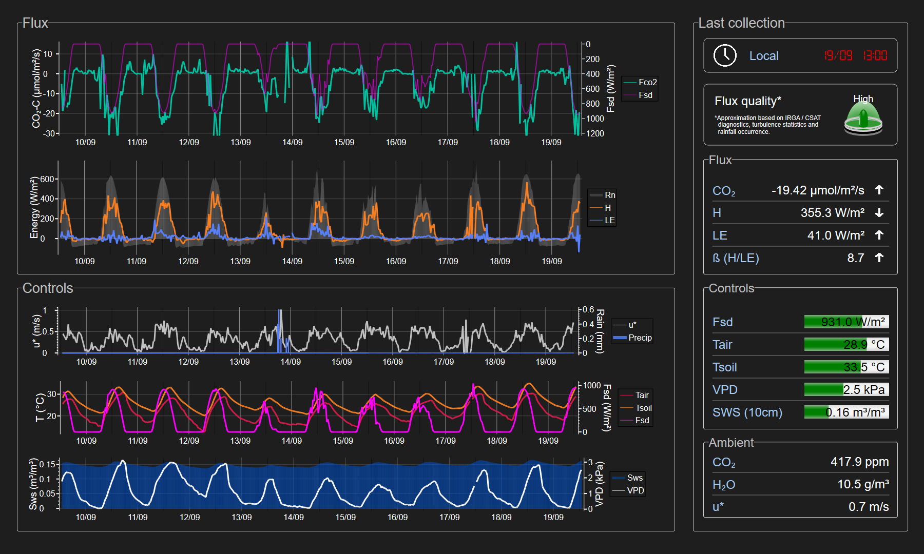
Turbulent flux
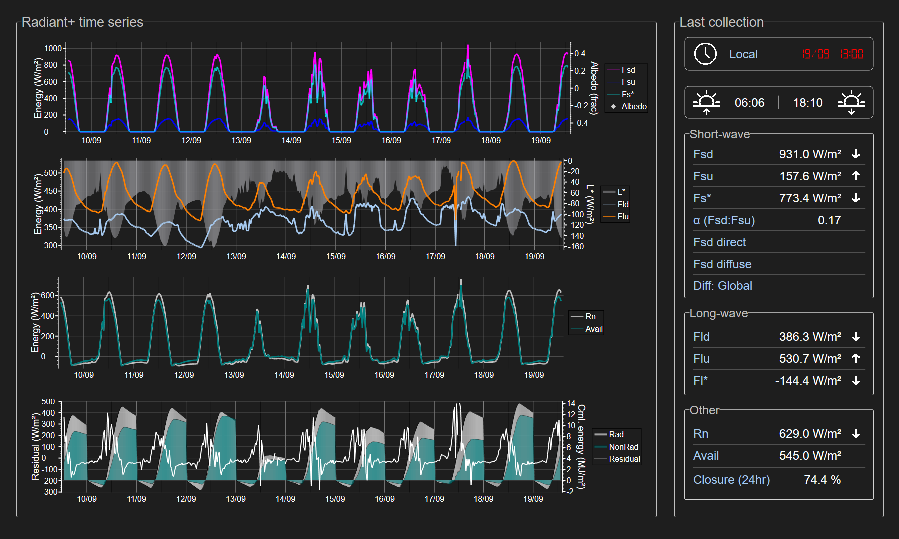
Radiant flux
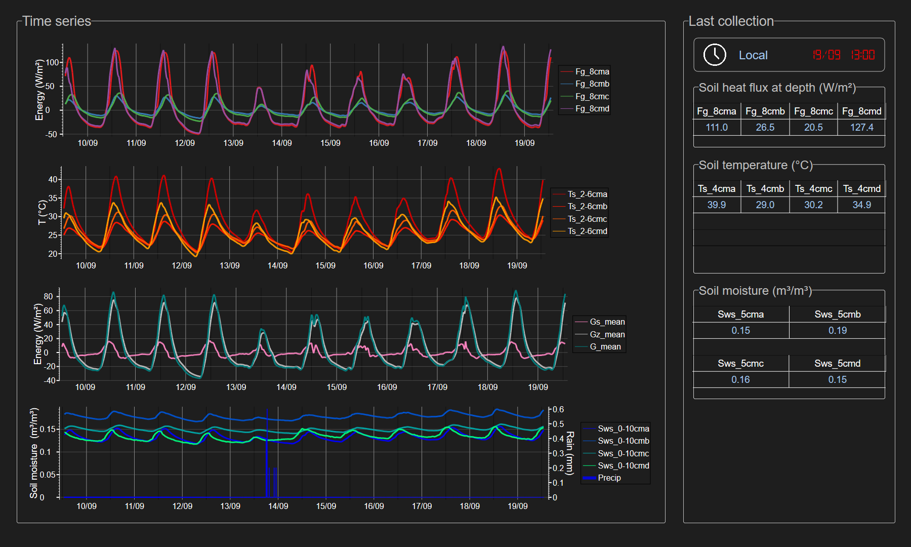
Soil
ccfc-1987
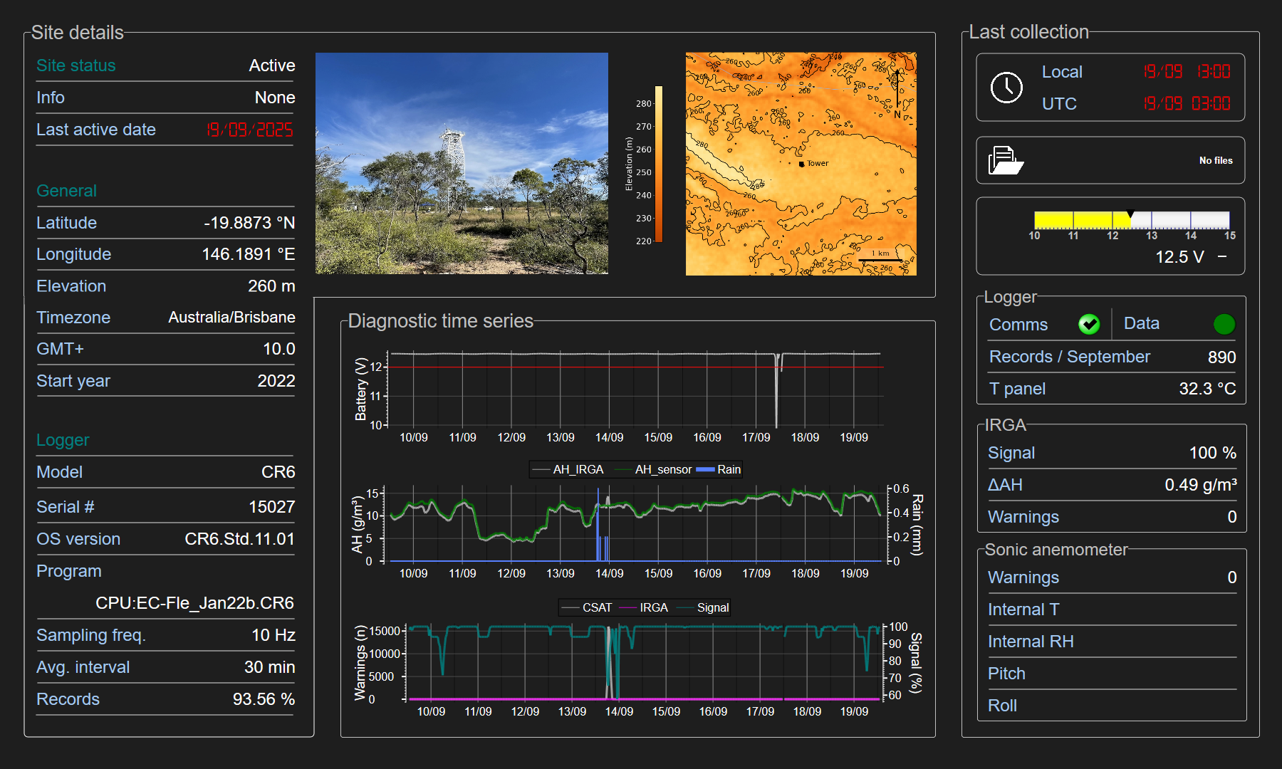
System
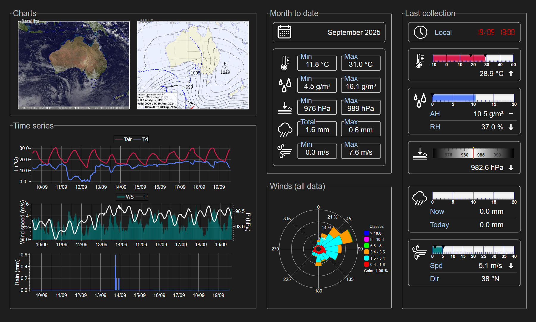
Meteorology
Turbulent flux
Radiant flux
Soil
ccfc-1987