Queensland Government scientists are using all scales of TERN data to help monitor and manage grazing pressure in the state’s two largest river catchments, Burdekin and Fitzroy, which flow to the coast, where they impact the Great Barrier Reef. Best practice management for agriculture in Queensland is a balance between using land sustainably and profitably in a highly variable climate with extreme rainfall variability. This is a major challenge for primary producers across northern Australia, but TERN is here to help.
TERN is deploying all-scales of its land observatory into Queensland’s Burdekin region. From high-tech sensor-laden towers, soil moisture sensors and numerous on-ground soil and vegetation monitoring plots to satellite measurements, NCRIS-enabled TERN is delivering critical infrastructure and data for research, management, industry-led extension and policy-making.
Enabling research for sustained productivity and improved profitability
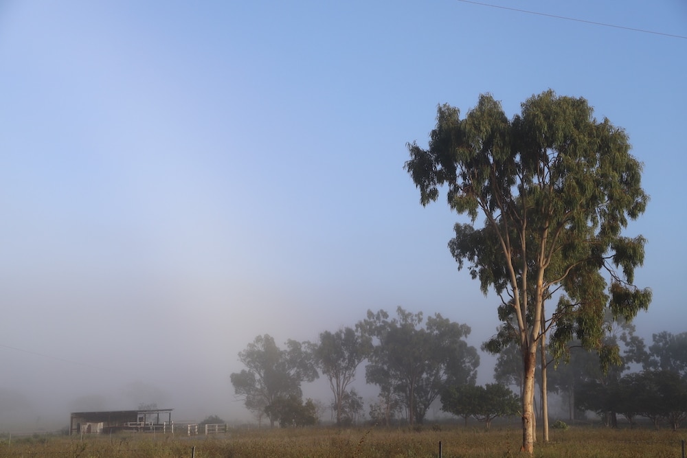
Since the establishment of TERN’s Fletcherview Tropical Rangeland SuperSite in early 2021, TERN has also installed six one-hectare soil and vegetation monitoring plots close to the SuperSite at the site of the Wambiana long-term grazing trial.
The Wambiana grazing trial was established in 1997 by the Queensland Government and Meat and Livestock Australia to test and develop sustainable and profitable strategies to manage for the effects of rainfall variability in grazed tropical savannas.
In the mid-2000s, initial results from this project provided the first experimental evidence clearly linking moderate stocking rates to sustained productivity and improved profitability over the medium term. Today, data collected over almost 25 years and multiple drought periods, show that managing stocking rates around long-term carrying capacity with regular pasture spelling maintains good pasture condition and maximises production.
To complement and enhance this valuable research, TERN monitoring plots at Wambiana are ‘paired’ to enable in-depth long-term environmental comparisons between different grazing regimes.
Data and samples collected at regular intervals are shared with researchers and land managers (and all TERN users) to detect and quantify change in soil characteristics and vegetation structure, composition and cover at the grazing trial site and compare to other TERN sites across the country.
“The Wambiana trial is actively demonstrating the productive benefits of improved grazing management, in a manner and scale of direct relevance to the grazing industry of northern Australia.
The addition of TERN monitoring plots at Wambiana enhances the ability of researchers to extrapolate the results across multiple spatial and temporal scales increasing their value for land managers.”
Peter O’Reagain, Queensland Department of Agriculture and Fisheries.
Data and samples collected by TERN at Wambiana add to the network of over 800 standardised monitoring plots collected by TERN across Australia over the past decade.
TERN is deploying all-scales of its land observatory into Queensland’s Brigalow Belt bioregion. Since the establishment of TERN’s Fletcherview Tropical Rangeland SuperSite in early 2021, TERN has also installed six one-hectare soil and vegetation monitoring plots close to the SuperSite at the site of the Wambiana long-term grazing trial. (Click here for a more comprehensive map showing all TERN monitoring sites)
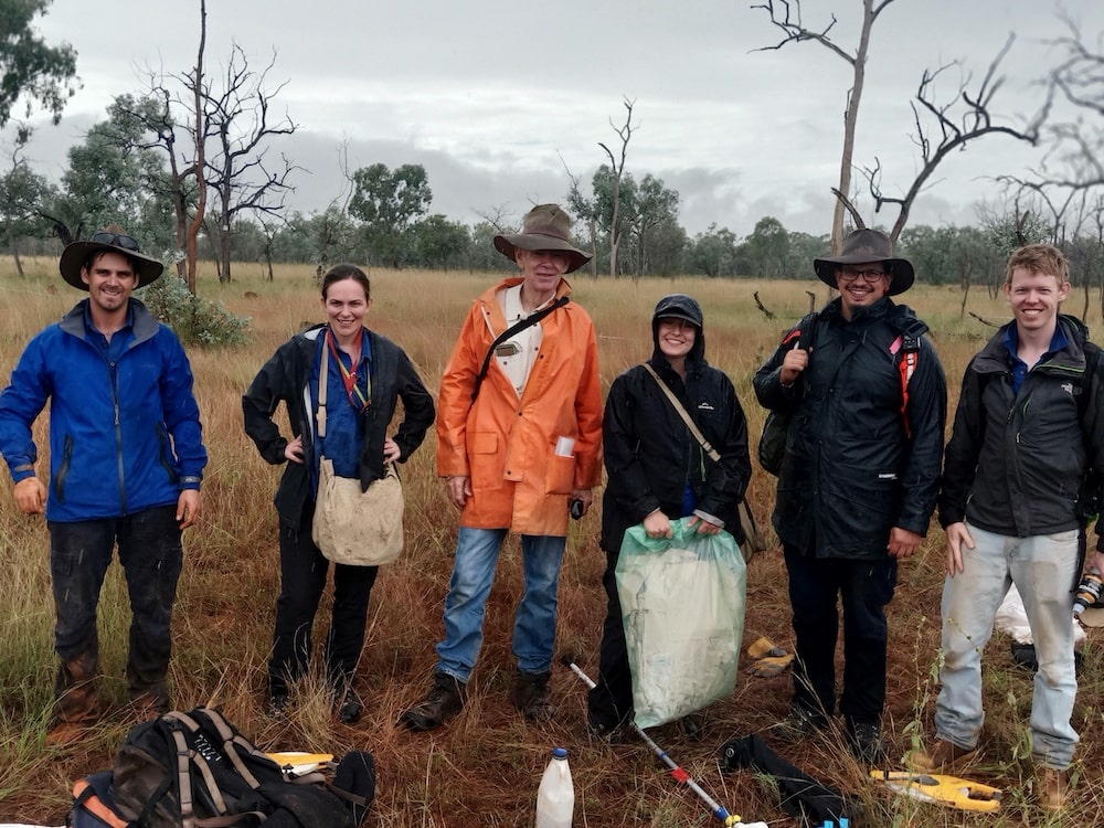
Peter O’Reagain of the Queensland Department of Agriculture and Fisheries (centre in orange) conducting soil and vegetation surveys at new TERN Ecosystem Surveillance monitoring sites at Wambiana Station in 2021
Understanding landscape-scale nutrient and sediment runoff
Data from TERN’s monitoring plots at Wambiana and the TERN Fletcherview Tropical Rangeland SuperSite are also being supplemented with TERN-delivered soil moisture and satellite data to understand landscape-scale nutrient and sediment runoff.
A recent study using TERN data within the Fitzroy Catchment to the south of the Burdekin Catchment measured the environmental impacts of different grazing regimes. This study, conducted by Queensland Government scientists Craig Thornton and Amanda Elledge, investigated sediment and particulate nutrients in runoff from grazed properties which flow to the Great Barrier Reef.
The researchers used a combination of data sources including TERN’s national and state scale seasonal ground cover data and to compare vegetation cover before and after grazing trials. Their findings were similar to those found at Wambiana: conservative grazing rates cause significantly less runoff and exports of total suspended solids compared to heavy grazing.
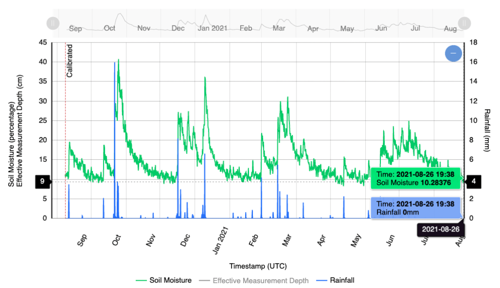
Soil moisture data from TERN’s Brigalow C3 COSMOS sensor at the Brigalow Catchment Study was also used in the study and plays an important role in quantify the impact of land development for agriculture on hydrology, productivity and resource condition.
Such research data and findings enabled by TERN’s raw and modelled data, will contribute to the Paddock to Reef program, which is used for evaluating and reporting progress towards water quality targets under the Reef 2050 Water Quality Improvement Plan.

TERN’s COSMOS soil moisture sensor in the Brigalow (above) delivers accurate data over a 30 square-hectare radius. Live and historical data (below) for this and many other COSMOS sensors are available online here.

TERN has established six one-hectare soil and vegetation monitoring plots at the site of the Wambiana long-term grazing trial. The addition of TERN monitoring plots at Wambiana enhances the ability of researchers to extrapolate the results across multiple spatial and temporal scales increasing their value for land managers.