SuperSite Research Infrastructure

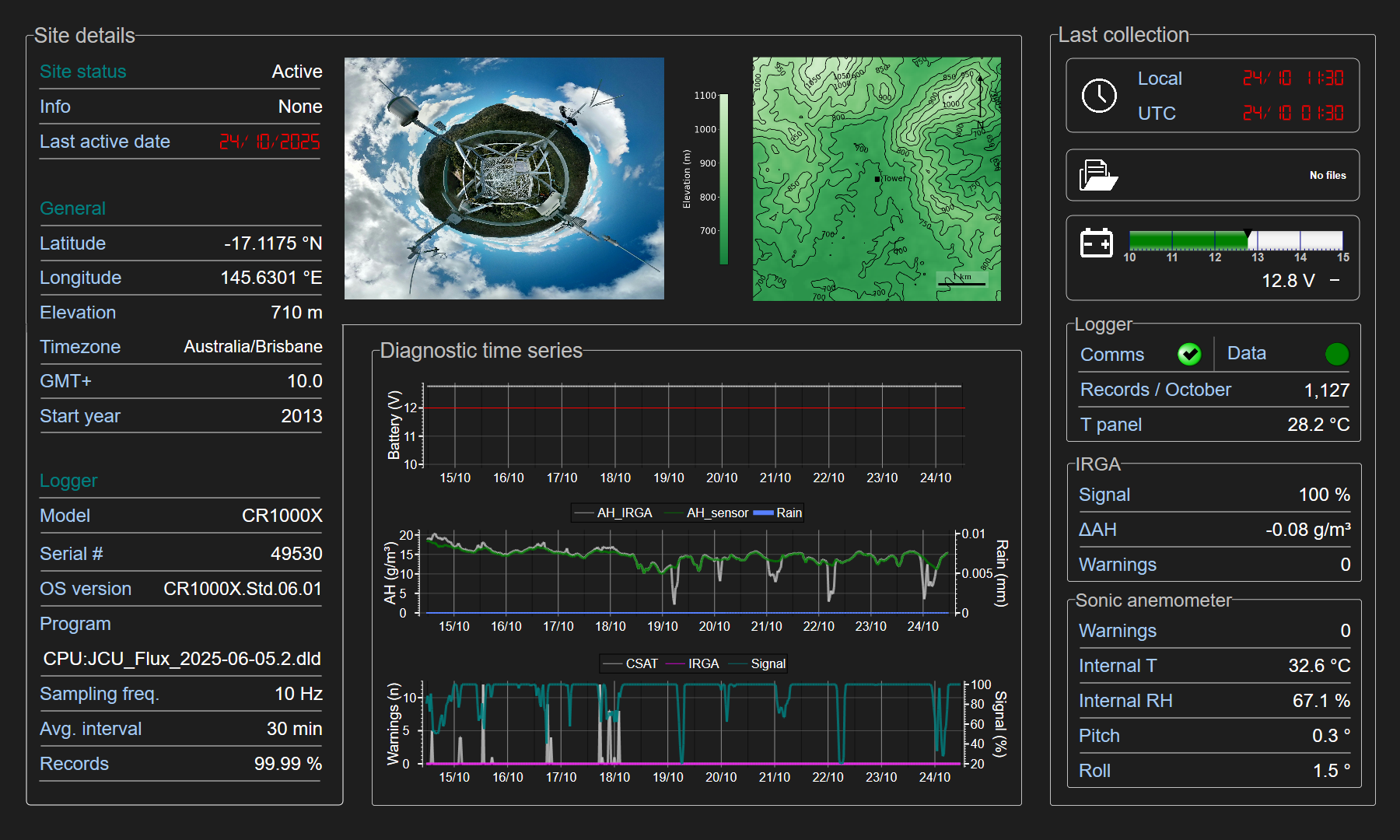
SuperSite Details
System
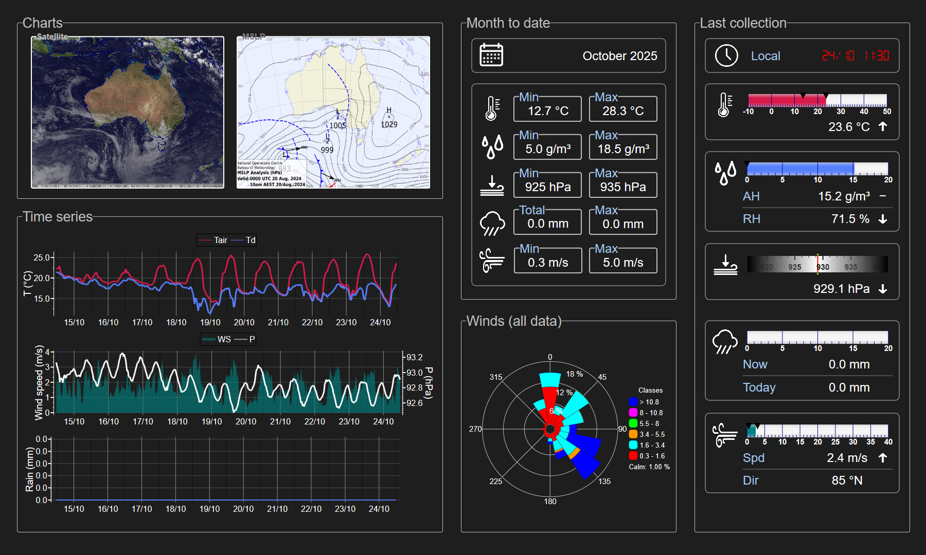
Meteorology
Turbulent flux
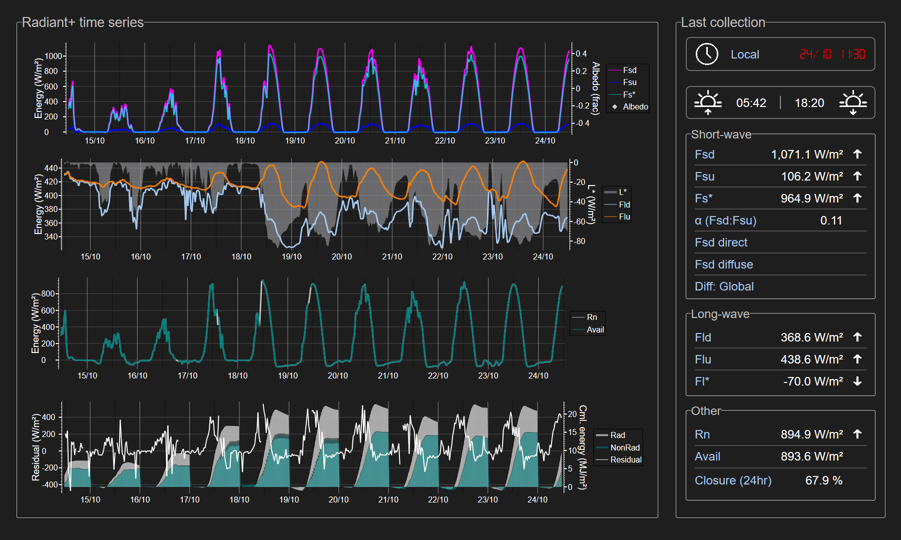
Radiant flux
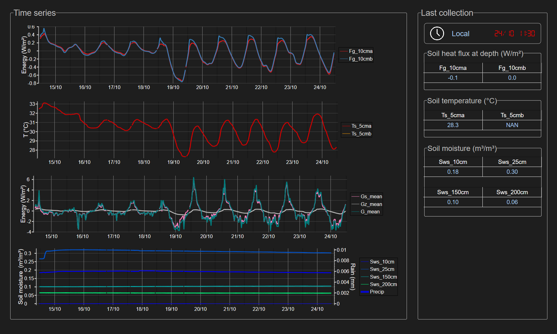
Soil
ccfc-1879
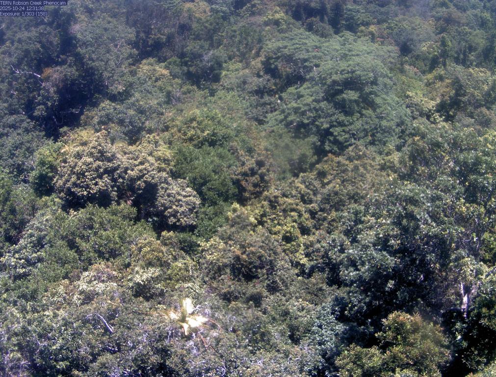
stardot-EC0383
System
Meteorology
Turbulent flux
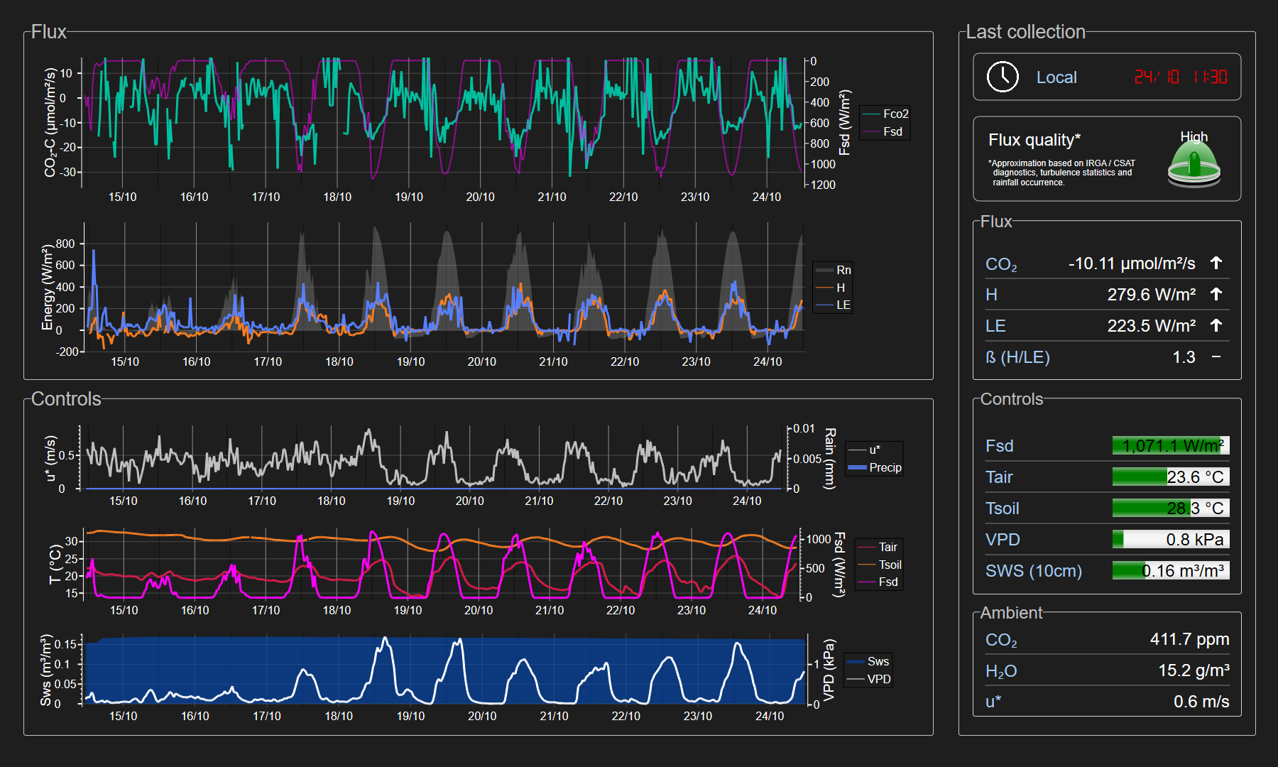
Radiant flux
Soil
ccfc-1879

stardot-EC0383