The borders might be closed but collaborative landscape observation is buzzing in Western Australia. Find out how the west is leading the way in piloting new ways to assess ecosystem health, stress and function, starting with an exciting new biodiversity monitoring capability.
Western Australia (WA) has some of the richest biodiversity on Earth and is home to hundreds of plant and animal species that occur nowhere else. It also has Australia’s only global biodiversity hotspot. However, like most places, WA’s biodiversity is under threat from climate change, altered fire regimes, development, exotic species and disease, and is constantly changing.
To detect and track this environmental change over time and space, TERN and its partners are excited to announce a new ecosystem biodiversity monitoring capability for WA.
Research infrastructure will collect the data to enable essential research, policy-making and management to ensure the ongoing conservation of precious natural resources.
“Establishment of monitoring plots across transition zones will provide information on the impacts of changing climates on biodiversity and enable us to test and refine predictions of impacts of biotic responses.
We envisage this research infrastructure will facilitate long term monitoring in three key ecosystems in this highly biodiverse region of Australia.”
Dr Margaret Byrne, Western Australia Department of Biodiversity, Conservation and Attractions
The new project has been made possible thanks to co-investment in NCRIS-enabled TERN from the Government of Western Australia and co-contributions from The University of Western Australia (UWA), Edith Cowan University (ECU), CSIRO, and the WA Department of Biodiversity, Conservation and Attractions (DBCA).
With an eye to future expansion, the capability will also serve as a pilot study for an Australia-wide biodiversity monitoring framework that could be rolled out nationally by TERN.
The new research infrastructure will establish three climate transition monitoring transects within and adjacent to the state’s global biodiversity hotspot, the Southwest Australia Botanical Province (credit: Suzanne Prober)
Monitoring biodiversity across three unique ecosystems
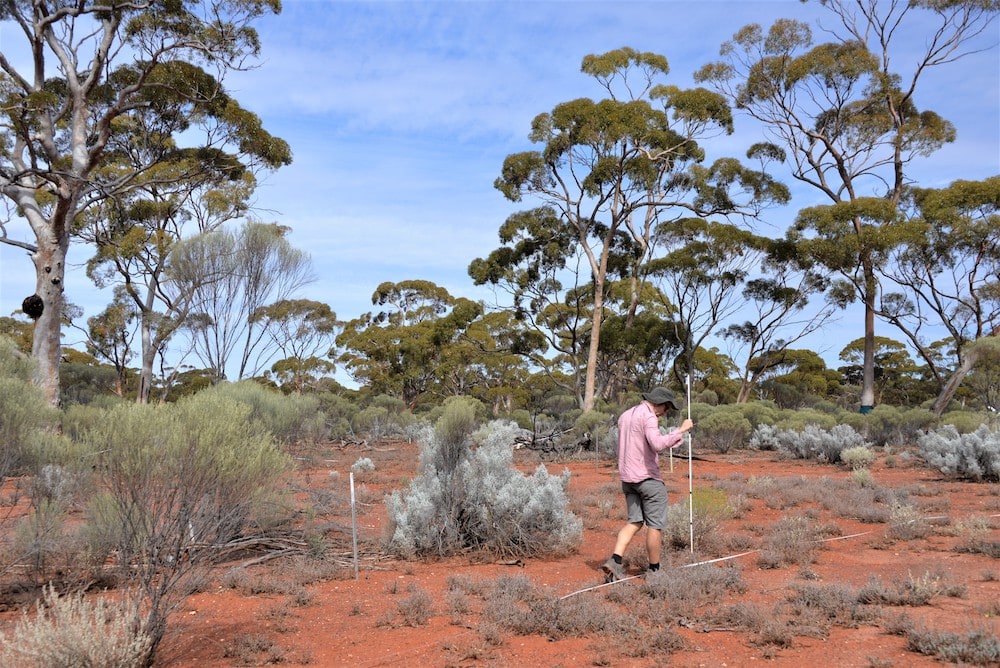
Over the past six months, stakeholder and expert consultations have aided project planning and, in particular, led to the scoping of monitoring transects across three biodiverse ecosystem types (Salmon gum, Wandoo and Banksia Woodlands).
Each transect will be tens of kilometres long, run along a climate gradient, and contain around ten permanent TERN ecosystem surveillance monitoring plots incorporating one of the three TERN SuperSites, with its suite of above-, on- and below-ground automated ecosystem processes monitoring sensors.
“Plots will be established along each transect to best capture rainfall and temperature gradients. This includes sampling the steep rainfall gradient from the Darling Scarp to the WA wheatbelt, a temperature gradient in climate-sensitive Banksia woodlands, and across the ‘Mulga-line’ that marks the major ecological transition from eucalypt to acacia-dominated ecosystems.
Collaborative planning is underway to help us deliver monitoring data and samples that benefit a diverse range of end-users.
We’re confident that this new infrastructure will better capture environmental changes across time and space for research on projecting and evaluating impacts of climate change on biodiversity in key ecosystems.”
Dr Suzanne Prober, CSIRO
Wandoo woodland (credit: Suzanne Prober)
Wandoo woodland (credit: Suzanne Prober)
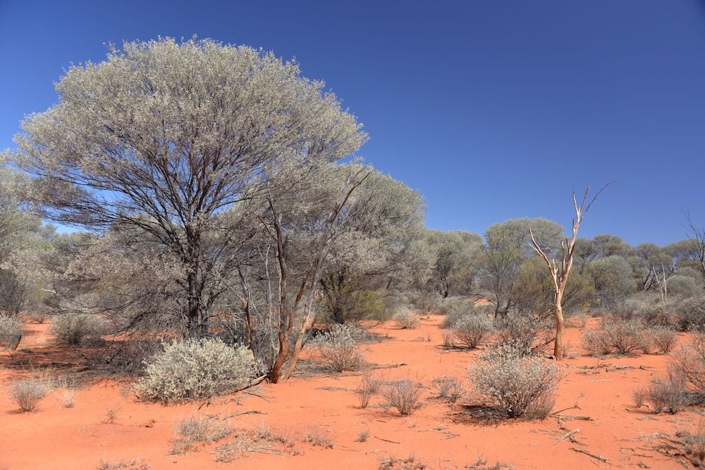
Salmon gum woodland (credit: Suzanne Prober)
Salmon gum woodland (credit: Suzanne Prober)
Banksia woodland (credit: Suzanne Prober)
Banksia woodland (credit: Richard Silberstein)
The location of monitoring transects, and their plots, across three biodiverse ecosystem types (Salmon gum (bottom row), Wandoo (top row) and Banksia woodlands (bottom row)) have been scoped (credits: Suzanne Prober)
Ecosystem productivity and stress monitoring infrastructure
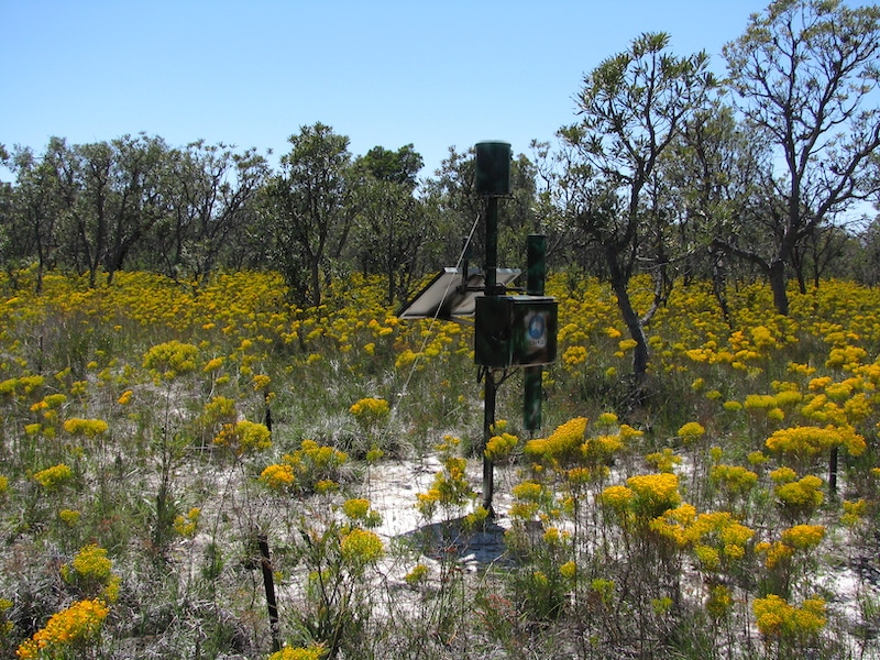
In addition to the new transects, additional monitoring equipment will be installed at the three TERN SuperSites to address a global demand for data on ecosystem productivity and stress.
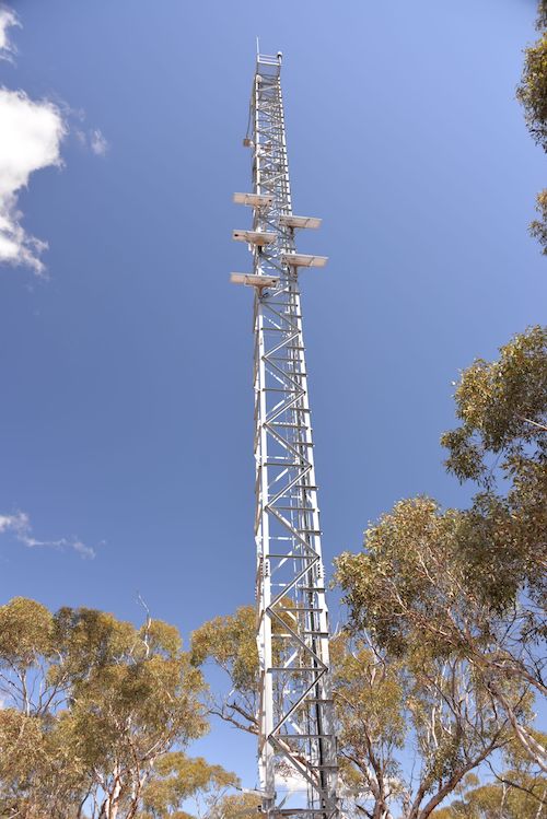
Spectral observatories will be established to detect solar-induced chlorophyll fluorescence (SIF) from plants and the complete radiation spectrum coming from the ecosystems. SIF sensors that detect plant stress and measure the signal emitted from leaves during photosynthesis will be installed on each of the eddy-covariance flux monitoring towers at the SuperSites using newly developed Fluorescence Auto‐Measurement Equipment (FAME) sensors.
This is the first time these FAME instruments will be deployed in Australia and the data they collect are set to further enable global monitoring projects that include a partnership with NASA’s ECOSTRESS mission.
In addition, on-ground lasers scanners (terrestrial LiDAR) and wireless light radiation sensor networks will measure vegetation structure and light interception to allow researchers to scale-up the data collected at the plots to a broader landscape-scale.
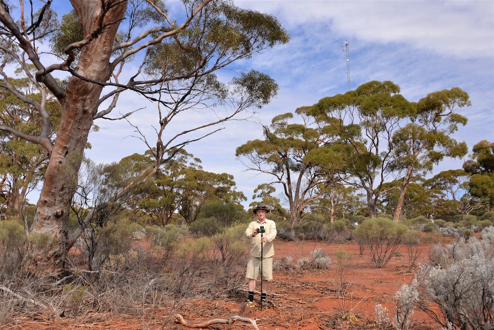
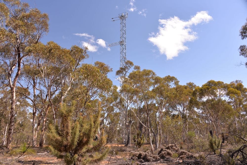
SIF sensors that detect plant stress and measure the signal emitted from leaves during photosynthesis will be installed on each of the eddy-covariance flux monitoring towers at three TERN SuperSites, including the Boyagin Wandoo Woodland SuperSite (above) (credit: Suzanne Prober)
“This new equipment will allow detailed monitoring of vegetation photosynthesis and physiological stress across a range of ecosystem types over time and help researchers understand how they respond to environmental stresses such as drought and heat, which are expected to occur more commonly with climate change, impacting biodiversity over time.
It will also enable the calibration and validation of models and remotely-sensed data, and help it be scaled from the processes at leaf level to a whole canopy, landscape or continental level.”
Prof. Jason Beringer, University of Western Australia
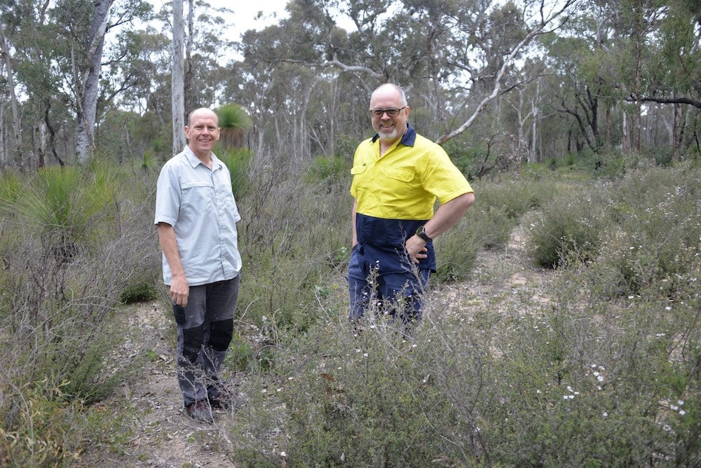
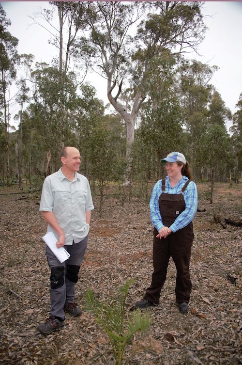
Prof Jason Beringer and Dr Caitlin Moore scoping biodiversity monitoring sites in Western Australia’s Wandoo woodlands near TERN’s Wandoo Woodlands SuperSite (credit: Suzanne Prober)
What’s next and when can I access the data from TERN?
Reconnaissance surveys to narrow down the location of long-term transect plots are being undertaken now —after initial delays due to COVID-19 restrictions. Once established, the plots will be surveyed by the TERN Field Team using the TERN AusPlots Rangelands Survey Protocol in spring 2021.
Between now and then, the team will be working on installing the new monitoring equipment at the SuperSites, and continuing their regular workshops, led by Assoc. Prof. Will Edwards of James Cook University, to develop the optimal ecosystem monitoring indicators and methodologies. Will and the team welcome your contributions to this process, particularly in the area of fauna surveys.
Biodiversity and productivity data from the new capability are expected to be openly-available to all researchers via the TERN Data Discovery Portal by the end of 2021. Field samples will be accessible from TERN’s field sample library at about the same time.
We look forward to bringing you more news on these data releases and the ongoing development of TERN’s biodiversity monitoring framework over the coming months and years.